<< Text Pages >> Glebe Well - Holy Well or Sacred Spring in Scotland in Dumfries and Galloway
Submitted by vicky on Monday, 29 March 2004 Page Views: 5348
Springs and Holy WellsSite Name: Glebe WellCountry: Scotland County: Dumfries and Galloway Type: Holy Well or Sacred Spring
Nearest Village: Kirkbean
Map Ref: NX9759159178 Landranger Map Number: 87
Latitude: 54.916763N Longitude: 3.599174W
Condition:
| 5 | Perfect |
| 4 | Almost Perfect |
| 3 | Reasonable but with some damage |
| 2 | Ruined but still recognisable as an ancient site |
| 1 | Pretty much destroyed, possibly visible as crop marks |
| 0 | No data. |
| -1 | Completely destroyed |
| 5 | Superb |
| 4 | Good |
| 3 | Ordinary |
| 2 | Not Good |
| 1 | Awful |
| 0 | No data. |
| 5 | Can be driven to, probably with disabled access |
| 4 | Short walk on a footpath |
| 3 | Requiring a bit more of a walk |
| 2 | A long walk |
| 1 | In the middle of nowhere, a nightmare to find |
| 0 | No data. |
| 5 | co-ordinates taken by GPS or official recorded co-ordinates |
| 4 | co-ordinates scaled from a detailed map |
| 3 | co-ordinates scaled from a bad map |
| 2 | co-ordinates of the nearest village |
| 1 | co-ordinates of the nearest town |
| 0 | no data |
Be the first person to rate this site - see the 'Contribute!' box in the right hand menu.
Internal Links:
External Links:
Holy Well / Spring in Dumfries & Galloway
Have you visited this site? Please add a comment below.
You may be viewing yesterday's version of this page. To see the most up to date information please register for a free account.
Do not use the above information on other web sites or publications without permission of the contributor.
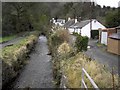
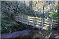
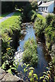
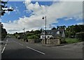
Nearby Images from Geograph Britain and Ireland:
©2008(licence)

©2008(licence)
©2012(licence)
©2017(licence)
©2017(licence)
The above images may not be of the site on this page, they are loaded from Geograph.
Please Submit an Image of this site or go out and take one for us!
Click here to see more info for this site
Nearby sites
Key: Red: member's photo, Blue: 3rd party photo, Yellow: other image, Green: no photo - please go there and take one, Grey: site destroyed
Download sites to:
KML (Google Earth)
GPX (GPS waypoints)
CSV (Garmin/Navman)
CSV (Excel)
To unlock full downloads you need to sign up as a Contributory Member. Otherwise downloads are limited to 50 sites.
Turn off the page maps and other distractions
Nearby sites listing. In the following links * = Image available
4.1km WSW 238° Kells Standing Stone* Standing Stone (Menhir) (NX94075709)
4.3km SW 235° Home Farm Stones* Standing Stones (NX93965677)
5.1km N 351° Loch Kindar Crannog (NX96896423)
5.2km WNW 294° Slewcairn NE* Cairn (NX92846143)
5.3km WNW 293° Slewcairn SW* Cairn (NX92766133)
5.6km N 6° Ingleston Cairn (NX983647)
5.7km WNW 293° Slewcairn* Cairn (NX924615)
5.9km N 352° Lochhill* Chambered Cairn (NX96886507)
8.9km NNE 32° Ward Law* Hillfort (NY0245766692)
10.3km WSW 245° Newbarns Passage Grave and Cairns* Passage Grave (NX88105505)
13.1km N 349° Picts Knowe* Henge (NX95387213)
13.2km N 350° St Queran's Well* Holy Well or Sacred Spring (NX95597222)
13.3km WNW 303° Kirkgunzeon Stone Circle (NX86576668)
13.5km NW 304° St Winning's Well (Kirkgunzeon)* Holy Well or Sacred Spring (NX86526699)
13.7km NE 51° Brow Well (Ruthwell)* Holy Well or Sacred Spring (NY0850567509)
14.0km WSW 247° Motte of Mark* Hillfort (NX8450454023)
15.4km NE 53° The Ruthwell Cross* Ancient Cross (NY1005968219)
15.7km NNW 338° Easthill* Stone Circle (NX91937388)
15.8km NNW 329° Lochrutton Loch* Crannog (NX89837299)
16.0km N 352° Troqueer Cursus Cursus (NX95837512)
16.0km N 353° Troqueer Cursus Cursus (NX96137517)
16.4km W 277° Slot Well (Buittle) Holy Well or Sacred Spring (NX8134861618)
16.5km N 357° Dumfries Museum* Museum (NX9698975731)
16.6km N 358° St Allan's Wells (Dumfries) Holy Well or Sacred Spring (NX97307576)
16.8km N 0° Greystone Park Stone Circle (NX980760)
View more nearby sites and additional images


 We would like to know more about this location. Please feel free to add a brief description and any relevant information in your own language.
 Wir möchten mehr über diese Stätte erfahren. Bitte zögern Sie nicht, eine kurze Beschreibung und relevante Informationen in Deutsch hinzuzufügen.
 Nous aimerions en savoir encore un peu sur les lieux. S'il vous plaît n'hesitez pas à ajouter une courte description et tous les renseignements pertinents dans votre propre langue.
 Quisieramos informarnos un poco más de las lugares. No dude en añadir una breve descripción y otros datos relevantes en su propio idioma.