<< Our Photo Pages >> Plas Newydd Barrow - Round Barrow(s) in Wales in Conwy
Submitted by coldrum on Thursday, 04 February 2010 Page Views: 4209
Neolithic and Bronze AgeSite Name: Plas Newydd BarrowCountry: Wales
NOTE: This site is 2.159 km away from the location you searched for.
County: Conwy Type: Round Barrow(s)
Map Ref: SH94716644
Latitude: 53.184601N Longitude: 3.577102W
Condition:
| 5 | Perfect |
| 4 | Almost Perfect |
| 3 | Reasonable but with some damage |
| 2 | Ruined but still recognisable as an ancient site |
| 1 | Pretty much destroyed, possibly visible as crop marks |
| 0 | No data. |
| -1 | Completely destroyed |
| 5 | Superb |
| 4 | Good |
| 3 | Ordinary |
| 2 | Not Good |
| 1 | Awful |
| 0 | No data. |
| 5 | Can be driven to, probably with disabled access |
| 4 | Short walk on a footpath |
| 3 | Requiring a bit more of a walk |
| 2 | A long walk |
| 1 | In the middle of nowhere, a nightmare to find |
| 0 | No data. |
| 5 | co-ordinates taken by GPS or official recorded co-ordinates |
| 4 | co-ordinates scaled from a detailed map |
| 3 | co-ordinates scaled from a bad map |
| 2 | co-ordinates of the nearest village |
| 1 | co-ordinates of the nearest town |
| 0 | no data |
Internal Links:
External Links:
")
"Human bones in cist or burial chamber revealed by quarrying, 1892. Possible bronze objects also found."
Source: Coflein.
You may be viewing yesterday's version of this page. To see the most up to date information please register for a free account.
")
")
")
")
Do not use the above information on other web sites or publications without permission of the contributor.
Nearby Images from Geograph Britain and Ireland:
©2014(licence)
©2014(licence)
©2006(licence)
©2019(licence)
©2014(licence)
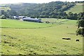
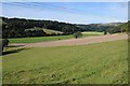
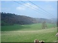
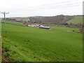
The above images may not be of the site on this page, they are loaded from Geograph.
Please Submit an Image of this site or go out and take one for us!
Click here to see more info for this site
Nearby sites
Key: Red: member's photo, Blue: 3rd party photo, Yellow: other image, Green: no photo - please go there and take one, Grey: site destroyed
Download sites to:
KML (Google Earth)
GPX (GPS waypoints)
CSV (Garmin/Navman)
CSV (Excel)
To unlock full downloads you need to sign up as a Contributory Member. Otherwise downloads are limited to 50 sites.
Turn off the page maps and other distractions
Nearby sites listing. In the following links * = Image available
3.9km SSW 212° Cau Du Barrow* Round Barrow(s) (SH9256063160)
5.1km SSW 212° Boncyn Crwn Barrow* Round Barrow(s) (SH9192062170)
5.3km WSW 241° Rhos Domen Barrow Cemetery (SH900640)
5.6km S 187° Blaen y Cwm Barrow* Round Barrow(s) (SH93916091)
5.8km S 181° Rhiwiau Barrow* Round Barrow(s) (SH94466063)
5.9km NNE 24° Mynydd-y-Gaer* Hillfort (SH973718)
7.1km SSE 162° Gorsedd Bran* Barrow Cemetery (SH968597)
7.3km W 277° St Digain (Llangernyw)* Ancient Cross (SH8749567455)
7.4km SSW 204° Aled Isaf Reservoir Standing Stone* Standing Stone (Menhir) (SH915598)
7.6km NE 49° Nant-Y-Graig Cave or Rock Shelter (SJ00567130)
7.6km SSW 205° Llyn Aled Isaf Ancient Village or Settlement (SH91295959)
7.8km WNW 283° Ffynnon Digain* Holy Well or Sacred Spring (SH87146833)
7.8km NE 51° Bontnewydd Cave* Cave or Rock Shelter (SJ009712)
8.5km NE 48° Tan-y-graig Stone Row / Alignment (SJ01137199)
8.5km NE 44° Tyddyn Bleiddyn* Chambered Cairn (SJ00727246)
8.6km ENE 61° Cefn-Yr-Ogof Cave or Rock Shelter (SJ023705)
8.6km SW 233° Gwytherin Churchyard* Stone Row / Alignment (SH87676147)
8.9km ENE 71° Plas Heaton Cave Cave or Rock Shelter (SJ03206911)
9.0km SSE 148° Tir Mostyn Kerb Cairns Cairn (SH99345870)
9.4km SSE 152° Brenig 47* Round Cairn (SH98925804)
9.4km ENE 59° Ffynnon Fair (Trefnant)* Holy Well or Sacred Spring (SJ02927107)
9.5km NNE 11° Dinorben Hillfort (SH968757)
9.6km SSE 156° Brenig Mesolithic Camp Site Ancient Village or Settlement (SH985576)
9.7km NNE 16° St George's Well (Denbighshire) Holy Well or Sacred Spring (SH97657567)
9.8km SSE 161° Brenig 40* Round Barrow(s) (SH97785711)
View more nearby sites and additional images


 We would like to know more about this location. Please feel free to add a brief description and any relevant information in your own language.
 Wir möchten mehr über diese Stätte erfahren. Bitte zögern Sie nicht, eine kurze Beschreibung und relevante Informationen in Deutsch hinzuzufügen.
 Nous aimerions en savoir encore un peu sur les lieux. S'il vous plaît n'hesitez pas à ajouter une courte description et tous les renseignements pertinents dans votre propre langue.
 Quisieramos informarnos un poco más de las lugares. No dude en añadir una breve descripción y otros datos relevantes en su propio idioma.