

<< Text Pages >> Bryn yr Aran - Stone Circle in Wales in Powys
Submitted by Tom_Bullock on Sunday, 14 July 2002 Page Views: 6887
Neolithic and Bronze AgeSite Name: Bryn yr AranCountry: Wales
NOTE: This site is 1.613 km away from the location you searched for.
County: Powys Type: Stone Circle
Nearest Town: Newtown
Map Ref: SN935953 Landranger Map Number: 136
Latitude: 52.545100N Longitude: 3.571918W
Condition:
| 5 | Perfect |
| 4 | Almost Perfect |
| 3 | Reasonable but with some damage |
| 2 | Ruined but still recognisable as an ancient site |
| 1 | Pretty much destroyed, possibly visible as crop marks |
| 0 | No data. |
| -1 | Completely destroyed |
| 5 | Superb |
| 4 | Good |
| 3 | Ordinary |
| 2 | Not Good |
| 1 | Awful |
| 0 | No data. |
| 5 | Can be driven to, probably with disabled access |
| 4 | Short walk on a footpath |
| 3 | Requiring a bit more of a walk |
| 2 | A long walk |
| 1 | In the middle of nowhere, a nightmare to find |
| 0 | No data. |
| 5 | co-ordinates taken by GPS or official recorded co-ordinates |
| 4 | co-ordinates scaled from a detailed map |
| 3 | co-ordinates scaled from a bad map |
| 2 | co-ordinates of the nearest village |
| 1 | co-ordinates of the nearest town |
| 0 | no data |
Internal Links:
External Links:
Four-poster(?)
Circle diameter: 30 feet(?), Number of stones: 4(?)
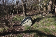
After long, wet and sloshy walk uphill, I found only a few scattered stones at site of coordinates. They did not appear to be remnants of a circle. There were a few other rock outcroppings within 100 yards or so. Very disappointing.
You may be viewing yesterday's version of this page. To see the most up to date information please register for a free account.
Do not use the above information on other web sites or publications without permission of the contributor.
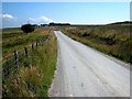
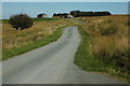
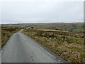
Nearby Images from Geograph Britain and Ireland:
©2008(licence)
©2010(licence)
©2024(licence)
©2024(licence)
©2008(licence)
The above images may not be of the site on this page, they are loaded from Geograph.
Please Submit an Image of this site or go out and take one for us!
Click here to see more info for this site
Nearby sites
Key: Red: member's photo, Blue: 3rd party photo, Yellow: other image, Green: no photo - please go there and take one, Grey: site destroyed
Download sites to:
KML (Google Earth)
GPX (GPS waypoints)
CSV (Garmin/Navman)
CSV (Excel)
To unlock full downloads you need to sign up as a Contributory Member. Otherwise downloads are limited to 50 sites.
Turn off the page maps and other distractions
Nearby sites listing. In the following links * = Image available
531m WSW 241° Esgair Draenllwyn Stone Row / Alignment (SN93039505)
1.6km WNW 283° Careg Lwyd* Stone Row / Alignment (SN91949569)
1.7km WNW 297° Trannon Moor* Cairn (SN92049609)
1.7km WNW 285° Trannon circles* Ring Cairn (SN91899577)
1.8km WNW 289° Twr-Gwyn Mawr* Cairn (SN9181695935)
2.7km SE 137° Esgair y Groes* Standing Stone (Menhir) (SN9532793293)
4.1km NNW 336° Ffridd yr Ystrad Standing Stone Standing Stone (Menhir) (SN9188699066)
5.5km NNW 334° Newydd Fynyddog Cairn (SH912003)
6.0km NNW 327° Newydd Fynyddog Enclosure Misc. Earthwork (SH903004)
6.1km NNW 328° Lled-Croen-Yr-Ych* Stone Circle (SH90400055)
6.1km NNW 327° Cerrig Gaerau* Stone Circle (SH903005)
6.3km NW 323° Yr Allor Cairn Cairn (SH89840040)
6.4km WSW 238° Staylittle* Barrow Cemetery (SN880920)
6.8km ENE 64° Craig y Llyn Mawr stone circle.* Stone Circle (SN9971298188)
6.9km ENE 64° Llyn Mawr stone circle (Clatter)* Stone Circle (SN9976598188)
7.0km ENE 63° Llyn Mawr settlement* Ancient Village or Settlement (SN99789834)
7.0km ENE 73° Llyn Mawr South* Standing Stone (Menhir) (SO00249714)
7.0km ENE 70° Llyn Mawr cairns* Cairn (SO00209755)
7.2km ENE 64° Lluest Uchaf* Stone Row / Alignment (SO00049832)
7.3km S 171° Pen-Y-Castell (Llanidloes Without)* Hillfort (SN94548809)
7.5km SE 137° Gaer Bella Hillfort (SN98508969)
7.9km SE 129° Pont Ar Daf Cairn Cairn (SN995902)
8.0km NE 52° Y Capel* Stone Circle (SH99950005)
8.0km ENE 77° Llyn Mawr East* Ring Cairn (SO01369700)
8.0km ENE 78° Clogau Standing Stone* Standing Stone (Menhir) (SO0142096856)
View more nearby sites and additional images


 We would like to know more about this location. Please feel free to add a brief description and any relevant information in your own language.
 Wir möchten mehr über diese Stätte erfahren. Bitte zögern Sie nicht, eine kurze Beschreibung und relevante Informationen in Deutsch hinzuzufügen.
 Nous aimerions en savoir encore un peu sur les lieux. S'il vous plaît n'hesitez pas à ajouter une courte description et tous les renseignements pertinents dans votre propre langue.
 Quisieramos informarnos un poco más de las lugares. No dude en añadir una breve descripción y otros datos relevantes en su propio idioma.