<< Text Pages >> Nant-Y-Graig - Cave or Rock Shelter in Wales in Conwy
Submitted by coldrum on Thursday, 21 July 2011 Page Views: 5186
Natural PlacesSite Name: Nant-Y-GraigCountry: Wales County: Conwy Type: Cave or Rock Shelter
Map Ref: SJ00567130
Latitude: 53.229398N Longitude: 3.491107W
Condition:
| 5 | Perfect |
| 4 | Almost Perfect |
| 3 | Reasonable but with some damage |
| 2 | Ruined but still recognisable as an ancient site |
| 1 | Pretty much destroyed, possibly visible as crop marks |
| 0 | No data. |
| -1 | Completely destroyed |
| 5 | Superb |
| 4 | Good |
| 3 | Ordinary |
| 2 | Not Good |
| 1 | Awful |
| 0 | No data. |
| 5 | Can be driven to, probably with disabled access |
| 4 | Short walk on a footpath |
| 3 | Requiring a bit more of a walk |
| 2 | A long walk |
| 1 | In the middle of nowhere, a nightmare to find |
| 0 | No data. |
| 5 | co-ordinates taken by GPS or official recorded co-ordinates |
| 4 | co-ordinates scaled from a detailed map |
| 3 | co-ordinates scaled from a bad map |
| 2 | co-ordinates of the nearest village |
| 1 | co-ordinates of the nearest town |
| 0 | no data |
Be the first person to rate this site - see the 'Contribute!' box in the right hand menu.
Internal Links:
External Links:
I have visited· I would like to visit
KevB visited on 1st Jan 1985 - their rating: Amb: 4 Access: 3 Access is problematic as the landowner and gamekeeper are not keen on anyone visiting. The caves of archaeological interest are in the bottom of a gorge cut by a small stream. There are a series of 8 caves properly known as the Brasgyll caves. Number 2 and 8 have been archaeologically excavated. More information here https://sites.google.com/site/cavesofnortheastwales/12-caves-a-b
Coflein entry:
"A fissure opening off a 'rock shelter'. Excavations in 1946 produced pottery with animal and human remains from within the fissure and flints with human and animal remains from the area of the shelter. Modern material was also found."
Read More at Coflein (https://www.coflein.gov.uk/en/site/306686
You may be viewing yesterday's version of this page. To see the most up to date information please register for a free account.
Do not use the above information on other web sites or publications without permission of the contributor.
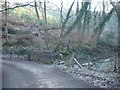
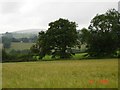
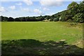
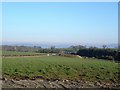
Nearby Images from Geograph Britain and Ireland:
©2006(licence)
©2005(licence)
©2014(licence)
©2006(licence)
©2014(licence)
The above images may not be of the site on this page, they are loaded from Geograph.
Please Submit an Image of this site or go out and take one for us!
Click here to see more info for this site
Nearby sites
Key: Red: member's photo, Blue: 3rd party photo, Yellow: other image, Green: no photo - please go there and take one, Grey: site destroyed
Download sites to:
KML (Google Earth)
GPX (GPS waypoints)
CSV (Garmin/Navman)
CSV (Excel)
To unlock full downloads you need to sign up as a Contributory Member. Otherwise downloads are limited to 50 sites.
Turn off the page maps and other distractions
Nearby sites listing. In the following links * = Image available
353m ESE 105° Bontnewydd Cave* Cave or Rock Shelter (SJ009712)
894m NE 38° Tan-y-graig Stone Row / Alignment (SJ01137199)
1.2km N 7° Tyddyn Bleiddyn* Chambered Cairn (SJ00727246)
1.9km ESE 114° Cefn-Yr-Ogof Cave or Rock Shelter (SJ023705)
2.4km E 94° Ffynnon Fair (Trefnant)* Holy Well or Sacred Spring (SJ02927107)
3.3km W 278° Mynydd-y-Gaer* Hillfort (SH973718)
3.4km SE 129° Plas Heaton Cave Cave or Rock Shelter (SJ03206911)
5.2km NW 325° St George's Well (Denbighshire) Holy Well or Sacred Spring (SH97657567)
5.3km NNW 334° Terfyn Well Holy Well or Sacred Spring (SH98317613)
5.8km NW 318° Dinorben Hillfort (SH968757)
7.6km SW 229° Plas Newydd Barrow* Round Barrow(s) (SH94716644)
7.8km E 81° St Beuno's Well (Tremeirchion)* Holy Well or Sacred Spring (SJ083723)
7.9km E 80° Cae Gwyn* Cave or Rock Shelter (SJ0843972501)
8.0km E 80° Ffynnon Beuno (Caves)* Cave or Rock Shelter (SJ0849972500)
8.5km ENE 76° Penuchaf Cairn (SJ08837315)
8.5km NNE 26° Ffynnon Fair (Rhuddlan)* Holy Well or Sacred Spring (SJ045788)
8.7km ENE 69° Moel Maen Efa* Barrow Cemetery (SJ087743)
8.8km NW 308° Castel Cawr* Hillfort (SH937768)
8.8km NE 52° Llyn-Y-Gorseddau 1 Round Barrow(s) (SJ07657651)
8.8km NE 52° Llyn-Y-Gorseddau 3 Round Barrow(s) (SJ07647662)
8.8km NE 52° Llyn-Y-Gorseddau 2 Round Barrow(s) (SJ07687657)
8.9km E 92° Moel-y-Gaer (Bodfari)* Hillfort (SJ09527080)
9.0km NE 45° Marion Bach 1 Round Barrow(s) (SJ07057759)
9.0km E 82° Cefn Du Ancient Village or Settlement (SJ0956272450)
9.1km NNW 342° Kinmel Bay Boundary Stone Marker Stone (SH980800)
View more nearby sites and additional images


 We would like to know more about this location. Please feel free to add a brief description and any relevant information in your own language.
 Wir möchten mehr über diese Stätte erfahren. Bitte zögern Sie nicht, eine kurze Beschreibung und relevante Informationen in Deutsch hinzuzufügen.
 Nous aimerions en savoir encore un peu sur les lieux. S'il vous plaît n'hesitez pas à ajouter une courte description et tous les renseignements pertinents dans votre propre langue.
 Quisieramos informarnos un poco más de las lugares. No dude en añadir una breve descripción y otros datos relevantes en su propio idioma.