<< Other Photo Pages >> Topsham Museum - Museum in England in Devon
Submitted by vicky on Saturday, 30 November 2002 Page Views: 5527
MuseumsSite Name: Topsham MuseumCountry: England
NOTE: This site is 3.355 km away from the location you searched for.
County: Devon Type: Museum
Nearest Town: Exeter
Map Ref: SX9673987646 Landranger Map Number: 192
Latitude: 50.679282N Longitude: 3.46289W
Condition:
| 5 | Perfect |
| 4 | Almost Perfect |
| 3 | Reasonable but with some damage |
| 2 | Ruined but still recognisable as an ancient site |
| 1 | Pretty much destroyed, possibly visible as crop marks |
| 0 | No data. |
| -1 | Completely destroyed |
| 5 | Superb |
| 4 | Good |
| 3 | Ordinary |
| 2 | Not Good |
| 1 | Awful |
| 0 | No data. |
| 5 | Can be driven to, probably with disabled access |
| 4 | Short walk on a footpath |
| 3 | Requiring a bit more of a walk |
| 2 | A long walk |
| 1 | In the middle of nowhere, a nightmare to find |
| 0 | No data. |
| 5 | co-ordinates taken by GPS or official recorded co-ordinates |
| 4 | co-ordinates scaled from a detailed map |
| 3 | co-ordinates scaled from a bad map |
| 2 | co-ordinates of the nearest village |
| 1 | co-ordinates of the nearest town |
| 0 | no data |
Internal Links:
External Links:
Museum in Devon
The Sail Loft displays the history of Topsham from Prehistoric times
Address: 25 The Strand, Topsham, EX3 0AX
Phone: 01392 873244
Opening Hours: Afternoons on Saturday, Sunday, Monday, Wednesday and Thursday, (plus Tuesdays in August), 2pm-5pm until 31st October.
Admission: Free
Website: Devon Museums
You may be viewing yesterday's version of this page. To see the most up to date information please register for a free account.
Do not use the above information on other web sites or publications without permission of the contributor.
davidmorgan has found this location on Google Street View:
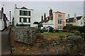
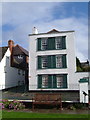
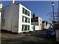
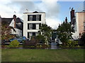
Nearby Images from Geograph Britain and Ireland:
©2009(licence)
©2006(licence)
©2016(licence)

©2012(licence)
©2016(licence)
The above images may not be of the site on this page, they are loaded from Geograph.
Please Submit an Image of this site or go out and take one for us!
Click here to see more info for this site
Nearby sites
Key: Red: member's photo, Blue: 3rd party photo, Yellow: other image, Green: no photo - please go there and take one, Grey: site destroyed
Download sites to:
KML (Google Earth)
GPX (GPS waypoints)
CSV (Garmin/Navman)
CSV (Excel)
To unlock full downloads you need to sign up as a Contributory Member. Otherwise downloads are limited to 50 sites.
Turn off the page maps and other distractions
Nearby sites listing. In the following links * = Image available
6.4km E 91° Woodbury Castle* Hillfort (SY032874)
6.6km NW 316° St Martin's Well (Exeter) Holy Well or Sacred Spring (SX922925)
6.9km NW 318° Royal Albert Memorial Museum* Museum (SX922929)
8.3km E 91° Tor Barrow (Colaton Raleigh Common) Round Barrow(s) (SY05088737)
8.4km N 349° Mincimore Copse Tumulus* Round Barrow(s) (SX953959)
9.7km ENE 65° Aylesbeare Common tumulus* Round Barrow(s) (SY056916)
11.6km SSW 202° Castle Dyke (Devon)* Ancient Village or Settlement (SX92147700)
12.3km SSW 199° Lidwell* Holy Well or Sacred Spring (SX924761)
12.5km N 2° Dolbury Hillfort* Hillfort (SS974001)
12.5km NNW 336° Long Plantation Bowl Barrows* Barrow Cemetery (SX9182199200)
12.6km NNW 347° Nether Exe Cursus* Cursus (SX94079995)
12.6km NNW 334° Three Barrows (Devon)* Barrow Cemetery (SX915991)
12.8km SW 225° Castle Dyke (Chudleigh)* Hillfort (SX875787)
13.5km N 9° Holy Well (Broadclyst)* Holy Well or Sacred Spring (SS9914700962)
13.6km SW 227° Pixie's Hole Cave or Rock Shelter (SX86547865)
13.6km NNW 335° No Mans Chapel tumulus* Barrow Cemetery (SS912001)
13.6km SW 228° Cow Cave Cave or Rock Shelter (SX86477866)
13.6km E 96° High Peak* Ancient Village or Settlement (SY103859)
13.9km SSW 202° Whitewell Woods Well* Holy Well or Sacred Spring (SX913749)
14.0km E 88° Seven Stones (Devon)* Stone Circle (SY10758787)
15.7km E 90° Sidmouth Museum* Museum (SY125874)
16.2km WSW 253° Tottiford Reservoir cairns* Cairn (SX81138312)
16.2km WSW 253° Tottiford Reservoir Row S* Stone Row / Alignment (SX81138309)
16.2km WSW 253° Tottiford Reservoir mound* Ancient Village or Settlement (SX81118313)
16.2km WSW 253° Tottiford Reservoir circle* Stone Circle (SX81098314)
View more nearby sites and additional images


 We would like to know more about this location. Please feel free to add a brief description and any relevant information in your own language.
 Wir möchten mehr über diese Stätte erfahren. Bitte zögern Sie nicht, eine kurze Beschreibung und relevante Informationen in Deutsch hinzuzufügen.
 Nous aimerions en savoir encore un peu sur les lieux. S'il vous plaît n'hesitez pas à ajouter une courte description et tous les renseignements pertinents dans votre propre langue.
 Quisieramos informarnos un poco más de las lugares. No dude en añadir una breve descripción y otros datos relevantes en su propio idioma.