<< Text Pages >> Our Lady's Well (St Mungo's Old Church) - Holy Well or Sacred Spring in Scotland in Dumfries and Galloway
Submitted by Anne T on Thursday, 30 June 2022 Page Views: 504
Springs and Holy WellsSite Name: Our Lady's Well (St Mungo's Old Church) Alternative Name: Ladies Well (old St Mungo's Church)Country: Scotland
NOTE: This site is 6.505 km away from the location you searched for.
County: Dumfries and Galloway Type: Holy Well or Sacred Spring
Nearest Town: Dumfries Nearest Village: Kirkbank
Map Ref: NY1477
Latitude: 55.079969N Longitude: 3.348631W
Condition:
| 5 | Perfect |
| 4 | Almost Perfect |
| 3 | Reasonable but with some damage |
| 2 | Ruined but still recognisable as an ancient site |
| 1 | Pretty much destroyed, possibly visible as crop marks |
| 0 | No data. |
| -1 | Completely destroyed |
| 5 | Superb |
| 4 | Good |
| 3 | Ordinary |
| 2 | Not Good |
| 1 | Awful |
| 0 | No data. |
| 5 | Can be driven to, probably with disabled access |
| 4 | Short walk on a footpath |
| 3 | Requiring a bit more of a walk |
| 2 | A long walk |
| 1 | In the middle of nowhere, a nightmare to find |
| 0 | No data. |
| 5 | co-ordinates taken by GPS or official recorded co-ordinates |
| 4 | co-ordinates scaled from a detailed map |
| 3 | co-ordinates scaled from a bad map |
| 2 | co-ordinates of the nearest village |
| 1 | co-ordinates of the nearest town |
| 0 | no data |
Be the first person to rate this site - see the 'Contribute!' box in the right hand menu.
Internal Links:
External Links:
Holy Well or Sacred Spring in Dumfries and Galloway
Classifled as just a simple 'well' by Canmore - see their entry for Site ID 66646, 'St Mungo, Our Lady's Well', this well may have connections with the old St Mungo's Church - see Canmore Site ID 66665. The name of the well indicates associations with The Virgin Mary.
There appears to be considerable confusion about whether there are two separate wells, or one well with the grid reference number incorrectly reported. Canmore tells us: "Both Walker ('Holy Wells in Scotland',1883) and' Fasti Ecclesiae Scoticanae' (H Scott, 1917) note a well, dedicated to 'Our Lady' in St Mungo parish (Parish name centred NY 14 77). (This name has not been published on OS maps, although there is a 'Ladies Well' at NY 1191 7529, in Dalton Parish, on the opposite side of the (river) Annan and about half a mile from the old St Mungo's parish church".
Can anyone shed any light on the actual locations of "Our Lady's Well" - both the one in St Mungo's Parish, and the other in Dalton parish at NY 1191 7529. If so, please would you be able to leave a comment on this site page? Many thanks!
You may be viewing yesterday's version of this page. To see the most up to date information please register for a free account.
Do not use the above information on other web sites or publications without permission of the contributor.
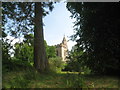
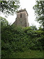
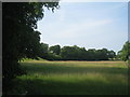
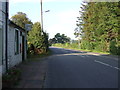
Nearby Images from Geograph Britain and Ireland:
©2016(licence)

©2013(licence)
©2007(licence)
©2016(licence)
©2015(licence)
The above images may not be of the site on this page, they are loaded from Geograph.
Please Submit an Image of this site or go out and take one for us!
Click here to see more info for this site
Nearby sites
Key: Red: member's photo, Blue: 3rd party photo, Yellow: other image, Green: no photo - please go there and take one, Grey: site destroyed
Download sites to:
KML (Google Earth)
GPX (GPS waypoints)
CSV (Garmin/Navman)
CSV (Excel)
To unlock full downloads you need to sign up as a Contributory Member. Otherwise downloads are limited to 50 sites.
Turn off the page maps and other distractions
Nearby sites listing. In the following links * = Image available
4.9km ENE 69° Burnswark Hillfort* Hillfort (NY18607870)
5.0km ENE 68° Burnswark Hill Cairn* Cairn (NY18697883)
5.2km SE 131° Hoddom Parish Church* Sculptured Stone (NY1783573516)
5.5km NNW 348° Chapel Well (Beckton) Holy Well or Sacred Spring (NY12948243)
9.6km NE 52° Whiteholme Rig* Stone Circle (NY21718269)
9.6km SSW 203° The Ruthwell Cross* Ancient Cross (NY1005968219)
11.0km SSW 209° Brow Well (Ruthwell)* Holy Well or Sacred Spring (NY0850567509)
11.1km E 97° Fair Helen's Cross (Kirkconnel)* Ancient Cross (NY24987537)
11.1km E 97° Fair Helen's Tombstone* Marker Stone (NY25037534)
11.9km NE 54° Newhall Hill (Paddockhole)* Ancient Village or Settlement (NY23808372)
12.4km NNW 336° Archwood Hill* Hillfort (NY0911488380)
13.0km NNW 338° Lochbrow Prehistoric Landscape* Ancient Village or Settlement (NY0942389153)
13.0km SSE 146° Woodhead Stone Circle Stone Circle (NY210660)
13.1km NNW 339° Lochbrow Cursus* Cursus (NY0951489350)
13.9km NE 36° Whitcastles* Stone Circle (NY22408806)
14.2km NE 35° Kirkslight Rig Stone Circle (NY223885)
15.4km SW 227° Ward Law* Hillfort (NY0245766692)
15.7km ESE 117° Mossknowe Tumulus* Cairn (NY27836948)
16.0km ESE 118° Mossknowe 3* Cairn (NY2793169102)
16.0km W 265° Greystone Park Stone Circle (NX980760)
16.0km ESE 118° Mossknowe 2* Cairn (NY2806469266)
16.7km W 265° St Allan's Wells (Dumfries) Holy Well or Sacred Spring (NX97307576)
17.0km W 265° Dumfries Museum* Museum (NX9698975731)
17.6km N 350° Skip Knowe* Standing Stone (Menhir) (NY1118094430)
17.8km NE 39° Bailiehill Fort* Hillfort (NY2558090520)
View more nearby sites and additional images


 We would like to know more about this location. Please feel free to add a brief description and any relevant information in your own language.
 Wir möchten mehr über diese Stätte erfahren. Bitte zögern Sie nicht, eine kurze Beschreibung und relevante Informationen in Deutsch hinzuzufügen.
 Nous aimerions en savoir encore un peu sur les lieux. S'il vous plaît n'hesitez pas à ajouter une courte description et tous les renseignements pertinents dans votre propre langue.
 Quisieramos informarnos un poco más de las lugares. No dude en añadir una breve descripción y otros datos relevantes en su propio idioma.