<< Our Photo Pages >> Castell-Y-Dail - Ancient Village or Settlement in Wales in Powys
Submitted by coldrum on Wednesday, 13 October 2010 Page Views: 4380
Multi-periodSite Name: Castell-Y-Dail Alternative Name: Pen-Y-CastellCountry: Wales
NOTE: This site is 2.498 km away from the location you searched for.
County: Powys Type: Ancient Village or Settlement
Map Ref: SO09448972
Latitude: 52.497838N Longitude: 3.335414W
Condition:
| 5 | Perfect |
| 4 | Almost Perfect |
| 3 | Reasonable but with some damage |
| 2 | Ruined but still recognisable as an ancient site |
| 1 | Pretty much destroyed, possibly visible as crop marks |
| 0 | No data. |
| -1 | Completely destroyed |
| 5 | Superb |
| 4 | Good |
| 3 | Ordinary |
| 2 | Not Good |
| 1 | Awful |
| 0 | No data. |
| 5 | Can be driven to, probably with disabled access |
| 4 | Short walk on a footpath |
| 3 | Requiring a bit more of a walk |
| 2 | A long walk |
| 1 | In the middle of nowhere, a nightmare to find |
| 0 | No data. |
| 5 | co-ordinates taken by GPS or official recorded co-ordinates |
| 4 | co-ordinates scaled from a detailed map |
| 3 | co-ordinates scaled from a bad map |
| 2 | co-ordinates of the nearest village |
| 1 | co-ordinates of the nearest town |
| 0 | no data |
Be the first person to rate this site - see the 'Contribute!' box in the right hand menu.
Internal Links:
External Links:
I have visited· I would like to visit
geoffstickland has visited here
")
"An irregular ridge-top enclosure, c.152m by 50m, defined by scarps with traces of a ditch, having an entrance to the SW."
Source: Coflein
You may be viewing yesterday's version of this page. To see the most up to date information please register for a free account.
Do not use the above information on other web sites or publications without permission of the contributor.
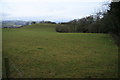
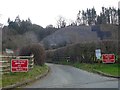
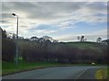
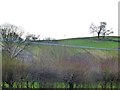
Nearby Images from Geograph Britain and Ireland:
©2008(licence)
©2019(licence)
©2019(licence)
©2019(licence)
©2013(licence)
The above images may not be of the site on this page, they are loaded from Geograph.
Please Submit an Image of this site or go out and take one for us!
Click here to see more info for this site
Nearby sites
Key: Red: member's photo, Blue: 3rd party photo, Yellow: other image, Green: no photo - please go there and take one, Grey: site destroyed
Download sites to:
KML (Google Earth)
GPX (GPS waypoints)
CSV (Garmin/Navman)
CSV (Excel)
To unlock full downloads you need to sign up as a Contributory Member. Otherwise downloads are limited to 50 sites.
Turn off the page maps and other distractions
Nearby sites listing. In the following links * = Image available
2.4km NNE 27° Newtown Gorsedd Circle* Modern Stone Circle etc (SO1057591808)
4.5km SE 135° Caebetin Hill Timber Circle (SO126865)
4.5km SE 135° Gwernescob Round Barrow(s) (SO12578647)
4.6km ESE 118° Hubert's Folly Ancient Village or Settlement (SO13458754)
5.2km SSE 153° Two Tumps* Round Barrow(s) (SO11688505)
5.3km SSE 164° Kerry Ridgeway* Ancient Trackway (SO108846)
5.7km E 83° Kerry barrows* Round Barrow(s) (SO151903)
7.3km ESE 118° Shenton's Tump Barrow* Round Barrow(s) (SO15848622)
7.3km ESE 119° Kerry Hill* Stone Circle (SO15768607)
7.4km W 266° Nant-Yr-Hebog* Ancient Village or Settlement (SO02058932)
7.8km SSE 167° Rhiw Porthnant* Barrow Cemetery (SO111821)
7.8km W 271° Cefn Carnedd Hillfort (SO016900)
9.9km W 272° Pont Ar Daf Cairn Cairn (SN995902)
10.0km E 101° Upper Short Ditch* Misc. Earthwork (SO192876)
10.2km NW 317° Llyn-y-Tarw* Stone Circle (SO02579726)
10.5km NW 316° Llyn-y-Tarw Hut Circle* Ancient Village or Settlement (SO0227597395)
10.7km NW 311° Clogau Standing Stone* Standing Stone (Menhir) (SO0142096856)
10.9km NW 311° Llyn Mawr East* Ring Cairn (SO01369700)
10.9km W 269° Gaer Bella Hillfort (SN98508969)
11.0km SE 124° Grey Stones* Stone Circle (SO185834)
11.7km SSW 205° Banc Du (Powys)* Stone Circle (SO042792)
11.8km NW 308° Llyn Mawr South* Standing Stone (Menhir) (SO00249714)
11.9km NW 308° Llyn Mawr Cairn 2* Round Barrow(s) (SO0019797244)
12.1km NW 309° Llyn Mawr cairns* Cairn (SO00209755)
12.7km NW 311° Lluest Uchaf* Stone Row / Alignment (SO00049832)
View more nearby sites and additional images


 We would like to know more about this location. Please feel free to add a brief description and any relevant information in your own language.
 Wir möchten mehr über diese Stätte erfahren. Bitte zögern Sie nicht, eine kurze Beschreibung und relevante Informationen in Deutsch hinzuzufügen.
 Nous aimerions en savoir encore un peu sur les lieux. S'il vous plaît n'hesitez pas à ajouter une courte description et tous les renseignements pertinents dans votre propre langue.
 Quisieramos informarnos un poco más de las lugares. No dude en añadir una breve descripción y otros datos relevantes en su propio idioma.