

<< Our Photo Pages >> Ffynnon Fair (Llanfair Caereinion) - Holy Well or Sacred Spring in Wales in Powys
Submitted by TimPrevett on Tuesday, 05 June 2007 Page Views: 7735
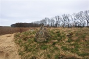
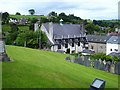
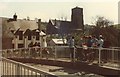
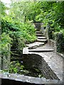
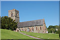
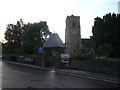
Springs and Holy WellsSite Name: Ffynnon Fair (Llanfair Caereinion) Alternative Name: St Mary's Well, Ffynnon yr EglwysCountry: Wales County: Powys Type: Holy Well or Sacred Spring
Nearest Town: Llanfair Caereinion
Map Ref: SJ1036106480
Latitude: 52.648620N Longitude: 3.326391W
Condition:
| 5 | Perfect |
| 4 | Almost Perfect |
| 3 | Reasonable but with some damage |
| 2 | Ruined but still recognisable as an ancient site |
| 1 | Pretty much destroyed, possibly visible as crop marks |
| 0 | No data. |
| -1 | Completely destroyed |
| 5 | Superb |
| 4 | Good |
| 3 | Ordinary |
| 2 | Not Good |
| 1 | Awful |
| 0 | No data. |
| 5 | Can be driven to, probably with disabled access |
| 4 | Short walk on a footpath |
| 3 | Requiring a bit more of a walk |
| 2 | A long walk |
| 1 | In the middle of nowhere, a nightmare to find |
| 0 | No data. |
| 5 | co-ordinates taken by GPS or official recorded co-ordinates |
| 4 | co-ordinates scaled from a detailed map |
| 3 | co-ordinates scaled from a bad map |
| 2 | co-ordinates of the nearest village |
| 1 | co-ordinates of the nearest town |
| 0 | no data |
Internal Links:
External Links:
I have visited· I would like to visit
Fallow would like to visit
 (PID:30412)")
St Mary's Well, on the north side of the churchyard, down steps. Believed to have been healing as recently as 1910, the well fell into disuse, and was reconstructed in 1990. Lovely peaceful spot.
You may be viewing yesterday's version of this page. To see the most up to date information please register for a free account.
 (PID:30413)")
 (PID:30418)")
 (PID:30417)")
 (PID:30414)")
Do not use the above information on other web sites or publications without permission of the contributor.
Nearby Images from Geograph Britain and Ireland:
©2007(licence)
©2009(licence)
©2007(licence)
©2009(licence)
©2012(licence)
The above images may not be of the site on this page, they are loaded from Geograph.
Please Submit an Image of this site or go out and take one for us!
Click here to see more info for this site
Nearby sites
Key: Red: member's photo, Blue: 3rd party photo, Yellow: other image, Green: no photo - please go there and take one, Grey: site destroyed
Download sites to:
KML (Google Earth)
GPX (GPS waypoints)
CSV (Garmin/Navman)
CSV (Excel)
To unlock full downloads you need to sign up as a Contributory Member. Otherwise downloads are limited to 50 sites.
Turn off the page maps and other distractions
Nearby sites listing. In the following links * = Image available
711m NNE 19° Tanllan Enclosure Ancient Village or Settlement (SJ10600715)
3.4km NNE 23° Pentre Camp Hillfort (SJ11730957)
6.6km NE 47° Ffynnon y Clawdd Llesg* Holy Well or Sacred Spring (SJ153109)
7.7km WNW 294° The Rustica Stone Early Christian Sculptured Stone (SJ0340809775)
8.4km NE 36° Meifod* Ancient Cross (SJ155132)
8.6km NNE 32° Meifod Cursus Cursus (SJ15121367)
8.8km NNE 33° Meifod Cursus Cursus (SJ15231380)
8.8km WSW 242° Llidiardau mawr Stone Row / Alignment (SJ025025)
10.1km WNW 292° St Cadfan's Well* Holy Well or Sacred Spring (SJ010104)
10.1km ESE 123° St Beuno (Berriew)* Natural Stone / Erratic / Other Natural Feature (SJ18780082)
11.2km ESE 117° Maen Beuno* Standing Stone (Menhir) (SJ2029201303)
11.3km ESE 116° Dyffryn Lane, Berriew* Henge (SJ2044101409)
11.4km E 97° Welshpool A Cursus Cursus (SJ21640480)
11.5km E 96° Sarn-y-bryn-caled II Cursus Cursus (SJ21830505)
11.5km E 96° Welshpool A Cursus Cursus (SJ21820497)
11.6km E 97° Sarn-y-Bryn-Caled* Timber Circle (SJ219049)
11.6km E 95° Sarn-y-bryn-caled II Cursus Cursus (SJ21970523)
12.1km SW 219° Llyn-y-Tarw* Stone Circle (SO02579726)
12.1km SW 221° Llyn-y-Tarw Hut Circle* Ancient Village or Settlement (SO0227597395)
12.2km E 84° Maen Llog* Standing Stone (Menhir) (SJ225076)
12.2km WSW 237° Y Capel* Stone Circle (SH99950005)
12.2km E 85° Powysland Museum* Museum (SJ226073)
12.5km E 85° Welshpool Eisteddfod Circle* Modern Stone Circle etc (SJ2286307263)
13.0km WNW 293° St Tydecho's Well Holy Well or Sacred Spring (SH985118)
13.1km SW 222° Llyn Mawr East* Ring Cairn (SO01369700)
View more nearby sites and additional images


 We would like to know more about this location. Please feel free to add a brief description and any relevant information in your own language.
 Wir möchten mehr über diese Stätte erfahren. Bitte zögern Sie nicht, eine kurze Beschreibung und relevante Informationen in Deutsch hinzuzufügen.
 Nous aimerions en savoir encore un peu sur les lieux. S'il vous plaît n'hesitez pas à ajouter une courte description et tous les renseignements pertinents dans votre propre langue.
 Quisieramos informarnos un poco más de las lugares. No dude en añadir una breve descripción y otros datos relevantes en su propio idioma.