<< Text Pages >> Meifod Cursus - Cursus in Wales in Powys
Submitted by EssexMan on Wednesday, 07 April 2010 Page Views: 3160
Neolithic and Bronze AgeSite Name: Meifod CursusCountry: Wales County: Powys Type: Cursus
Nearest Town: Welshpool Nearest Village: Meifod
Map Ref: SJ15231380 Landranger Map Number: 125
Latitude: 52.715192N Longitude: 3.256328W
Condition:
| 5 | Perfect |
| 4 | Almost Perfect |
| 3 | Reasonable but with some damage |
| 2 | Ruined but still recognisable as an ancient site |
| 1 | Pretty much destroyed, possibly visible as crop marks |
| 0 | No data. |
| -1 | Completely destroyed |
| 5 | Superb |
| 4 | Good |
| 3 | Ordinary |
| 2 | Not Good |
| 1 | Awful |
| 0 | No data. |
| 5 | Can be driven to, probably with disabled access |
| 4 | Short walk on a footpath |
| 3 | Requiring a bit more of a walk |
| 2 | A long walk |
| 1 | In the middle of nowhere, a nightmare to find |
| 0 | No data. |
| 5 | co-ordinates taken by GPS or official recorded co-ordinates |
| 4 | co-ordinates scaled from a detailed map |
| 3 | co-ordinates scaled from a bad map |
| 2 | co-ordinates of the nearest village |
| 1 | co-ordinates of the nearest town |
| 0 | no data |
Internal Links:
External Links:
Long Enclosure in Powys
Status: Doubtful
NMR No. PRN 7123
Extent: 160mx20m
Note: This location marks one terminal (end) of a cursus monument. The location of the other terminal can be found in the Nearby Site list below.
You may be viewing yesterday's version of this page. To see the most up to date information please register for a free account.
Do not use the above information on other web sites or publications without permission of the contributor.
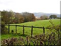
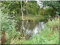
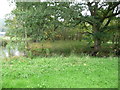
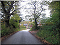
Nearby Images from Geograph Britain and Ireland:
©2007(licence)
©2012(licence)
©2012(licence)
©2010(licence)

©2012(licence)
The above images may not be of the site on this page, they are loaded from Geograph.
Please Submit an Image of this site or go out and take one for us!
Click here to see more info for this site
Nearby sites
Key: Red: member's photo, Blue: 3rd party photo, Yellow: other image, Green: no photo - please go there and take one, Grey: site destroyed
Download sites to:
KML (Google Earth)
GPX (GPS waypoints)
CSV (Garmin/Navman)
CSV (Excel)
To unlock full downloads you need to sign up as a Contributory Member. Otherwise downloads are limited to 50 sites.
Turn off the page maps and other distractions
Nearby sites listing. In the following links * = Image available
170m SW 219° Meifod Cursus Cursus (SJ15121367)
657m SSE 155° Meifod* Ancient Cross (SJ155132)
2.9km S 178° Ffynnon y Clawdd Llesg* Holy Well or Sacred Spring (SJ153109)
5.5km SW 219° Pentre Camp Hillfort (SJ11730957)
5.9km NNW 346° St Myllin's Well* Holy Well or Sacred Spring (SJ1393819533)
6.7km E 96° Trinity Well, Guilsfield Holy Well or Sacred Spring (SJ21881297)
7.1km E 95° Gaer Fawr (Guilsfield)* Hillfort (SJ223130)
7.1km ENE 67° Collfryn Ring Ditch Misc. Earthwork (SJ21861650)
8.1km SW 214° Tanllan Enclosure Ancient Village or Settlement (SJ10600715)
8.8km SSW 213° Ffynnon Fair (Llanfair Caereinion)* Holy Well or Sacred Spring (SJ1036106480)
9.5km SE 130° Maen Llog* Standing Stone (Menhir) (SJ225076)
9.8km SE 130° Powysland Museum* Museum (SJ226073)
10.0km SE 130° Welshpool Eisteddfod Circle* Modern Stone Circle etc (SJ2286307263)
10.9km SE 141° Sarn-y-bryn-caled II Cursus Cursus (SJ21970523)
10.9km ENE 78° Trinity Well, Arddleen Holy Well or Sacred Spring (SJ25951594)
10.9km SE 142° Sarn-y-bryn-caled II Cursus Cursus (SJ21830505)
11.0km SE 142° Welshpool A Cursus Cursus (SJ21820497)
11.0km SE 144° Welshpool A Cursus Cursus (SJ21640480)
11.1km N 9° Llwyn Bryn Dinas* Hillfort (SJ172247)
11.1km SE 142° Sarn-y-Bryn-Caled* Timber Circle (SJ219049)
11.1km N 351° Aber Rhaeadr* Standing Stone (Menhir) (SJ1369624820)
11.5km N 350° Meusydd Henge Complex* Henge (SJ134252)
12.4km NNW 347° Llanrhaeadr ym Mochnant (Standing Stone)* Standing Stone (Menhir) (SJ1254425902)
12.5km WSW 250° The Rustica Stone Early Christian Sculptured Stone (SJ0340809775)
12.5km NNW 346° St Dogfan's (Llanrhaeadr ym Mochnant)* Ancient Cross (SJ123260)
View more nearby sites and additional images

")
 We would like to know more about this location. Please feel free to add a brief description and any relevant information in your own language.
 Wir möchten mehr über diese Stätte erfahren. Bitte zögern Sie nicht, eine kurze Beschreibung und relevante Informationen in Deutsch hinzuzufügen.
 Nous aimerions en savoir encore un peu sur les lieux. S'il vous plaît n'hesitez pas à ajouter une courte description et tous les renseignements pertinents dans votre propre langue.
 Quisieramos informarnos un poco más de las lugares. No dude en añadir una breve descripción y otros datos relevantes en su propio idioma.