 with our Megalithic Portal iPhone app")

<< Text Pages >> Y Domen Fawr Cairn - Cairn in Wales in Monmouthshire
Submitted by thehappydruid on Wednesday, 24 July 2019 Page Views: 1254
Neolithic and Bronze AgeSite Name: Y Domen Fawr CairnCountry: Wales
NOTE: This site is 1.925 km away from the location you searched for.
County: Monmouthshire Type: Cairn
Nearest Town: Ebbw Vale
Map Ref: SO16600717
Latitude: 51.756985N Longitude: 3.209703W
Condition:
| 5 | Perfect |
| 4 | Almost Perfect |
| 3 | Reasonable but with some damage |
| 2 | Ruined but still recognisable as an ancient site |
| 1 | Pretty much destroyed, possibly visible as crop marks |
| 0 | No data. |
| -1 | Completely destroyed |
| 5 | Superb |
| 4 | Good |
| 3 | Ordinary |
| 2 | Not Good |
| 1 | Awful |
| 0 | No data. |
| 5 | Can be driven to, probably with disabled access |
| 4 | Short walk on a footpath |
| 3 | Requiring a bit more of a walk |
| 2 | A long walk |
| 1 | In the middle of nowhere, a nightmare to find |
| 0 | No data. |
| 5 | co-ordinates taken by GPS or official recorded co-ordinates |
| 4 | co-ordinates scaled from a detailed map |
| 3 | co-ordinates scaled from a bad map |
| 2 | co-ordinates of the nearest village |
| 1 | co-ordinates of the nearest town |
| 0 | no data |
Be the first person to rate this site - see the 'Contribute!' box in the right hand menu.
Internal Links:
External Links:
Cairn in Monmouthshire
Bronze age round cairn
You may be viewing yesterday's version of this page. To see the most up to date information please register for a free account.
Do not use the above information on other web sites or publications without permission of the contributor.
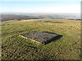
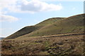
Nearby Images from Geograph Britain and Ireland:
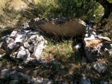
©2015(licence)
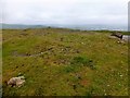
©2016(licence)
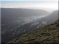
©2016(licence)
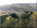
©2016(licence)
©2018(licence)
The above images may not be of the site on this page, they are loaded from Geograph.
Please Submit an Image of this site or go out and take one for us!
Click here to see more info for this site
Nearby sites
Key: Red: member's photo, Blue: 3rd party photo, Yellow: other image, Green: no photo - please go there and take one, Grey: site destroyed
Download sites to:
KML (Google Earth)
GPX (GPS waypoints)
CSV (Garmin/Navman)
CSV (Excel)
To unlock full downloads you need to sign up as a Contributory Member. Otherwise downloads are limited to 50 sites.
Turn off the page maps and other distractions
Nearby sites listing. In the following links * = Image available
4.9km SSE 155° Twyn-y-Bleddiaid Round Cairn (SO186027)
5.2km SW 216° New Tredegar House Platforms Ancient Village or Settlement (SO135030)
5.2km SW 221° New Tredeger Cairns Cairn (SO131033)
5.5km SW 221° New Tredegar Cairn Cairn (SO129031)
5.6km NE 54° Carreg Gywir Marker Stone (SO21191033)
7.0km WSW 246° Pentwyn Cairns Cairn (SO101044)
7.1km WSW 250° Mynydd Fochriw Cairn Cairn (SO099049)
7.1km S 177° St Sannan's Well* Holy Well or Sacred Spring (SO16860011)
7.3km WSW 238° Gelligaer Common Standing Stone* Standing Stone (Menhir) (SO10340340)
7.3km SE 135° St Illtyd's Castle Mound Artificial Mound (SO2172601919)
7.4km WSW 236° Blaenllwynau, Cairn II Cairn (SO10340318)
7.4km WSW 236° Blaenllwynau, Cairn I Cairn (SO10350316)
7.4km NW 321° Trefil-Las Round Barrow(s) (SO1213)
7.4km WSW 237° Pen Garnbugail Cairn (SO10250328)
7.5km WSW 240° Cairn North of Cairn Bugail Cairn (SO10010359)
7.5km WSW 241° Carn Y Bugail* Round Cairn (SO100036)
7.7km WSW 240° Pen Garnbugail Ring Cairn Ring Cairn (SO09870341)
7.8km WSW 239° Pen Garnbugail Ring Cairn (SO09870324)
7.8km WSW 239° Pen Garnbugail Round Barrow Cairn (SO09810329)
7.9km SSE 158° Twyn-Yr-Oerfel 1 Round Barrow(s) (ST195998)
7.9km WSW 238° Gelligaer Common Round Barrow(s) (SO09810305)
8.0km WSW 239° Cefn Gelli-Gaer Round Barrow(s) (SO09610318)
8.1km WSW 240° Coly Uchaf Cairn (SO09470326)
8.2km NE 48° Twyn-y-Dinas Hillfort (SO228125)
8.2km NNE 26° Mynydd Pen-cyrn Barrow Cemetery* Barrow Cemetery (SO20281449)
View more nearby sites and additional images


 We would like to know more about this location. Please feel free to add a brief description and any relevant information in your own language.
 Wir möchten mehr über diese Stätte erfahren. Bitte zögern Sie nicht, eine kurze Beschreibung und relevante Informationen in Deutsch hinzuzufügen.
 Nous aimerions en savoir encore un peu sur les lieux. S'il vous plaît n'hesitez pas à ajouter une courte description et tous les renseignements pertinents dans votre propre langue.
 Quisieramos informarnos un poco más de las lugares. No dude en añadir una breve descripción y otros datos relevantes en su propio idioma.