<< Our Photo Pages >> Fontaine de Krenenan - Holy Well or Sacred Spring in France in Bretagne:Morbihan (56)
Submitted by ogham on Wednesday, 22 May 2013 Page Views: 1950
Springs and Holy WellsSite Name: Fontaine de KrenenanCountry: France
NOTE: This site is 2.434 km away from the location you searched for.
Département: Bretagne:Morbihan (56) Type: Holy Well or Sacred Spring
Nearest Town: Pontivy Nearest Village: Guemene-sur-Scorff
Latitude: 48.082781N Longitude: 3.23042W
Condition:
| 5 | Perfect |
| 4 | Almost Perfect |
| 3 | Reasonable but with some damage |
| 2 | Ruined but still recognisable as an ancient site |
| 1 | Pretty much destroyed, possibly visible as crop marks |
| 0 | No data. |
| -1 | Completely destroyed |
| 5 | Superb |
| 4 | Good |
| 3 | Ordinary |
| 2 | Not Good |
| 1 | Awful |
| 0 | No data. |
| 5 | Can be driven to, probably with disabled access |
| 4 | Short walk on a footpath |
| 3 | Requiring a bit more of a walk |
| 2 | A long walk |
| 1 | In the middle of nowhere, a nightmare to find |
| 0 | No data. |
| 5 | co-ordinates taken by GPS or official recorded co-ordinates |
| 4 | co-ordinates scaled from a detailed map |
| 3 | co-ordinates scaled from a bad map |
| 2 | co-ordinates of the nearest village |
| 1 | co-ordinates of the nearest town |
| 0 | no data |
Internal Links:
External Links:
I have visited· I would like to visit
rrmoser would like to visit
Ogham has visited here
")
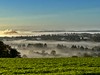
As you head out of Guemene-sur-Scorff on the D1 heading towards Plouray the fountain is on the right hand side of the road but you will hardly see it as it is well below the road level.
You will need to park in the layby and cross the road following the sign down to the fountain.
You may be viewing yesterday's version of this page. To see the most up to date information please register for a free account.
")
")
Do not use the above information on other web sites or publications without permission of the contributor.
davidmorgan has found this location on Google Street View:
Nearby Images from Flickr


The above images may not be of the site on this page, but were taken nearby. They are loaded from Flickr so please click on them for image credits.
Click here to see more info for this site
Nearby sites
Click here to view sites on an interactive map of the areaKey: Red: member's photo, Blue: 3rd party photo, Yellow: other image, Green: no photo - please go there and take one, Grey: site destroyed
Download sites to:
KML (Google Earth)
GPX (GPS waypoints)
CSV (Garmin/Navman)
CSV (Excel)
To unlock full downloads you need to sign up as a Contributory Member. Otherwise downloads are limited to 50 sites.
Turn off the page maps and other distractions
Nearby sites listing. In the following links * = Image available
986m N 9° Allée Couverte du Lannic* Passage Grave
6.3km NNW 340° Menhir de Kergoët Standing Stone (Menhir)
6.3km NNE 16° Dolmen de Villeneuve Burial Chamber or Dolmen
8.0km N 8° Quenouille Du Diable* Standing Stone (Menhir)
9.1km ESE 109° Menhir dit la Pierre du Diable (Guern) Standing Stone (Menhir)
9.3km SE 131° Menhir dit Men Glass Standing Stone (Menhir)
9.5km E 98° Les Trois Menhirs de Saint-Etienne* Standing Stones
10.3km SE 129° Pierres de Kerlen* Standing Stones
10.6km NE 47° Allée Couverte du Grand Boduic Passage Grave
10.7km E 93° Saint Nizon allée couverte* Burial Chamber or Dolmen
11.7km W 261° Dolmen de Moustérien Burial Chamber or Dolmen
12.2km NNW 346° Menhir de Cornec* Standing Stone (Menhir)
12.2km SSE 159° Menhir de Plomedec* Standing Stone (Menhir)
12.3km WNW 297° Dolmen de Guidfosse* Burial Chamber or Dolmen
12.4km NE 49° Allée Couverte de Toulhardi Passage Grave
12.6km N 350° Menhir d'Hacadour* Standing Stone (Menhir)
12.7km NE 54° Allée Couverte de Park-er-Bé Passage Grave
13.8km WSW 251° Dolmen de Rostren Cist
13.8km NE 53° Menhir du Breuil-du-Chêne 3 Standing Stone (Menhir)
13.9km NE 51° Menhir du Breuil-du-Chêne 2 Standing Stone (Menhir)
14.0km NE 51° Menhir du Breuil-du-Chêne 1 Standing Stone (Menhir)
14.2km NE 50° Menhir du Breuil-du-Chêne 4 Standing Stone (Menhir)
14.7km NE 55° Bugul-er-Hoet* Standing Stone (Menhir)
14.9km NE 52° Bugul er Hoët Menhir* Standing Stone (Menhir)
15.0km NNE 17° Bochacoat allée couverte* Passage Grave
View more nearby sites and additional images


 We would like to know more about this location. Please feel free to add a brief description and any relevant information in your own language.
 Wir möchten mehr über diese Stätte erfahren. Bitte zögern Sie nicht, eine kurze Beschreibung und relevante Informationen in Deutsch hinzuzufügen.
 Nous aimerions en savoir encore un peu sur les lieux. S'il vous plaît n'hesitez pas à ajouter une courte description et tous les renseignements pertinents dans votre propre langue.
 Quisieramos informarnos un poco más de las lugares. No dude en añadir una breve descripción y otros datos relevantes en su propio idioma.