<< Our Photo Pages >> Niddrie House - Standing Stone (Menhir) in Scotland in Midlothian
Submitted by crannog on Sunday, 22 December 2002 Page Views: 10352
Neolithic and Bronze AgeSite Name: Niddrie HouseCountry: Scotland
NOTE: This site is 0.47 km away from the location you searched for.
County: Midlothian Type: Standing Stone (Menhir)
Nearest Town: Edinburgh Nearest Village: Niddrie House
Map Ref: NT29877125 Landranger Map Number: 66
Latitude: 55.929183N Longitude: 3.123976W
Condition:
| 5 | Perfect |
| 4 | Almost Perfect |
| 3 | Reasonable but with some damage |
| 2 | Ruined but still recognisable as an ancient site |
| 1 | Pretty much destroyed, possibly visible as crop marks |
| 0 | No data. |
| -1 | Completely destroyed |
| 5 | Superb |
| 4 | Good |
| 3 | Ordinary |
| 2 | Not Good |
| 1 | Awful |
| 0 | No data. |
| 5 | Can be driven to, probably with disabled access |
| 4 | Short walk on a footpath |
| 3 | Requiring a bit more of a walk |
| 2 | A long walk |
| 1 | In the middle of nowhere, a nightmare to find |
| 0 | No data. |
| 5 | co-ordinates taken by GPS or official recorded co-ordinates |
| 4 | co-ordinates scaled from a detailed map |
| 3 | co-ordinates scaled from a bad map |
| 2 | co-ordinates of the nearest village |
| 1 | co-ordinates of the nearest town |
| 0 | no data |
Internal Links:
External Links:
I have visited· I would like to visit
Anne T visited on 28th Oct 2018 - their rating: Cond: 3 Amb: 2 Access: 5 Niddrie House Stone: This has to be one of the saddest little standing stones I’ve seen. Largely hidden by ivy and surrounded by rubbish, in between a largish utility building and a padlocked, disused cemetery, with a bus stop about 10m to the south west and a new estate with many security cameras to the north east. And a splodge of what was red paint running down from the top of the stone, too. If I could have dug this up and taken it home with me, I would.
")
Half-covered in ivy with a great splosh of pink paint covering the top, this wee stone sits surrounded by established housing with new-build developments blossoming all around. Has one cup mark.
For more information see Canmore ID 52221, which adds that this stone previously stood at an 'unspecified spot east of Craigmillar (and) was, in 1921, used "as a gatepost at the entrance to a private churchyard ... This cup-marked stone has been re-discovered by Mr Wilson at the corner of Greendykes Road and Niddrie House Avenue, a few metres behind a utility building (electricity) and just outside a small burial ground."
This standing stone is featured on The Ancient Stones: A Guide to Standing Stones and Stone Circles in the South of Scotland - see their entry for the Standing Stone, Niddrie House, Edinburgh, which includes a description, directions for finding this stone together with nearby parking, and fieldnotes. The Ancient Stones adds that 'the old graveyard immediately to the north may have some lost connection with this stone."
You may be viewing yesterday's version of this page. To see the most up to date information please register for a free account.
")
")
")
Do not use the above information on other web sites or publications without permission of the contributor.
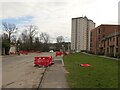
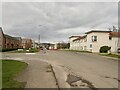
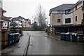
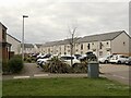
Nearby Images from Geograph Britain and Ireland:
©2023(licence)
©2023(licence)
©2021(licence)
©2023(licence)
©2009(licence)
The above images may not be of the site on this page, they are loaded from Geograph.
Please Submit an Image of this site or go out and take one for us!
Click here to see more info for this site
Nearby sites
Key: Red: member's photo, Blue: 3rd party photo, Yellow: other image, Green: no photo - please go there and take one, Grey: site destroyed
Download sites to:
KML (Google Earth)
GPX (GPS waypoints)
CSV (Garmin/Navman)
CSV (Excel)
To unlock full downloads you need to sign up as a Contributory Member. Otherwise downloads are limited to 50 sites.
Turn off the page maps and other distractions
Nearby sites listing. In the following links * = Image available
1.8km WSW 244° Ravenswood Avenue* Standing Stone (Menhir) (NT2828270502)
2.2km NW 310° Delf Well* Holy Well or Sacred Spring (NT282727)
2.5km NW 319° Holyrood Park Stone (Edinburgh) Natural Stone / Erratic / Other Natural Feature (NT28267313)
2.5km WSW 256° Cat Stane (Inch)* Standing Stone (Menhir) (NT27457068)
2.6km NW 317° Dunsapie Crag* Hillfort (NT28177316)
2.7km WNW 296° Samson's Ribs* Promontory Fort / Cliff Castle (NT27457250)
2.7km NW 304° Arthur's Seat* Hillfort (NT27647282)
3.3km NW 315° St Anthony's Well (Edinburgh)* Holy Well or Sacred Spring (NT27527364)
3.4km WNW 295° Slidey Stane (Holyrood Park)* Natural Stone / Erratic / Other Natural Feature (NT2676672765)
3.5km NW 304° Salisbury Crags* Promontory Fort / Cliff Castle (NT27007326)
3.5km W 278° Penny Well (Edinburgh)* Holy Well or Sacred Spring (NT26367177)
3.6km NNW 334° St Triduana's Wellhouse* Holy Well or Sacred Spring (NT2833274468)
3.7km NW 311° St Margaret's Well (Edinburgh)* Holy Well or Sacred Spring (NT2713373712)
3.8km SW 220° Balm Well* Holy Well or Sacred Spring (NT2732268363)
4.1km NW 309° Girth Cross (Canongate)* Ancient Cross (NT2673973910)
4.2km WNW 293° Edinburgh Runestone* Carving (NT2598972937)
4.2km NW 306° Canongate Mercat Cross* Ancient Cross (NT2647273812)
4.3km NW 304° St John's Cross (Canongate)* Ancient Cross (NT2628873733)
4.5km WNW 296° National Museum of Scotland (Early Christian Stones)* Ancient Cross (NT2583273324)
4.6km WNW 295° National Museum of Scotland* Museum (NT2574873290)
4.6km WNW 295° National Museum of Scotland (Pictish Stones)* Museum (NT2572173302)
5.0km WNW 294° Grassmarket modern menhir* Standing Stone (Menhir) (NT25337333)
5.0km WNW 293° The Portsburgh Stone* Natural Stone / Erratic / Other Natural Feature (NT25287327)
5.1km E 94° Inveresk A Cursus Cursus (NT34947080)
5.1km WNW 295° Stone of Scone* Marker Stone (NT253735)
View more nearby sites and additional images


 We would like to know more about this location. Please feel free to add a brief description and any relevant information in your own language.
 Wir möchten mehr über diese Stätte erfahren. Bitte zögern Sie nicht, eine kurze Beschreibung und relevante Informationen in Deutsch hinzuzufügen.
 Nous aimerions en savoir encore un peu sur les lieux. S'il vous plaît n'hesitez pas à ajouter une courte description et tous les renseignements pertinents dans votre propre langue.
 Quisieramos informarnos un poco más de las lugares. No dude en añadir una breve descripción y otros datos relevantes en su propio idioma.