

<< Text Pages >> Twyn Pant-Teg - Cairn in Wales in Mid Glamorgan
Submitted by vicky on Wednesday, 25 February 2004 Page Views: 5241
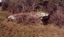
Neolithic and Bronze AgeSite Name: Twyn Pant-TegCountry: Wales
NOTE: This site is 2.725 km away from the location you searched for.
County: Mid Glamorgan Type: Cairn
Nearest Town: Newport Nearest Village: Lower Machen
Map Ref: ST239888 Landranger Map Number: 171
Latitude: 51.592888N Longitude: 3.099954W
Condition:
| 5 | Perfect |
| 4 | Almost Perfect |
| 3 | Reasonable but with some damage |
| 2 | Ruined but still recognisable as an ancient site |
| 1 | Pretty much destroyed, possibly visible as crop marks |
| 0 | No data. |
| -1 | Completely destroyed |
| 5 | Superb |
| 4 | Good |
| 3 | Ordinary |
| 2 | Not Good |
| 1 | Awful |
| 0 | No data. |
| 5 | Can be driven to, probably with disabled access |
| 4 | Short walk on a footpath |
| 3 | Requiring a bit more of a walk |
| 2 | A long walk |
| 1 | In the middle of nowhere, a nightmare to find |
| 0 | No data. |
| 5 | co-ordinates taken by GPS or official recorded co-ordinates |
| 4 | co-ordinates scaled from a detailed map |
| 3 | co-ordinates scaled from a bad map |
| 2 | co-ordinates of the nearest village |
| 1 | co-ordinates of the nearest town |
| 0 | no data |
Be the first person to rate this site - see the 'Contribute!' box in the right hand menu.
Internal Links:
External Links:
Cairn in Mid Glamorgan (Caerphilly)
RCAHMW Coflein record:
Twyn Pant-Teg.
Have you visited this site? Please add a comment below.
You may be viewing yesterday's version of this page. To see the most up to date information please register for a free account.
Do not use the above information on other web sites or publications without permission of the contributor.
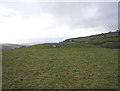
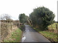
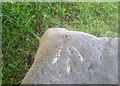
Nearby Images from Geograph Britain and Ireland:
©2008(licence)
©2010(licence)
©2019(licence)
©2017(licence)
©2022(licence)
The above images may not be of the site on this page, they are loaded from Geograph.
Please Submit an Image of this site or go out and take one for us!
Click here to see more info for this site
Nearby sites
Key: Red: member's photo, Blue: 3rd party photo, Yellow: other image, Green: no photo - please go there and take one, Grey: site destroyed
Download sites to:
KML (Google Earth)
GPX (GPS waypoints)
CSV (Garmin/Navman)
CSV (Excel)
To unlock full downloads you need to sign up as a Contributory Member. Otherwise downloads are limited to 50 sites.
Turn off the page maps and other distractions
Nearby sites listing. In the following links * = Image available
141m NE 44° Twyn Pant-Teg Round Barrow(s) (ST240889)
1.9km NW 307° Begwns Cairn (ST22379000)
2.3km NNE 28° Rogerstone 2 Round Barrow(s) (ST250908)
2.5km NE 44° Risca Round Cairn (ST257906)
2.7km ESE 113° Rhiwderin Camp Hillfort (ST264877)
2.8km SE 130° Rhiwderin (Newport) Rock Art (ST260870)
2.8km NE 34° Rogerstone 1 Round Barrow(s) (ST255911)
3.1km SE 142° Croes-Carn-Einion Hillfort (ST258863)
3.4km NNE 18° Henllys Complex Barrow Cemetery (ST2592)
3.8km N 4° Twm Barlwm* Hillfort (ST24209260)
3.9km N 6° Twm Barlwm Round Cairn Round Cairn (ST244927)
4.1km NNE 16° Mynydd Henllys* Barrow Cemetery (ST251927)
4.3km SE 128° Coed Ffynnon-Oer Hillfort (ST273861)
4.4km SSE 152° The Mount* Hillfort (ST259849)
4.4km SSE 154° Graig (Monmouthshire) Cairn (ST258848)
5.3km SE 134° Gwern y Cleppa* Chambered Tomb (ST27648505)
5.4km S 177° Druidstone (Michaelstone)* Standing Stone (Menhir) (ST24138342)
5.5km ESE 111° Tredegar Hillfort* Hillfort (ST290868)
5.8km WNW 287° Twyn-Yr-Oerfel A* Round Barrow(s) (ST18399058)
5.9km SW 214° Graig Llwyn Iron Age Fort* Hillfort (ST205840)
6.1km WNW 287° Twyn-Yr-Oerfel B* Round Barrow(s) (ST18109068)
6.8km NW 317° Twyn Tudor (Mynyddislwyn)* Artificial Mound (ST193938)
7.0km WNW 292° Twyn Cae-Hugh* Round Barrow(s) (ST17379149)
7.3km NNE 32° Green Meadow Woods Holy Well or Sacred Spring (ST27859489)
7.4km E 96° Newport Museum and Art Gallery* Museum (ST31278791)
View more nearby sites and additional images


 We would like to know more about this location. Please feel free to add a brief description and any relevant information in your own language.
 Wir möchten mehr über diese Stätte erfahren. Bitte zögern Sie nicht, eine kurze Beschreibung und relevante Informationen in Deutsch hinzuzufügen.
 Nous aimerions en savoir encore un peu sur les lieux. S'il vous plaît n'hesitez pas à ajouter une courte description et tous les renseignements pertinents dans votre propre langue.
 Quisieramos informarnos un poco más de las lugares. No dude en añadir una breve descripción y otros datos relevantes en su propio idioma.