

<< Text Pages >> Cwm Mawr Stone Axe Factory - Ancient Mine, Quarry or other Industry in Wales in Powys
Submitted by Andy B on Tuesday, 06 May 2008 Page Views: 11007
Multi-periodSite Name: Cwm Mawr Stone Axe FactoryCountry: Wales County: Powys Type: Ancient Mine, Quarry or other Industry
Map Ref: SO305950
Latitude: 52.548392N Longitude: 3.02636W
Condition:
| 5 | Perfect |
| 4 | Almost Perfect |
| 3 | Reasonable but with some damage |
| 2 | Ruined but still recognisable as an ancient site |
| 1 | Pretty much destroyed, possibly visible as crop marks |
| 0 | No data. |
| -1 | Completely destroyed |
| 5 | Superb |
| 4 | Good |
| 3 | Ordinary |
| 2 | Not Good |
| 1 | Awful |
| 0 | No data. |
| 5 | Can be driven to, probably with disabled access |
| 4 | Short walk on a footpath |
| 3 | Requiring a bit more of a walk |
| 2 | A long walk |
| 1 | In the middle of nowhere, a nightmare to find |
| 0 | No data. |
| 5 | co-ordinates taken by GPS or official recorded co-ordinates |
| 4 | co-ordinates scaled from a detailed map |
| 3 | co-ordinates scaled from a bad map |
| 2 | co-ordinates of the nearest village |
| 1 | co-ordinates of the nearest town |
| 0 | no data |
Be the first person to rate this site - see the 'Contribute!' box in the right hand menu.
Internal Links:
External Links:
Stone Axe Factory in Powys. Cwm Mawr Axe Factory, Hyssington, Archaeological Survey and Excavation 2007.
A programme of survey and trial excavation has now been completed in an attempt to confirm the source of the Group XII Bronze Age battle axes and axe hammers which have been found in Wales and the Marches. The axes are made from a distinct rock type known as picrite which is has a very limited distribution, with one of the known outcrops being a small hill near Cwm Mawr, just to the north-west of the village of Hyssington in eastern Montgomeryshire.
The Cwm Mawr area was first suggested as a potential source for the axes following a study in the 1950s, the results of which were published in a paper by Shotton, Chitty and Seaby in the Proceedings of the Prehistoric Society in 1951. They identified a number of likely rock sources around the hill, including a small quarry, and concluded that the site 'clearly calls for excavation'. Since the 1950s other products from the axe factory have been found over a wide distribution and a number of other local features such as picrite outcrops, boulders, and small quarries have been recorded.
The present project was undertaken with funding from Cadw in an attempt to define the extent of prehistoric workings and assess their potential, as well as considering their future management.
Read more at CPAT
You may be viewing yesterday's version of this page. To see the most up to date information please register for a free account.
Do not use the above information on other web sites or publications without permission of the contributor.
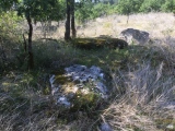
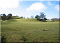
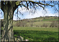
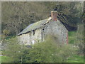
Nearby Images from Geograph Britain and Ireland:
©2008(licence)
©2008(licence)
©2018(licence)
©2008(licence)
©2008(licence)
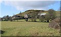
The above images may not be of the site on this page, they are loaded from Geograph.
Please Submit an Image of this site or go out and take one for us!
Click here to see more info for this site
Nearby sites
Key: Red: member's photo, Blue: 3rd party photo, Yellow: other image, Green: no photo - please go there and take one, Grey: site destroyed
Download sites to:
KML (Google Earth)
GPX (GPS waypoints)
CSV (Garmin/Navman)
CSV (Excel)
To unlock full downloads you need to sign up as a Contributory Member. Otherwise downloads are limited to 50 sites.
Turn off the page maps and other distractions
Nearby sites listing. In the following links * = Image available
1.1km N 1° Corndon Hill 6* Cairn (SO30539608)
1.1km W 268° Roundton* Hillfort (SO29389498)
1.4km NNE 14° Corndon Hill 5* Cairn (SO30869632)
1.7km N 357° Corndon Hill 1* Cairn (SO30449666)
1.7km N 356° Corndon Hill 8* Cairn (SO304967)
1.8km NNE 12° Corndon Hill 3* Cairn (SO30909676)
1.8km NNW 347° Corndon Hill 7* Cairn (SO301968)
1.9km NNE 13° Corndon Hill 4* Cairn (SO30949680)
1.9km N 2° Corndon Hill 2* Cairn (SO30609693)
2.4km NNW 347° New House Long Barrow* Long Barrow (SO300973)
2.5km N 357° The Whetstones* Stone Circle (SO30429753)
2.9km E 100° Heath Mynd Bronze Age Homestead* Misc. Earthwork (SO33369447)
3.1km N 359° Druid's Castle* Stone Circle (SO305981)
3.2km SE 141° The Roveries* Hillfort (SO325925)
3.3km N 358° Mitchell's Fold outlier* Standing Stone (Menhir) (SO30429828)
3.3km WNW 285° Calcot Camp* Hillfort (SO273959)
3.4km N 358° Mitchell's Fold* Stone Circle (SO30429837)
3.7km N 355° Middleton Hill Round Barrow(s) (SO302987)
3.9km N 10° Stapeley Hill Earthworks* Misc. Earthwork (SO312988)
3.9km N 5° Cow Stone (Shropshire)* Standing Stone (Menhir) (SO30919888)
4.0km NNW 348° Middleton Hall* Standing Stone (Menhir) (SO297989)
4.1km N 10° Stapeley Hill Cairn* Cairn (SO31279904)
4.4km NNE 14° Giant's Grave (Shropshire)* Burial Chamber or Dolmen (SO31659925)
4.7km NE 55° Ritton Castle* Hillfort (SO34449765)
5.3km NNE 20° Hoarstones* Stone Circle (SO32419990)
View more nearby sites and additional images


 We would like to know more about this location. Please feel free to add a brief description and any relevant information in your own language.
 Wir möchten mehr über diese Stätte erfahren. Bitte zögern Sie nicht, eine kurze Beschreibung und relevante Informationen in Deutsch hinzuzufügen.
 Nous aimerions en savoir encore un peu sur les lieux. S'il vous plaît n'hesitez pas à ajouter une courte description et tous les renseignements pertinents dans votre propre langue.
 Quisieramos informarnos un poco más de las lugares. No dude en añadir una breve descripción y otros datos relevantes en su propio idioma.