<< Our Photo Pages >> Twyn yr Allt - Ancient Village or Settlement in Wales in Monmouthshire
Submitted by vicky on Sunday, 21 July 2002 Page Views: 5970
Multi-periodSite Name: Twyn yr AlltCountry: Wales
NOTE: This site is 0.413 km away from the location you searched for.
County: Monmouthshire Type: Ancient Village or Settlement
Nearest Town: Abergavenny
Map Ref: SO296163 Landranger Map Number: 161
Latitude: 51.840847N Longitude: 3.023251W
Condition:
| 5 | Perfect |
| 4 | Almost Perfect |
| 3 | Reasonable but with some damage |
| 2 | Ruined but still recognisable as an ancient site |
| 1 | Pretty much destroyed, possibly visible as crop marks |
| 0 | No data. |
| -1 | Completely destroyed |
| 5 | Superb |
| 4 | Good |
| 3 | Ordinary |
| 2 | Not Good |
| 1 | Awful |
| 0 | No data. |
| 5 | Can be driven to, probably with disabled access |
| 4 | Short walk on a footpath |
| 3 | Requiring a bit more of a walk |
| 2 | A long walk |
| 1 | In the middle of nowhere, a nightmare to find |
| 0 | No data. |
| 5 | co-ordinates taken by GPS or official recorded co-ordinates |
| 4 | co-ordinates scaled from a detailed map |
| 3 | co-ordinates scaled from a bad map |
| 2 | co-ordinates of the nearest village |
| 1 | co-ordinates of the nearest town |
| 0 | no data |
Be the first person to rate this site - see the 'Contribute!' box in the right hand menu.
Internal Links:
External Links:
I have visited· I would like to visit
eyesopen visited on 2nd Feb 2018 - their rating: Cond: 2 Amb: 4 Access: 4 a short footpath approach from Deri lane but steep.
")
Have you visited this site? Please add a comment below.
You may be viewing yesterday's version of this page. To see the most up to date information please register for a free account.
Do not use the above information on other web sites or publications without permission of the contributor.
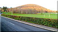
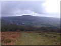
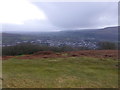
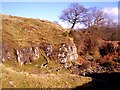
Nearby Images from Geograph Britain and Ireland:
©2012(licence)
©2013(licence)
©2013(licence)
©2009(licence)
©2007(licence)
The above images may not be of the site on this page, they are loaded from Geograph.
Please Submit an Image of this site or go out and take one for us!
Click here to see more info for this site
Nearby sites
Key: Red: member's photo, Blue: 3rd party photo, Yellow: other image, Green: no photo - please go there and take one, Grey: site destroyed
Download sites to:
KML (Google Earth)
GPX (GPS waypoints)
CSV (Garmin/Navman)
CSV (Excel)
To unlock full downloads you need to sign up as a Contributory Member. Otherwise downloads are limited to 50 sites.
Turn off the page maps and other distractions
Nearby sites listing. In the following links * = Image available
1.5km E 88° St Teilo's Church (Llantilio Pertholey)* Ancient Cross (SO31141633)
2.2km NE 55° Trillech Stone Row / Alignment (SO314175)
2.4km S 171° Abergavenny Museum* Museum (SO2995913943)
2.5km SSE 165° Priory Well (Abergavenny)* Holy Well or Sacred Spring (SO30231387)
2.6km SSW 197° Llanfoist Standing Stone* Standing Stone (Menhir) (SO28781379)
3.2km NNW 348° Blaenawey Well (Bettws)* Holy Well or Sacred Spring (SO290194)
4.0km ENE 59° Ysgyryd Fawr* Hillfort (SO331183)
5.1km SSW 210° Blorenge Cairn* Round Cairn (SO270119)
5.7km N 357° Twyn-y-Gaer (Monmouthshire) Hillfort (SO2938721948)
5.8km WSW 239° Bedd y Gwr Hir* Standing Stone (Menhir) (SO246134)
5.8km WNW 284° Golden Grove* Standing Stone (Menhir) (SO2396217829)
6.2km SW 215° Blorenge West Flank - Y Blorens* Not Known (by us) (SO260113)
6.4km NNW 344° Partrishow Churchyard Cross* Ancient Cross (SO2788822434)
6.4km W 274° Cwrt-y-Gollen* Standing Stone (Menhir) (SO2324116860)
6.4km NNW 343° Ffynnon Ishow* Holy Well or Sacred Spring (SO2784322428)
6.4km WNW 292° Coed Ynys Faen* Standing Stones (SO237188)
6.6km SW 234° Carreg Gywir* Stone Row / Alignment (SO242125)
6.7km SSW 201° Carn y Defaid (N)* Cairn (SO27081004)
6.8km SSW 201° Carn y Defaid (S)* Cairn (SO27040997)
6.8km E 82° St Gwytherine's Grave Stone* Early Christian Sculptured Stone (SO364172)
6.9km SW 234° Gilwern Hill* Standing Stone (Menhir) (SO2395512301)
7.1km E 83° Llanvetherine Holy Well* Holy Well or Sacred Spring (SO36671704)
7.1km N 2° St Martin's Church (Cwmyoy)* Ancient Cross (SO29902340)
7.1km NNE 20° Pen-Twyn Hillfort (SO321230)
7.2km W 261° Gaer Settlement Ancient Village or Settlement (SO225153)
View more nearby sites and additional images


 We would like to know more about this location. Please feel free to add a brief description and any relevant information in your own language.
 Wir möchten mehr über diese Stätte erfahren. Bitte zögern Sie nicht, eine kurze Beschreibung und relevante Informationen in Deutsch hinzuzufügen.
 Nous aimerions en savoir encore un peu sur les lieux. S'il vous plaît n'hesitez pas à ajouter une courte description et tous les renseignements pertinents dans votre propre langue.
 Quisieramos informarnos un poco más de las lugares. No dude en añadir una breve descripción y otros datos relevantes en su propio idioma.