<< Our Photo Pages >> Caer Caradoc (Chapel Lawn) - Hillfort in England in Shropshire

Submitted by Jenniferalicemay on Friday, 02 September 2022  Page Views: 20236

Iron Age and Later PrehistorySite Name: Caer Caradoc (Chapel Lawn)
Country: England
NOTE: This site is 1.475 km away from the location you searched for.

County: Shropshire Type: Hillfort
Nearest Town: Knighton  Nearest Village: Chapel Lawn
Map Ref: SO310758  Landranger Map Number: 137
Latitude: 52.375875N  Longitude: 3.01501W
Condition:
5Perfect
4Almost Perfect
3Reasonable but with some damage
2Ruined but still recognisable as an ancient site
1Pretty much destroyed, possibly visible as crop marks
0No data.
-1Completely destroyed
4 Ambience:
5Superb
4Good
3Ordinary
2Not Good
1Awful
0No data.
4 Access:
5Can be driven to, probably with disabled access
4Short walk on a footpath
3Requiring a bit more of a walk
2A long walk
1In the middle of nowhere, a nightmare to find
0No data.
3 Accuracy:
5co-ordinates taken by GPS or official recorded co-ordinates
4co-ordinates scaled from a detailed map
3co-ordinates scaled from a bad map
2co-ordinates of the nearest village
1co-ordinates of the nearest town
0no data
3

Internal Links:
External Links:

I have visited· I would like to visit

SolarMegalith would like to visit

Jenniferalicemay visited on 15th Mar 2020 - their rating: Cond: 3 Amb: 5 Access: 3 I grew up a couple of miles from this site and I have visited the hillfort hundreds of times. The earthworks are well preserved with several ditches at least one entrance. The fort is accessible via a footpath on either side, sheep roam over the hill and there is a fair bit of gorse growing on the top. Some people in the village say that the river Redlake got its name from a bloody battle that happened at the fort, which is upstream from the village of Bucknell. On a clear day looking towards the east from the “gates” you can see the standing stone of Pen-y-cwm.

TheWhiteRider TimPrevett have visited here
Caer Caradoc (Chapel Lawn)
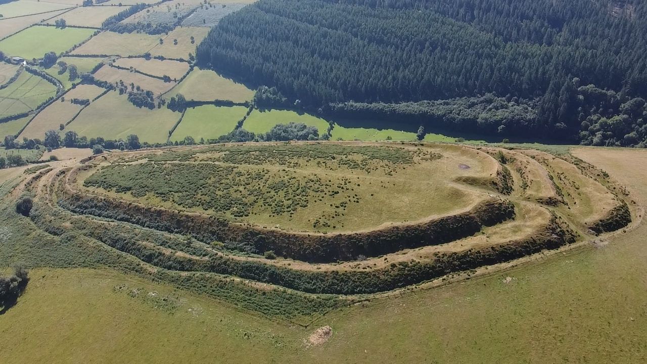
Caer Caradoc (Chapel Lawn) submitted by camperman : An aerial view from the North. (Vote or comment on this photo)
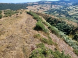
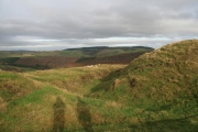
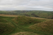
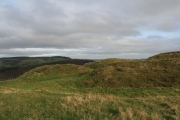
This is the more southerly of two hillforts in Shropshire named Caer Caradoc. The earthworks are well preserved with several ditches at least one entrance. The fort is accessible via a footpath on either side, sheep roam over the hill and there is a fair bit of gorse growing on the top. On a clear day looking towards the east from the “gates” you can see the standing stone of Pen-y-cwm.

Some people in the village say that the river Redlake got its name from a bloody battle that happened at the fort, which is upstream from the village of Bucknell.

Page originally by Vicky
You may be viewing yesterday's version of this page. To see the most up to date information please register for a free account.
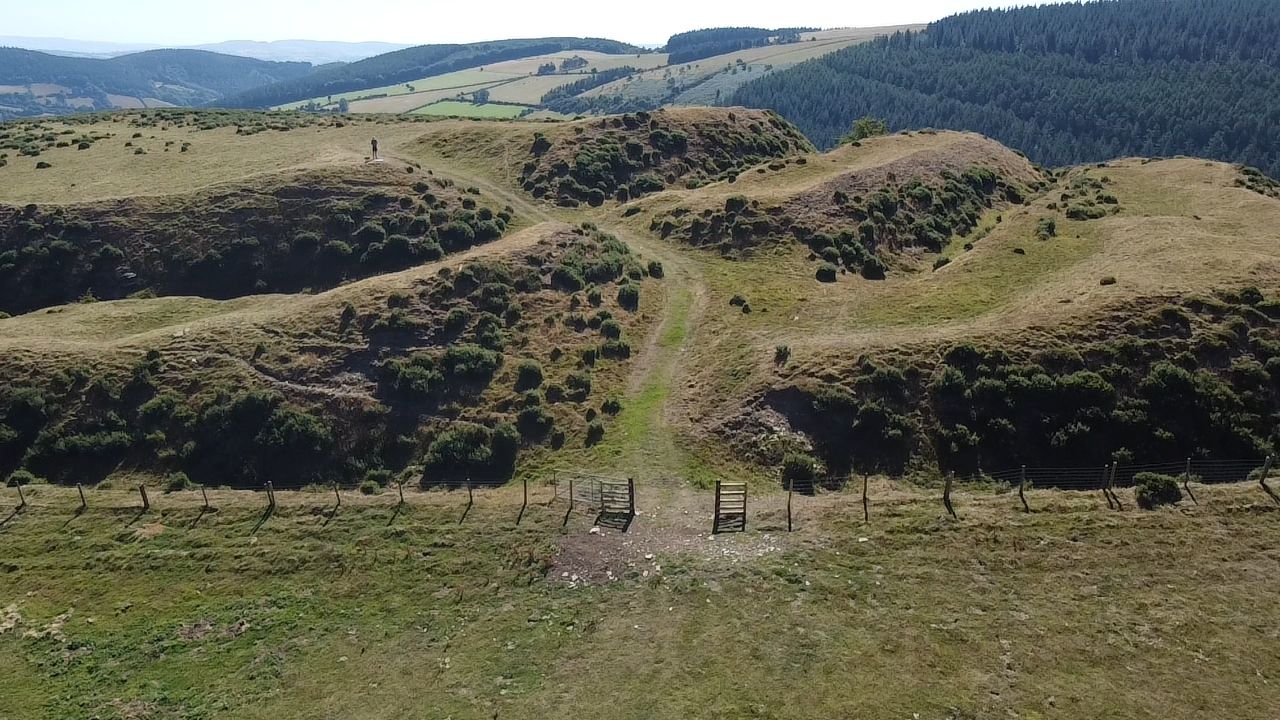
Caer Caradoc (Chapel Lawn)
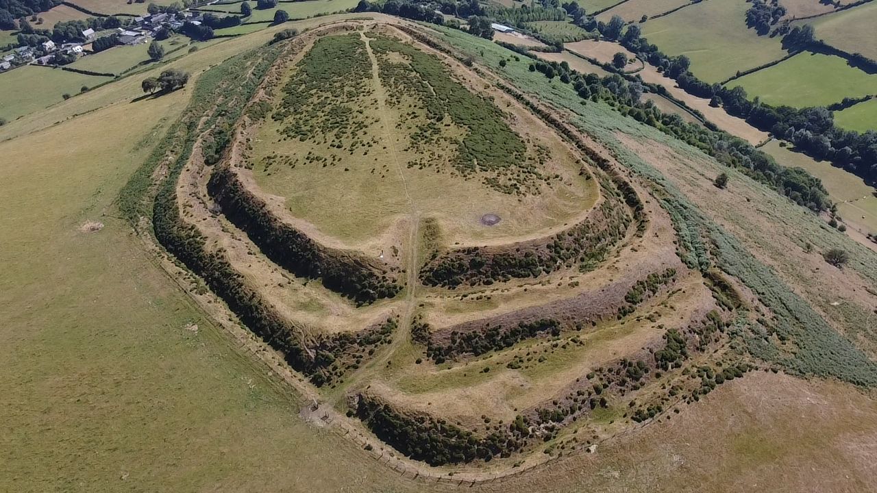
Caer Caradoc (Chapel Lawn) submitted by camperman : An aerial view of Caer Caradoc showing the ipressive earthworks and elaborate entrance to the West. (Vote or comment on this photo)

Caer Caradoc (Chapel Lawn)
Caer Caradoc (Chapel Lawn) submitted by camperman : The Western entrance defended by widely spaced curving ramparts. (Vote or comment on this photo)

Caer Caradoc (Chapel Lawn)
Caer Caradoc (Chapel Lawn) submitted by TimPrevett : A view of Caer Carodoc, one of two so-named hillforts in Shropshire; this view from the Great Hagley standing stone to the East. This shows its superb hilltop position around the crest of the hill here. We were also suspicious of the small upright feature in the middle distance... a tree stump, or something a bit more lithic? (1 comment - Vote or comment on this photo)

Caer Caradoc (Chapel Lawn)
Caer Caradoc (Chapel Lawn) submitted by camperman : The Eastern entrance. (Vote or comment on this photo)

Caer Caradoc (Chapel Lawn)
Caer Caradoc (Chapel Lawn) submitted by camperman : The Southern rampart and ditch.

Caer Caradoc (Chapel Lawn)
Caer Caradoc (Chapel Lawn) submitted by Postman : The less impressive east entrance, looking over to Great Hagley standing stone.

Caer Caradoc (Chapel Lawn)
Caer Caradoc (Chapel Lawn) submitted by Postman : Looking over the west entrance, it's very impressive.

Caer Caradoc (Chapel Lawn)
Caer Caradoc (Chapel Lawn) submitted by Postman : Autumnal

Caer Caradoc (Chapel Lawn)
Caer Caradoc (Chapel Lawn) submitted by Postman : Looking along the northern ramparts.

Caer Caradoc (Chapel Lawn)
Caer Caradoc (Chapel Lawn) submitted by Postman : Hill works carved out by high energy lasers from an orbital platform. Honest to god, I was there.

Caer Caradoc (Chapel Lawn)
Caer Caradoc (Chapel Lawn) submitted by Postman : The west entrance

Caer Caradoc (Chapel Lawn)
Caer Caradoc (Chapel Lawn) submitted by Postman

Caer Caradoc (Chapel Lawn)
Caer Caradoc (Chapel Lawn) submitted by Postman : Looking out the main posh west entrance.

Caer Caradoc (Chapel Lawn)
Caer Caradoc (Chapel Lawn) submitted by Postman : Looking in the the main posh west entrance.

Caer Caradoc (Chapel Lawn)
Caer Caradoc (Chapel Lawn) submitted by Postman : Further round the corner, on the south ramparts.

Caer Caradoc (Chapel Lawn)
Caer Caradoc (Chapel Lawn) submitted by Postman : Round the south corner from the east entrance

Caer Caradoc (Chapel Lawn)
Caer Caradoc (Chapel Lawn) submitted by jfarrar : The southern aspect, looking down into the Redlake Valley

Caer Caradoc (Chapel Lawn)
Caer Caradoc (Chapel Lawn) submitted by jfarrar : Looking westwards from the western entrance

Caer Caradoc (Chapel Lawn)
Caer Caradoc (Chapel Lawn) submitted by TheWhiteRider : This view of Caer Caradoc was taken from close to the Pen-Y-Wern Stone Circle. Very impressive, despite a dull day.

Caer Caradoc (Chapel Lawn)
Caer Caradoc (Chapel Lawn) submitted by TimPrevett : This is the more southerly of two hillforts in Shropshire named Caer Caradoc. Looking S on the W Side, towards the Herefordshire border.

Caer Caradoc (Chapel Lawn)
Caer Caradoc (Chapel Lawn) submitted by TimPrevett : This is the more southerly of two hillforts in Shropshire named Caer Caradoc. Looking N on the W Side, entrance in the foreground. (1 comment)

Do not use the above information on other web sites or publications without permission of the contributor.
Click here to see more info for this site

Nearby sites

Click here to view sites on an interactive OS map

Key: Red: member's photo, Blue: 3rd party photo, Yellow: other image, Green: no photo - please go there and take one, Grey: site destroyed

Download sites to:
KML (Google Earth)
GPX (GPS waypoints)
CSV (Garmin/Navman)
CSV (Excel)

To unlock full downloads you need to sign up as a Contributory Member. Otherwise downloads are limited to 50 sites.


Turn off the page maps and other distractions

Nearby sites listing. In the following links * = Image available
 2.9km N 7° Pen-Y-Wern Conglomerate* Standing Stone (Menhir) (SO31407871)
 3.0km N 5° Pen-Y-Wern Hill* Stone Circle (SO313788)
 3.0km NNE 18° Fiddler's Elbow Standing Stone (Menhir) (SO32007865)
 3.0km N 8° Pen-Y-Wern Outlier Standing Stone (Menhir) (SO31447880)
 3.1km NNW 338° Clun Hill Stones* Standing Stones (SO29897873)
 3.3km NNW 335° Clun Hill Glacial Erratic* Natural Stone / Erratic / Other Natural Feature (SO29667881)
 3.4km NW 323° Rockhill Iron Age Enclosure* Misc. Earthwork (SO290785)
 3.4km ENE 74° Great Hagley* Standing Stone (Menhir) (SO343767)
 4.2km SW 216° Offa's Dyke Centre* Museum (SO2850172430)
 4.3km E 87° Castle Ditches (Shropshire)* Ancient Village or Settlement (SO35357594)
 5.1km SW 218° Jacket's Well, The Jackets, Jackets Well* Holy Well or Sacred Spring (SO2776271836)
 5.6km NW 311° Llanfair Hill East Standing Stone (Menhir) (SO26797950)
 5.7km S 183° Spaceguard Centre* Modern Stone Circle etc (SO3066970104)
 6.0km N 9° Radnor Wood Camp* Hillfort (SO320817)
 6.1km ESE 112° Coxall Knoll* Hillfort (SO366734)
 6.1km ENE 59° Hopton Castle Standing Stone (Menhir) (SO36297883)
 6.3km WNW 296° Offa's Dyke west of Llanfair Hill Misc. Earthwork (SO25407862)
 6.4km SE 128° Brampton Bryan Lady Well* Holy Well or Sacred Spring (SO36007172)
 6.8km NNW 336° Oak Farm Bowl Barrow* Round Barrow(s) (SO283820)
 7.0km NW 307° Llanfair Hill North Standing Stone (Menhir) (SO25428006)
 7.3km ENE 58° Fairy Stone* Natural Stone / Erratic / Other Natural Feature (SO37237958)
 7.3km NNW 332° Whitcott Keysett* Standing Stone (Menhir) (SO27648234)
 8.1km NNE 11° Bury Ditches (Shropshire)* Hillfort (SO327837)
 8.6km E 92° Leintwardine Cursus Cursus (SO39577534)
 9.1km NW 318° Fron Camp* Hillfort (SO250826)
View more nearby sites and additional images

<< Hengistbury Head

Wanna Steingrab (16) >>

Please add your thoughts on this site

Metallurgical Reports on British and Irish Bronze Age Implements

Metallurgical Reports on British and Irish Bronze Age Implements

Sponsors

Auto-Translation (Google)

Translate from English into:

"Caer Caradoc (Chapel Lawn)" | Login/Create an Account | 9 News and Comments
  
Go back to top of page    Comments are owned by the poster. We aren't responsible for their content.
Re: Caer Caradoc by Anonymous on Monday, 12 September 2022
Brenin [King] Beli issued his own bronze coinage, Brython had a cash economy.
Cunobelin(us), “Brenin Beli” ruled 00 - 40 AD, same name as his grandfather; his sons were
Caradog, (Caractacus), Togodumnus, Amminius.

FAMILY TREE/RULERS of BRYTHON
Manogan 2nd century BC ruled say 125-100 BC
Cunobelin = Beli = issued own coinage; ruled maybe 100-75 BC
Lludd, Nyniaw, Llefelys, Caswallawn ruled 50-25 BC, who pursued 54 BC Julius C.
Lliaws 25 BC-00 BC/AD Nwyfre of Arlechwedd ??
Gwermynwyn and Gwanar, accompanied their uncle Caswallawn 54 BC Julius C
Cunobelin 00-40 AD
Togodumnus, Amminius, Caradog=(Caractacus) ruled say 50 AD, taken to Rome

Wikipedia 12 Sept 22
We next hear of Caratacus in Tacitus's Annals, leading the Silures and Ordovices of Wales against Plautius's successor as governor, Publius Ostorius Scapula.[11] Finally, in 50, Scapula managed to defeat Caratacus in a set-piece battle somewhere in Ordovician territory, capturing Caratacus's wife and daughter and receiving the
surrender of his brothers. Caratacus himself escaped, and fled north to the lands of the Brigantes (modern Yorkshire) where the Brigantian queen, Cartimandua, handed him over to the Romans in chains.


Megalithic item wording:-
“Caer Caradoc (Chapel Lawn)
Country: England Topic: Iron Age and Later Prehistory
This is the more southerly of two hill forts in Shropshire named Caer Caradoc. The earthworks are well preserved with several ditches at least one entrance. The fort is accessible via a footpath on either side, sheep roam over the hill and there is a fair bit of gorse growing on the top. On a clear day looking towards the east from the “gates” you can see the standing stone of Pen-y-cwm.”

Neil L. Thomas comment 12/09/22:
To include the term Caer Caradog [Castle Caradog] (Chapel Lawn) misleads the Reader; this prehistoric sites was a major centre of the greater Powys realm in Wales, nothing to do with any Chapel; which because of the family tree and Caradog’s ancestors could well have been Cunobelin’s seat, centre of his cash economy where a bronze foundry and coin treasury was located. A thorough metal scan of the inner area could well find bronze fragments, slag detritus, a foundry building indications.
After the Ordovician territory battle in 50 AD and then four centuries of a subsequent Roman occupation Anno Domini mean it would be unlikely a find of buried Cunobelin bronze coins would be found on or near Caer Caradog. A very strongly administered Roman policy was to confiscate native bronze currency coins and replace it with dinars sesterces and libra coins.

The Shropshire Archaeological Society please note.


[ Reply to This ]

Re: Caer Caradoc (Chapel Lawn) by joneser on Monday, 17 August 2009
(User Info | Send a Message)
has any one heard the story of caer caradoc? i was told it was where caradoc made his last stand, there was a great battle, the river ran red with blood (river red lake) and caradoc was taken to rome where he begged for his life and became the emporers right hand man. I went to school at chapel lawn and was often told this story. is it true?
[ Reply to This ]
    Re: Caer Caradoc (Chapel Lawn) by Anonymous on Wednesday, 23 September 2009
    I also went to Chapel Lawn School. This story is true, although there are many versions and some say he may have made his last stand in Bucknell or Church Stretton. He was betrayed by his step mother and captured. The emperor Claudius respected his mighty fight and he was sent home to rule as chief over some part of Britain.
    My duo, Emma & The Professor have even written a song about it called The River Red.
    Check us out if you like at http://www.myspace.com/emmaandtheprofesor
    Hope the above helps!
    Best wishes from Emma
    [ Reply to This ]

Re: Caer Caradoc (Chapel Lawn) by Anonymous on Sunday, 07 September 2008
I live only a couple miles away from the fort at Caer Caradoc and have visited the site often.
However, there is one thing that has always intrigued me. If you stand at the 'gate' facing towards Bucknell and look straight ahead, you will notice a standing stone is in almost exact alignment with you on a hill two miles away.
On further investigation, I found that this standing stone is between Black Hill and Pen-y-Wern in a ploughed field. It seems to me made of a rock which reflects the sun well, and I couldn't help but wonder if it was put in place so as to warn the fort of attack. I imagine it would be easy to locate in the landscape, and signals could be made to the gate. After all, it does have spectacular view of the surrounding valley, far beyond that of Caer Caradoc.
Of course this is mere speculation, but I couldn't find anything on the internet that mentions such a connection.

Has anyone else noticed this as well? Please e-mail if you have any further information at '[email protected]' (excuse my address, it's the only one I would feel comfortable giving out on the internet!).

~South Shropshire Wanderer x

[ Reply to This ]

Re: Caer Caradoc (Chapel Lawn) by Anonymous on Sunday, 08 April 2007
Open access is now available to the hill fort.
[ Reply to This ]
    Re: Caer Caradoc (Chapel Lawn) by Anonymous on Tuesday, 02 October 2007
    From which direction?
    [ Reply to This ]

Re: Caer Caradoc (Chapel Lawn) by Anonymous on Thursday, 12 May 2005
Spectacular site to visit, however there is no public access, the footpath is below the fort. The landowner recently won a court case removing this site of the "right to roam" portfolio. Having said that, the natives are friendly and simply need to be asked and be made aware of who,s there. You will not win frends and influence people by allowing dogs and uncontrolable kids disturb livestock. I made sure the landowner was approached and my group had no problem. Steve Southwick
[email protected]
[ Reply to This ]

Re: Caer Caradoc by Andy B on Thursday, 07 October 2004
(User Info | Send a Message)
Aerial photo and info:
http://www.bbc.co.uk/shropshire/history/2004/01/gallery_hill_forts_04.shtml
[ Reply to This ]

Re: Caer Caradoc by Anonymous on Friday, 01 August 2003
I climbed up to Caer Caradoc from the Chapel Lawn road (footpath past The Quern and Bryncambric) on Wednesday 30 July 2003. Quite a climb, but well worth it. Access could be better, but I couldn't believe how well preserved it was. Good views of the Redlake valley and excellent mobile phone reception as well! There are some exposed rocks close to the eastern (Bucknell) entrance to the fort. I couldn't decide whether they were man-made or natural.
[ Reply to This ]

Your Name: Anonymous [ Register Now ]
Subject:


Add your comment or contribution to this page. Spam or offensive posts are deleted immediately, don't even bother

<<< What is five plus one as a number? (Please type the answer to this question in the little box on the left)
You can also embed videos and other things. For Youtube please copy and paste the 'embed code'.
For Google Street View please include Street View in the text.
Create a web link like this: <a href="https://www.megalithic.co.uk">This is a link</a>  

Allowed HTML is:
<p> <b> <i> <a> <img> <em> <br> <strong> <blockquote> <tt> <li> <ol> <ul> <object> <param> <embed> <iframe>

We would like to know more about this location. Please feel free to add a brief description and any relevant information in your own language.
Wir möchten mehr über diese Stätte erfahren. Bitte zögern Sie nicht, eine kurze Beschreibung und relevante Informationen in Deutsch hinzuzufügen.
Nous aimerions en savoir encore un peu sur les lieux. S'il vous plaît n'hesitez pas à ajouter une courte description et tous les renseignements pertinents dans votre propre langue.
Quisieramos informarnos un poco más de las lugares. No dude en añadir una breve descripción y otros datos relevantes en su propio idioma.