<< Our Photo Pages >> Newport Museum and Art Gallery - Museum in Wales in Monmouthshire
Submitted by coldrum on Wednesday, 26 November 2008 Page Views: 5616
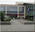
MuseumsSite Name: Newport Museum and Art GalleryCountry: Wales
NOTE: This site is 0.69 km away from the location you searched for.
County: Monmouthshire Type: Museum
Nearest Town: Newport
Map Ref: ST31278791
Latitude: 51.585836N Longitude: 2.993406W
Condition:
| 5 | Perfect |
| 4 | Almost Perfect |
| 3 | Reasonable but with some damage |
| 2 | Ruined but still recognisable as an ancient site |
| 1 | Pretty much destroyed, possibly visible as crop marks |
| 0 | No data. |
| -1 | Completely destroyed |
| 5 | Superb |
| 4 | Good |
| 3 | Ordinary |
| 2 | Not Good |
| 1 | Awful |
| 0 | No data. |
| 5 | Can be driven to, probably with disabled access |
| 4 | Short walk on a footpath |
| 3 | Requiring a bit more of a walk |
| 2 | A long walk |
| 1 | In the middle of nowhere, a nightmare to find |
| 0 | No data. |
| 5 | co-ordinates taken by GPS or official recorded co-ordinates |
| 4 | co-ordinates scaled from a detailed map |
| 3 | co-ordinates scaled from a bad map |
| 2 | co-ordinates of the nearest village |
| 1 | co-ordinates of the nearest town |
| 0 | no data |
Internal Links:
External Links:
")
Website: Newport Museum and Art Gallery
You may be viewing yesterday's version of this page. To see the most up to date information please register for a free account.
Do not use the above information on other web sites or publications without permission of the contributor.
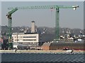
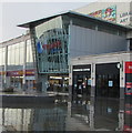
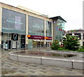
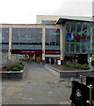
Nearby Images from Geograph Britain and Ireland:
©2008(licence)
©2020(licence)
©2018(licence)
©2018(licence)
©2020(licence)
The above images may not be of the site on this page, they are loaded from Geograph.
Please Submit an Image of this site or go out and take one for us!
Click here to see more info for this site
Nearby sites
Key: Red: member's photo, Blue: 3rd party photo, Yellow: other image, Green: no photo - please go there and take one, Grey: site destroyed
Download sites to:
KML (Google Earth)
GPX (GPS waypoints)
CSV (Garmin/Navman)
CSV (Excel)
To unlock full downloads you need to sign up as a Contributory Member. Otherwise downloads are limited to 50 sites.
Turn off the page maps and other distractions
Nearby sites listing. In the following links * = Image available
1.9km ENE 68° Maindy Hill Camp Misc. Earthwork (ST3304588604)
1.9km ENE 68° Maindee Camp Ancient Village or Settlement (ST3304588604)
2.5km WSW 243° Tredegar Hillfort* Hillfort (ST290868)
3.0km ENE 64° St Julian's Wood Hillfort (ST340892)
3.5km NNE 16° Lodge Wood* Hillfort (ST323913)
3.8km NE 46° Caerleon Roman Fortress and Baths* Ancient Village or Settlement (ST34039050)
4.4km WSW 245° Coed Ffynnon-Oer Hillfort (ST273861)
4.6km SW 231° Gwern y Cleppa* Chambered Tomb (ST27648505)
4.6km N 7° Malthouse Lane Motte* Artificial Mound (ST31899249)
4.9km W 267° Rhiwderin Camp Hillfort (ST264877)
5.3km W 259° Rhiwderin (Newport) Rock Art (ST260870)
5.5km SSE 163° Mesolithic Human Footprints at Uskmouth* Natural Stone / Erratic / Other Natural Feature (ST32808260)
5.7km WSW 253° Croes-Carn-Einion Hillfort (ST258863)
5.8km NNE 17° Cerau* Hillfort (ST330934)
6.1km WSW 240° The Mount* Hillfort (ST259849)
6.2km WNW 295° Risca Round Cairn (ST257906)
6.3km WSW 240° Graig (Monmouthshire) Cairn (ST258848)
6.5km SE 132° Goldcliff Earthwork Misc. Earthwork (ST361835)
6.6km WNW 298° Rogerstone 1 Round Barrow(s) (ST255911)
6.6km ENE 74° Lang Stone (Newport)* Standing Stone (Menhir) (ST37698961)
6.9km WNW 294° Rogerstone 2 Round Barrow(s) (ST250908)
7.0km E 79° Langstone (Bishton)* Round Barrow(s) (ST382891)
7.1km NE 43° Glen Usk Hillfort Hillfort (ST362931)
7.3km W 277° Twyn Pant-Teg Round Barrow(s) (ST240889)
7.4km W 276° Twyn Pant-Teg Cairn (ST239888)
View more nearby sites and additional images


 We would like to know more about this location. Please feel free to add a brief description and any relevant information in your own language.
 Wir möchten mehr über diese Stätte erfahren. Bitte zögern Sie nicht, eine kurze Beschreibung und relevante Informationen in Deutsch hinzuzufügen.
 Nous aimerions en savoir encore un peu sur les lieux. S'il vous plaît n'hesitez pas à ajouter une courte description et tous les renseignements pertinents dans votre propre langue.
 Quisieramos informarnos un poco más de las lugares. No dude en añadir una breve descripción y otros datos relevantes en su propio idioma.