

<< Our Photo Pages >> Cortachy - Standing Stone (Menhir) in Scotland in Angus
Submitted by golux on Tuesday, 08 March 2011 Page Views: 6345
Neolithic and Bronze AgeSite Name: Cortachy Alternative Name: Gertrude Cottage, Cortachy Castle PoliciesCountry: Scotland County: Angus Type: Standing Stone (Menhir)
Nearest Town: Kirriemuir Nearest Village: Cortachy
Map Ref: NO38795911
Latitude: 56.719636N Longitude: 3.001703W
Condition:
| 5 | Perfect |
| 4 | Almost Perfect |
| 3 | Reasonable but with some damage |
| 2 | Ruined but still recognisable as an ancient site |
| 1 | Pretty much destroyed, possibly visible as crop marks |
| 0 | No data. |
| -1 | Completely destroyed |
| 5 | Superb |
| 4 | Good |
| 3 | Ordinary |
| 2 | Not Good |
| 1 | Awful |
| 0 | No data. |
| 5 | Can be driven to, probably with disabled access |
| 4 | Short walk on a footpath |
| 3 | Requiring a bit more of a walk |
| 2 | A long walk |
| 1 | In the middle of nowhere, a nightmare to find |
| 0 | No data. |
| 5 | co-ordinates taken by GPS or official recorded co-ordinates |
| 4 | co-ordinates scaled from a detailed map |
| 3 | co-ordinates scaled from a bad map |
| 2 | co-ordinates of the nearest village |
| 1 | co-ordinates of the nearest town |
| 0 | no data |
Internal Links:
External Links:
")
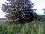
A large unsculptured boulder, 1.7m high by 1.6m by 0.7m with a flat top measuring about 1.1m by 0.7m. It is situated on the crest of a south-facing slope, in a fenced-off square.
Listed by RCAHMS as "possible henge" but no henge is visible to the naked eye or in aerial photographs (though it would perhaps explain why such a large area has been fenced-off).
You may be viewing yesterday's version of this page. To see the most up to date information please register for a free account.
")
")
Do not use the above information on other web sites or publications without permission of the contributor.
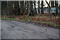
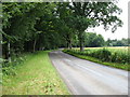
Nearby Images from Geograph Britain and Ireland:
©2009(licence)
©2011(licence)
©2017(licence)
©2009(licence)
©2012(licence)
The above images may not be of the site on this page, they are loaded from Geograph.
Please Submit an Image of this site or go out and take one for us!
Click here to see more info for this site
Nearby sites
Key: Red: member's photo, Blue: 3rd party photo, Yellow: other image, Green: no photo - please go there and take one, Grey: site destroyed
Download sites to:
KML (Google Earth)
GPX (GPS waypoints)
CSV (Garmin/Navman)
CSV (Excel)
To unlock full downloads you need to sign up as a Contributory Member. Otherwise downloads are limited to 50 sites.
Turn off the page maps and other distractions
Nearby sites listing. In the following links * = Image available
2.8km S 185° Caddam* Standing Stone (Menhir) (NO385563)
2.9km S 185° Caddam (Kirriemuir) Standing Stone (Menhir) (NO38485625)
4.0km WNW 285° Corogle Burn* Standing Stones (NO349602)
4.0km WNW 284° Corogle Burn Stone Circle (NO34886017)
4.2km S 188° Rocking Stones (Kirriemuir) Natural Stone / Erratic / Other Natural Feature (NO38135496)
4.5km S 174° Kirriemuir Stone Circle* Stone Circle (NO39175463)
4.5km SW 229° Culhawk Hill Stone Circle (NO353562)
5.2km ENE 76° Easter Memus Standing Stone (Menhir) (NO439603)
6.7km SSE 168° Fletcherfield Standing Stones (NO401525)
7.5km SSE 157° Balinshoe Standing Stone (Menhir) (NO41645219)
8.0km NNW 346° Whitehillocks Farm Stone Circle* Stone Circle (NO370669)
8.2km NNW 347° Whitehillock* Rock Art (NO37016716)
8.4km SSW 201° Airlie Cursus Cursus (NO35605130)
8.5km SW 234° Meikle Kenny C* Stone Circle (NO31825418)
8.5km SW 234° Meikle Kenny B* Stone Circle (NO31805417)
8.6km SSW 201° Airlie Cursus Cursus (NO35645113)
8.6km SW 234° Meikle Kenny A* Stone Circle (NO31765415)
9.0km W 264° Auldallan* Standing Stones (NO298583)
9.1km SE 125° Carse Gray* Stone Circle (NO462538)
9.2km S 171° Cossans* Class II Pictish Symbol Stone (NO4008350019)
9.3km WSW 249° Brankam Hill NW Stone Circle (NO300559)
9.3km WSW 249° Brankam Hill SE Stone Circle (NO300559)
9.5km SSW 203° Lendrick Lodge* Standing Stone (Menhir) (NO350504)
9.7km ESE 123° Baggerton Class I Pictish Symbol Stone (NO469537)
9.9km ENE 74° Ghaist Stone (Fern) Standing Stone (Menhir) (NO48326173)
View more nearby sites and additional images


 We would like to know more about this location. Please feel free to add a brief description and any relevant information in your own language.
 Wir möchten mehr über diese Stätte erfahren. Bitte zögern Sie nicht, eine kurze Beschreibung und relevante Informationen in Deutsch hinzuzufügen.
 Nous aimerions en savoir encore un peu sur les lieux. S'il vous plaît n'hesitez pas à ajouter une courte description et tous les renseignements pertinents dans votre propre langue.
 Quisieramos informarnos un poco más de las lugares. No dude en añadir una breve descripción y otros datos relevantes en su propio idioma.