<< Text Pages >> North Somerset Museum - Museum in England in Somerset
Submitted by vicky on Saturday, 30 November 2002 Page Views: 6887
MuseumsSite Name: North Somerset MuseumCountry: England
NOTE: This site is 2.837 km away from the location you searched for.
County: Somerset Type: Museum
Nearest Town: Weston-super-Mare
Map Ref: ST322615 Landranger Map Number: 182
Latitude: 51.348517N Longitude: 2.97491W
Condition:
| 5 | Perfect |
| 4 | Almost Perfect |
| 3 | Reasonable but with some damage |
| 2 | Ruined but still recognisable as an ancient site |
| 1 | Pretty much destroyed, possibly visible as crop marks |
| 0 | No data. |
| -1 | Completely destroyed |
| 5 | Superb |
| 4 | Good |
| 3 | Ordinary |
| 2 | Not Good |
| 1 | Awful |
| 0 | No data. |
| 5 | Can be driven to, probably with disabled access |
| 4 | Short walk on a footpath |
| 3 | Requiring a bit more of a walk |
| 2 | A long walk |
| 1 | In the middle of nowhere, a nightmare to find |
| 0 | No data. |
| 5 | co-ordinates taken by GPS or official recorded co-ordinates |
| 4 | co-ordinates scaled from a detailed map |
| 3 | co-ordinates scaled from a bad map |
| 2 | co-ordinates of the nearest village |
| 1 | co-ordinates of the nearest town |
| 0 | no data |
Be the first person to rate this site - see the 'Contribute!' box in the right hand menu.
Internal Links:
External Links:
Museum in Somerset
Archaeology Gallery - material dating from the Ice Age to the Medieval period. Iron Age material from local hillforts.
Address: Burlington Street, BS23 1PR
Phone: 01934 621 028
Opening Hours: Open all year round Monday to Saturday, 10am - 4:30pm, Closed Xmas Day, Boxing Day and New Year`s Day
Admission: Charge
Visit their web site
You may be viewing yesterday's version of this page. To see the most up to date information please register for a free account.
Do not use the above information on other web sites or publications without permission of the contributor.
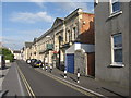
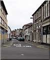
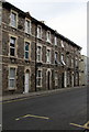
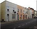
Nearby Images from Geograph Britain and Ireland:
©2008(licence)
©2018(licence)
©2023(licence)
©2018(licence)
©2018(licence)
The above images may not be of the site on this page, they are loaded from Geograph.
Please Submit an Image of this site or go out and take one for us!
Click here to see more info for this site
Nearby sites
Key: Red: member's photo, Blue: 3rd party photo, Yellow: other image, Green: no photo - please go there and take one, Grey: site destroyed
Download sites to:
KML (Google Earth)
GPX (GPS waypoints)
CSV (Garmin/Navman)
CSV (Excel)
To unlock full downloads you need to sign up as a Contributory Member. Otherwise downloads are limited to 50 sites.
Turn off the page maps and other distractions
Nearby sites listing. In the following links * = Image available
74m NNW 335° Weston-super-Mare Museum* Museum (ST3217061568)
1.2km NW 324° Worlebury Camp* Hillfort (ST315625)
3.6km S 189° Walborough Barrows Round Barrow(s) (ST31615791)
4.4km SW 235° Brean Down* Hillfort (ST28535898)
5.0km SSE 157° Bleadon Cross* Ancient Cross (ST3411056921)
5.8km NNE 23° Woodspring Priory Field System Misc. Earthwork (ST345668)
5.8km NNE 24° Middle Hope Round Barrow(s) (ST34656676)
5.9km NE 48° Wick St Lawrence Village Cross* Ancient Cross (ST3660565388)
6.2km SE 135° Loxton Hill Barrows Round Barrow(s) (ST36565704)
6.5km E 92° Rolstone* Standing Stone (Menhir) (ST38736120)
6.8km E 92° Banwell Moor Stone 1 Marker Stone (ST39036113)
6.8km ESE 124° Flagstaff Hill* Stone Circle (ST3785257630)
7.4km E 86° Banwell Moor Stone 4 Marker Stone (ST39576188)
7.7km ESE 118° Wook's Quoit* Standing Stone (Menhir) (ST39045783)
7.8km SE 136° Loxton Churchyard Cross* Ancient Cross (ST3762455813)
8.0km ESE 107° Butstone (Banwell) Marker Stone (ST398590)
8.2km E 94° Banwell Moor Stone 2 Marker Stone (ST40406086)
9.0km ESE 105° Banwell Camp Hillfort (ST409590)
9.5km NE 55° Kingston Seymour Churchyard Cross* Ancient Cross (ST4010166846)
9.6km SE 129° Compton Bishop Church Cross* Ancient Cross (ST3959955378)
9.7km NE 55° Kingston Seymour Village Cross* Ancient Cross (ST4022366941)
9.9km SSE 166° East Brent Churchyard Cross* Ancient Cross (ST3439051891)
10.0km SE 143° Biddisham Churchyard Cross* Ancient Cross (ST3819353429)
10.2km ESE 123° Wavering Down cairn* Round Cairn (ST40705590)
10.7km S 169° Brent Knoll Camp* Hillfort (ST34115097)
View more nearby sites and additional images


 We would like to know more about this location. Please feel free to add a brief description and any relevant information in your own language.
 Wir möchten mehr über diese Stätte erfahren. Bitte zögern Sie nicht, eine kurze Beschreibung und relevante Informationen in Deutsch hinzuzufügen.
 Nous aimerions en savoir encore un peu sur les lieux. S'il vous plaît n'hesitez pas à ajouter une courte description et tous les renseignements pertinents dans votre propre langue.
 Quisieramos informarnos un poco más de las lugares. No dude en añadir una breve descripción y otros datos relevantes en su propio idioma.