


<< Text Pages >> Gaer Fawr (Monmouthshire) - Hillfort in Wales in Monmouthshire
Submitted by coldrum on Wednesday, 20 February 2008 Page Views: 7698
Iron Age and Later PrehistorySite Name: Gaer Fawr (Monmouthshire)Country: Wales
NOTE: This site is 0.194 km away from the location you searched for.
County: Monmouthshire Type: Hillfort
Map Ref: ST441986
Latitude: 51.683364N Longitude: 2.809958W
Condition:
| 5 | Perfect |
| 4 | Almost Perfect |
| 3 | Reasonable but with some damage |
| 2 | Ruined but still recognisable as an ancient site |
| 1 | Pretty much destroyed, possibly visible as crop marks |
| 0 | No data. |
| -1 | Completely destroyed |
| 5 | Superb |
| 4 | Good |
| 3 | Ordinary |
| 2 | Not Good |
| 1 | Awful |
| 0 | No data. |
| 5 | Can be driven to, probably with disabled access |
| 4 | Short walk on a footpath |
| 3 | Requiring a bit more of a walk |
| 2 | A long walk |
| 1 | In the middle of nowhere, a nightmare to find |
| 0 | No data. |
| 5 | co-ordinates taken by GPS or official recorded co-ordinates |
| 4 | co-ordinates scaled from a detailed map |
| 3 | co-ordinates scaled from a bad map |
| 2 | co-ordinates of the nearest village |
| 1 | co-ordinates of the nearest town |
| 0 | no data |
Be the first person to rate this site - see the 'Contribute!' box in the right hand menu.
Internal Links:
External Links:
Hillfort in Monmouthshire (Sir Fynwy)
You may be viewing yesterday's version of this page. To see the most up to date information please register for a free account.
Do not use the above information on other web sites or publications without permission of the contributor.
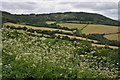
Nearby Images from Geograph Britain and Ireland:
©2014(licence)
©2014(licence)
©2011(licence)
©2011(licence)
©2011(licence)
The above images may not be of the site on this page, they are loaded from Geograph.
Please Submit an Image of this site or go out and take one for us!
Click here to see more info for this site
Nearby sites
Key: Red: member's photo, Blue: 3rd party photo, Yellow: other image, Green: no photo - please go there and take one, Grey: site destroyed
Download sites to:
KML (Google Earth)
GPX (GPS waypoints)
CSV (Garmin/Navman)
CSV (Excel)
To unlock full downloads you need to sign up as a Contributory Member. Otherwise downloads are limited to 50 sites.
Turn off the page maps and other distractions
Nearby sites listing. In the following links * = Image available
1.4km NNE 33° Cwrt-Y-Gaer Misc. Earthwork (ST449998)
1.8km NW 308° Camp Farm* Misc. Earthwork (ST427997)
1.9km SW 234° Golden Hill Earthwork Hillfort (ST42579753)
2.0km SSE 160° y Garn Llwyd* Chambered Tomb (ST44769674)
3.0km NW 325° Earthwork Misc. Earthwork (SO424011)
4.7km SSW 194° Forresters' Oaks Round Barrow* Round Barrow(s) (ST42929410)
4.7km SSW 210° Llanvaches 1* Round Barrow(s) (ST41699455)
4.7km SSW 210° Llanvaches 2* Round Barrow(s) (ST41669455)
4.8km NNW 349° Great House Camp* Hillfort (SO432033)
5.0km S 183° Gray Hill stone row* Standing Stone (Menhir) (ST43769357)
5.1km S 183° Gray Hill circle* Stone Circle (ST43809353)
5.1km S 187° Gray Hill summit cairn* Round Cairn (ST43399355)
5.1km ESE 102° Chepstow Park Wood Cairn Cairn (ST491975)
5.3km S 180° Gray Hill Cairn Cemetery* Barrow Cemetery (ST4408693273)
5.9km NW 311° Gwehelog Fawr Ancient Village or Settlement (SO397025)
6.2km ESE 122° Itton Cross (St Deiniol's)* Ancient Cross (ST4933095290)
6.2km SSE 159° Llan-melin wood Earthwork Misc. Earthwork (ST463928)
6.3km SSE 161° Llanmelin Wood* Hillfort (ST46109260)
6.4km ENE 64° Trellech United Standing Stone (Menhir) (SO499013)
6.4km WSW 249° Llangybi Bottom Stone* Standing Stone (Menhir) (ST38049638)
6.7km WNW 281° Twyn Bell Camp Ancient Village or Settlement (SO375000)
6.9km WSW 253° St Cybi's Well (Llangybi)* Holy Well or Sacred Spring (ST3744796662)
6.9km SSE 154° NOT SET
6.9km SSW 206° Castell Prin* Hillfort (ST410924)
7.0km SW 232° Bwllfa Cottages Henge Henge (ST38509431)
View more nearby sites and additional images


 We would like to know more about this location. Please feel free to add a brief description and any relevant information in your own language.
 Wir möchten mehr über diese Stätte erfahren. Bitte zögern Sie nicht, eine kurze Beschreibung und relevante Informationen in Deutsch hinzuzufügen.
 Nous aimerions en savoir encore un peu sur les lieux. S'il vous plaît n'hesitez pas à ajouter une courte description et tous les renseignements pertinents dans votre propre langue.
 Quisieramos informarnos un poco más de las lugares. No dude en añadir una breve descripción y otros datos relevantes en su propio idioma.