<< Text Pages >> Pickett Farm Neolithic Site - Misc. Earthwork in England in Dorset
Submitted by Andy B on Wednesday, 26 March 2008 Page Views: 9965
Neolithic and Bronze AgeSite Name: Pickett Farm Neolithic Site Alternative Name: Pickett's FarmCountry: England
NOTE: This site is 1.388 km away from the location you searched for.
County: Dorset Type: Misc. Earthwork
Nearest Village: South Perrott
Map Ref: ST47100519
Latitude: 50.843803N Longitude: 2.752719W
Condition:
| 5 | Perfect |
| 4 | Almost Perfect |
| 3 | Reasonable but with some damage |
| 2 | Ruined but still recognisable as an ancient site |
| 1 | Pretty much destroyed, possibly visible as crop marks |
| 0 | No data. |
| -1 | Completely destroyed |
| 5 | Superb |
| 4 | Good |
| 3 | Ordinary |
| 2 | Not Good |
| 1 | Awful |
| 0 | No data. |
| 5 | Can be driven to, probably with disabled access |
| 4 | Short walk on a footpath |
| 3 | Requiring a bit more of a walk |
| 2 | A long walk |
| 1 | In the middle of nowhere, a nightmare to find |
| 0 | No data. |
| 5 | co-ordinates taken by GPS or official recorded co-ordinates |
| 4 | co-ordinates scaled from a detailed map |
| 3 | co-ordinates scaled from a bad map |
| 2 | co-ordinates of the nearest village |
| 1 | co-ordinates of the nearest town |
| 0 | no data |
Internal Links:
External Links:
Neolithic circular ditch in Dorset. The puzzle of Pickett's Farm. A series of finds by metal detectorists of Roman brooches and small-denomination Roman coins in a hilltop field near South Perrott, in Dorset, resulted in Time Team being called in by the landowner. Further encouraged by what, at first sight, had appeared to be fragments of Roman tile and other building material, the Team assembled its best Roman experts in the expectation that they were most likely looking at the site of a Roman temple.
It didn't take the experts long, however, to start pouring cold water on this theory. The tile and other building material turned out not to be Roman after all; the pottery discovered during field walking was all medieval; and although additional Roman coins were uncovered as the trenches went in, there was no sign of any buildings, Roman or otherwise.
But something had been going on in this field. What was it?
Gradually the trenches revealed their contents – and they told a very different story from a very different period. It seemed that the Team had stumbled on a prehistoric burial site dating back into the Neolithic period. Remarkably, it was still being treated as a place worthy of veneration right into Roman times, which explained the presence of the coins and brooches, which had been deliberately buried there in small pits as offerings to the gods of the day.
The experts ultimately thought this was a circular Neolithic ditch feature, possibly used for excarnation.
More details and photos on the Time Team page for this site.
You may be viewing yesterday's version of this page. To see the most up to date information please register for a free account.
Do not use the above information on other web sites or publications without permission of the contributor.
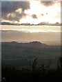
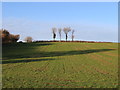
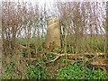
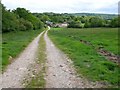
Nearby Images from Geograph Britain and Ireland:
©2011(licence)
©2009(licence)
©2017(licence)
©2014(licence)
©2011(licence)
The above images may not be of the site on this page, they are loaded from Geograph.
Please Submit an Image of this site or go out and take one for us!
Click here to see more info for this site
Nearby sites
Key: Red: member's photo, Blue: 3rd party photo, Yellow: other image, Green: no photo - please go there and take one, Grey: site destroyed
Download sites to:
KML (Google Earth)
GPX (GPS waypoints)
CSV (Garmin/Navman)
CSV (Excel)
To unlock full downloads you need to sign up as a Contributory Member. Otherwise downloads are limited to 50 sites.
Turn off the page maps and other distractions
Nearby sites listing. In the following links * = Image available
3.6km E 98° Higher Ground Meadow Modern Burial Mound* Artificial Mound (ST5066904650)
4.3km E 95° Corscombe* Standing Stones (ST514048)
4.5km WSW 237° St Dunstan's Well* Holy Well or Sacred Spring (ST433028)
5.0km ESE 110° Hore Stones* Standing Stones (ST5178603403)
5.2km SW 220° Lewesdon Hillfort Hillfort (ST437012)
5.7km NW 325° Pople's Well* Holy Well or Sacred Spring (ST4387909886)
7.0km SW 235° Pilsdon Pen* Hillfort (ST413013)
8.2km SW 235° Bettiscombe Stone Natural Stone / Erratic / Other Natural Feature (ST4036800561)
9.7km ESE 118° Wraxall Cromlech Burial Chamber or Dolmen (ST557006)
9.9km NE 35° Holy Well (West Coker)* Holy Well or Sacred Spring (ST52951325)
10.1km E 93° St John's Well (Evershot)* Holy Well or Sacred Spring (ST5721304596)
10.5km E 92° Evershot Stones* Standing Stones (ST57600469)
10.6km ENE 62° Closworth Cursus Cursus (ST56581008)
11.6km SE 128° Toller Porcorum* Standing Stones (SY561979)
11.6km WSW 238° Lambert's Castle* Hillfort (SY372991)
11.6km N 4° Ham Hill (Somerset)* Hillfort (ST480168)
11.9km N 3° Ham Hill stone circle* Modern Stone Circle etc (ST478171)
12.2km SW 217° St Candida & Holy Cross (Whitchurch Canonicorum)* Early Christian Sculptured Stone (SY3967895432)
12.5km SW 232° Coney's Castle* Hillfort (SY372975)
12.6km SE 146° Eggardon Hill* Hillfort (SY54129472)
13.0km SE 144° Eggardon earthwork* Henge (SY54689460)
13.3km ESE 112° The Castle Hillfort (ST594001)
13.3km ESE 115° Cattistock holy well Holy Well or Sacred Spring
13.4km ENE 65° St Andrew (Yetminster) Ancient Cross (ST59421066)
13.5km SSW 211° St Candida's Well* Holy Well or Sacred Spring (SY3995193753)
View more nearby sites and additional images


 We would like to know more about this location. Please feel free to add a brief description and any relevant information in your own language.
 Wir möchten mehr über diese Stätte erfahren. Bitte zögern Sie nicht, eine kurze Beschreibung und relevante Informationen in Deutsch hinzuzufügen.
 Nous aimerions en savoir encore un peu sur les lieux. S'il vous plaît n'hesitez pas à ajouter une courte description et tous les renseignements pertinents dans votre propre langue.
 Quisieramos informarnos un poco más de las lugares. No dude en añadir una breve descripción y otros datos relevantes en su propio idioma.