

<< Our Photo Pages >> Harters Hill - Ancient Trackway in England in Somerset
Submitted by Andy B on Thursday, 16 August 2007 Page Views: 7634
Multi-periodSite Name: Harters HillCountry: England
NOTE: This site is 2.588 km away from the location you searched for.
County: Somerset Type: Ancient Trackway
Nearest Town: Glastonbury
Map Ref: ST529430
Latitude: 51.184277N Longitude: 2.675268W
Condition:
| 5 | Perfect |
| 4 | Almost Perfect |
| 3 | Reasonable but with some damage |
| 2 | Ruined but still recognisable as an ancient site |
| 1 | Pretty much destroyed, possibly visible as crop marks |
| 0 | No data. |
| -1 | Completely destroyed |
| 5 | Superb |
| 4 | Good |
| 3 | Ordinary |
| 2 | Not Good |
| 1 | Awful |
| 0 | No data. |
| 5 | Can be driven to, probably with disabled access |
| 4 | Short walk on a footpath |
| 3 | Requiring a bit more of a walk |
| 2 | A long walk |
| 1 | In the middle of nowhere, a nightmare to find |
| 0 | No data. |
| 5 | co-ordinates taken by GPS or official recorded co-ordinates |
| 4 | co-ordinates scaled from a detailed map |
| 3 | co-ordinates scaled from a bad map |
| 2 | co-ordinates of the nearest village |
| 1 | co-ordinates of the nearest town |
| 0 | no data |
Internal Links:
External Links:
I have visited· I would like to visit
Andy B has visited here
")
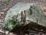
Desiccation has caused the overlying peat deposits to oxidise, shrink and waste away until the ground surface has reached the tops of the oak piles. Now the wooden structure itself is beginning to be damaged by desiccation.
IMPORTANT NOTE: Grid Ref is only approximate, site location unknown
You may be viewing yesterday's version of this page. To see the most up to date information please register for a free account.
")
")
")
Do not use the above information on other web sites or publications without permission of the contributor.
Nearby Images from Geograph Britain and Ireland:
©2006(licence)
©2018(licence)
©2014(licence)
©2014(licence)
©2006(licence)
The above images may not be of the site on this page, they are loaded from Geograph.
Please Submit an Image of this site or go out and take one for us!
Click here to see more info for this site
Nearby sites
Key: Red: member's photo, Blue: 3rd party photo, Yellow: other image, Green: no photo - please go there and take one, Grey: site destroyed
Download sites to:
KML (Google Earth)
GPX (GPS waypoints)
CSV (Garmin/Navman)
CSV (Excel)
To unlock full downloads you need to sign up as a Contributory Member. Otherwise downloads are limited to 50 sites.
Turn off the page maps and other distractions
Nearby sites listing. In the following links * = Image available
3.5km NE 41° Glastonbury Tor milestone at Wells* Modern Stone Circle etc (ST552456)
3.6km NE 37° Wells and Mendip Museum* Museum (ST551459)
3.6km NE 37° Wells Cathedral* Early Christian Sculptured Stone (ST5514645865)
3.7km NE 39° St Andrew's Well (Wells)* Holy Well or Sacred Spring (ST5522745824)
4.3km WSW 237° Glastonbury Lake Village* Ancient Village or Settlement (ST493407)
4.7km NE 56° King's Castle (Wells) Ancient Village or Settlement (ST568456)
4.7km SSW 200° Glastonbury Tor* Ancient Village or Settlement (ST51223861)
4.7km N 2° Wookey Hole Caves Museum* Museum (ST531477)
5.0km N 3° Badger Hole (Somerset) Cave or Rock Shelter (ST53244795)
5.0km SSW 205° White Spring (Somerset)* Holy Well or Sacred Spring (ST5073238506)
5.0km SSW 205° Chalice Well* Holy Well or Sacred Spring (ST507385)
5.0km N 3° Wookey Hole Caves* Cave or Rock Shelter (ST53194801)
5.1km SW 216° Market Cross (Glastonbury) Ancient Cross (ST4987538924)
5.1km SW 216° Glastonbury Lake Village Museum* Museum (ST499389)
5.1km SW 214° St Joseph's Well* Holy Well or Sacred Spring (ST49993883)
5.1km SSW 212° Omphalos Stone (Glastonbury Abbey)* Natural Stone / Erratic / Other Natural Feature (ST501387)
5.3km S 175° Ponter's Ball Dyke Ancient Village or Settlement (ST533377)
5.9km NNW 349° Deerleap Stones* Standing Stones (ST51804876)
6.6km NNE 30° Pen Hill Longbarrow* Long Barrow (ST563487)
7.1km ENE 69° Crapnell Stone Circle (ST596455)
7.4km NNE 23° Drove Cottage Henge* Henge (ST559498)
7.6km SE 125° Glastonbury Stone Circle* Modern Stone Circle etc (ST59143858)
7.6km NNW 344° Westbury-Sub-Mendip Cave or Rock Shelter (ST50855036)
7.7km NNE 22° Hunter's Lodge Inn Barrow* Round Barrow(s) (ST559501)
8.0km N 11° Fair Lady Well* Holy Well or Sacred Spring (ST54515079)
View more nearby sites and additional images


 We would like to know more about this location. Please feel free to add a brief description and any relevant information in your own language.
 Wir möchten mehr über diese Stätte erfahren. Bitte zögern Sie nicht, eine kurze Beschreibung und relevante Informationen in Deutsch hinzuzufügen.
 Nous aimerions en savoir encore un peu sur les lieux. S'il vous plaît n'hesitez pas à ajouter une courte description et tous les renseignements pertinents dans votre propre langue.
 Quisieramos informarnos un poco más de las lugares. No dude en añadir una breve descripción y otros datos relevantes en su propio idioma.