<< Image Pages >> Howerigg - Ancient Village or Settlement in England in Cumbria
Submitted by Zooks777 on Wednesday, 21 July 2021 Page Views: 438
Date UncertainSite Name: HoweriggCountry: England
NOTE: This site is 4.971 km away from the location you searched for.
County: Cumbria Type: Ancient Village or Settlement
Nearest Town: Kirkby Lonsdale Nearest Village: Barbon
Map Ref: SD62488192
Latitude: 54.231604N Longitude: 2.577077W
Condition:
| 5 | Perfect |
| 4 | Almost Perfect |
| 3 | Reasonable but with some damage |
| 2 | Ruined but still recognisable as an ancient site |
| 1 | Pretty much destroyed, possibly visible as crop marks |
| 0 | No data. |
| -1 | Completely destroyed |
| 5 | Superb |
| 4 | Good |
| 3 | Ordinary |
| 2 | Not Good |
| 1 | Awful |
| 0 | No data. |
| 5 | Can be driven to, probably with disabled access |
| 4 | Short walk on a footpath |
| 3 | Requiring a bit more of a walk |
| 2 | A long walk |
| 1 | In the middle of nowhere, a nightmare to find |
| 0 | No data. |
| 5 | co-ordinates taken by GPS or official recorded co-ordinates |
| 4 | co-ordinates scaled from a detailed map |
| 3 | co-ordinates scaled from a bad map |
| 2 | co-ordinates of the nearest village |
| 1 | co-ordinates of the nearest town |
| 0 | no data |
Internal Links:
External Links:
")
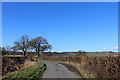
South of Barbon, Cumbria. SD62488192. Scheduled Monument 1007218 first reported 19th century. Little found online. Lidar illuminated from NNW
Enclosed settlement with internal divisions and possible hut circle. Iron Age(?)
You may be viewing yesterday's version of this page. To see the most up to date information please register for a free account.
Do not use the above information on other web sites or publications without permission of the contributor.
Nearby Images from Geograph Britain and Ireland:
©2010(licence)
©2019(licence)
©2021(licence)
©2014(licence)
©2015(licence)
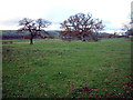
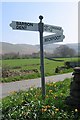
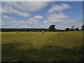
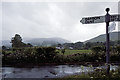
The above images may not be of the site on this page, they are loaded from Geograph.
Please Submit an Image of this site or go out and take one for us!
Click here to see more info for this site
Nearby sites
Key: Red: member's photo, Blue: 3rd party photo, Yellow: other image, Green: no photo - please go there and take one, Grey: site destroyed
Download sites to:
KML (Google Earth)
GPX (GPS waypoints)
CSV (Garmin/Navman)
CSV (Excel)
To unlock full downloads you need to sign up as a Contributory Member. Otherwise downloads are limited to 50 sites.
Turn off the page maps and other distractions
Nearby sites listing. In the following links * = Image available
2.4km SE 143° Casterton* Stone Circle (SD63937999)
2.7km ESE 122° Brownthwaite Pike Round Cairn* Round Cairn (SD6477280479)
5.0km SSW 203° Sellet Bank Enclosure* Ancient Village or Settlement (SD60517733)
5.2km SW 234° Gallowber Lane Romano-British Settlement/Enclosure* Ancient Village or Settlement (SD5823678908)
5.7km SSE 154° Leck Hall* Ancient Village or Settlement (SD64927677)
6.7km WSW 236° Hutton Roof Crag perched Limestone Boulder* Natural Stone / Erratic / Other Natural Feature (SD5686878268)
8.1km S 187° St John the Baptist (Tunstall)* Early Christian Sculptured Stone (SD6141473925)
8.3km WSW 256° Holme Park Fell 2* Rock Outcrop (SD5439879957)
8.4km ESE 110° Yordas cave* Cave or Rock Shelter (SD704790)
8.5km WSW 257° Holme Park Fell 1* Rock Outcrop (SD5419280141)
9.0km ESE 111° Apron Full of Stones* Ring Cairn (SD709787)
10.2km SE 127° Twisleton Scar Rock Outcrop (SD70597563)
10.6km WSW 242° St James's Church (Burton-in-Kendal) Ancient Cross (SD5305076921)
10.7km NNE 17° Old Market Cross (Sedbergh) Ancient Cross (SD657921)
11.1km SSW 194° St Wilfrid (Melling)* Ancient Cross (SD5978571115)
11.5km NW 305° Helm Hill* Hillfort (SD531887)
12.3km SE 131° White Scars Cairn (SD717738)
12.6km WNW 288° Levens Park ring cairn 2* Ring Cairn (SD5053385945)
12.6km WNW 289° Leven's Park ringcairn* Ring Cairn (SD506862)
12.9km W 276° St Peter's Church (Heversham)* Ancient Cross (SD4960083390)
12.9km WSW 257° The Rent Stone* Natural Stone / Erratic / Other Natural Feature (SD498792)
12.9km SSW 199° Castle Stede Hillfort (SD582697)
12.9km W 276° St Mary's Well (Heversham)* Holy Well or Sacred Spring (SD4958383452)
13.0km WSW 239° Yealand ancient stone walls or rows 2 Misc. Earthwork (SD513753)
13.0km ESE 110° Keld Bank Settlement* Ancient Village or Settlement (SD74657734)
View more nearby sites and additional images


 We would like to know more about this location. Please feel free to add a brief description and any relevant information in your own language.
 Wir möchten mehr über diese Stätte erfahren. Bitte zögern Sie nicht, eine kurze Beschreibung und relevante Informationen in Deutsch hinzuzufügen.
 Nous aimerions en savoir encore un peu sur les lieux. S'il vous plaît n'hesitez pas à ajouter une courte description et tous les renseignements pertinents dans votre propre langue.
 Quisieramos informarnos un poco más de las lugares. No dude en añadir una breve descripción y otros datos relevantes en su propio idioma.