<< Our Photo Pages >> St John's Well (Evershot) - Holy Well or Sacred Spring in England in Dorset
Submitted by jamesrattue on Friday, 26 August 2011 Page Views: 7055
Springs and Holy WellsSite Name: St John's Well (Evershot)Country: England
NOTE: This site is 3.251 km away from the location you searched for.
County: Dorset Type: Holy Well or Sacred Spring
Nearest Town: Dorchester Nearest Village: Evershot
Map Ref: ST5721304596
Latitude: 50.839300N Longitude: 2.609022W
Condition:
| 5 | Perfect |
| 4 | Almost Perfect |
| 3 | Reasonable but with some damage |
| 2 | Ruined but still recognisable as an ancient site |
| 1 | Pretty much destroyed, possibly visible as crop marks |
| 0 | No data. |
| -1 | Completely destroyed |
| 5 | Superb |
| 4 | Good |
| 3 | Ordinary |
| 2 | Not Good |
| 1 | Awful |
| 0 | No data. |
| 5 | Can be driven to, probably with disabled access |
| 4 | Short walk on a footpath |
| 3 | Requiring a bit more of a walk |
| 2 | A long walk |
| 1 | In the middle of nowhere, a nightmare to find |
| 0 | No data. |
| 5 | co-ordinates taken by GPS or official recorded co-ordinates |
| 4 | co-ordinates scaled from a detailed map |
| 3 | co-ordinates scaled from a bad map |
| 2 | co-ordinates of the nearest village |
| 1 | co-ordinates of the nearest town |
| 0 | no data |
Internal Links:
External Links:
 (PID:81073)")
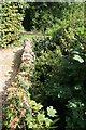
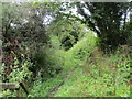
St John's Well is the source of the Frome River and still provides some millions of gallons of water to the Ilchester Estate. It pours from a narrow gap in a rough stone wall beside a small enclosure next to a lane leading north from Evershot Church, and was restored for Millennium Year in 2000 - an information plaque gives details of the well and the local geology. It is first referred to in 1761 when the churchwardens levied penalties against anyone fouling the water, and early accounts describe it as a 'black iron pump'. Why it is called St John's Well when the church is named after St Osmund is not clear.
You may be viewing yesterday's version of this page. To see the most up to date information please register for a free account.
 (PID:109945)")
Do not use the above information on other web sites or publications without permission of the contributor.
davidmorgan has found this location on Google Street View:
Nearby Images from Geograph Britain and Ireland:
©2018(licence)
©2017(licence)
©2012(licence)
©2012(licence)
©2013(licence)
The above images may not be of the site on this page, they are loaded from Geograph.
Please Submit an Image of this site or go out and take one for us!
Click here to see more info for this site
Nearby sites
Key: Red: member's photo, Blue: 3rd party photo, Yellow: other image, Green: no photo - please go there and take one, Grey: site destroyed
Download sites to:
KML (Google Earth)
GPX (GPS waypoints)
CSV (Garmin/Navman)
CSV (Excel)
To unlock full downloads you need to sign up as a Contributory Member. Otherwise downloads are limited to 50 sites.
Turn off the page maps and other distractions
Nearby sites listing. In the following links * = Image available
397m ENE 76° Evershot Stones* Standing Stones (ST57600469)
4.3km SSW 200° Wraxall Cromlech Burial Chamber or Dolmen (ST557006)
5.0km SSE 154° The Castle Hillfort (ST594001)
5.4km SSE 159° Cattistock holy well Holy Well or Sacred Spring
5.5km N 353° Closworth Cursus Cursus (ST56581008)
5.5km WSW 257° Hore Stones* Standing Stones (ST5178603403)
5.8km W 272° Corscombe* Standing Stones (ST514048)
6.0km NE 53° Leigh Miz Maze* Turf Maze (ST62000818)
6.0km E 97° Cross and Hand Stone* Standing Stone (Menhir) (ST632038)
6.5km NNE 19° St Andrew (Yetminster) Ancient Cross (ST59421066)
6.5km W 270° Higher Ground Meadow Modern Burial Mound* Artificial Mound (ST5066904650)
6.8km S 189° Toller Porcorum* Standing Stones (SY561979)
7.1km SE 133° The Combe (Dorset) Misc. Earthwork (SY624997)
7.9km E 89° St Mary's Well (Hermitage)* Holy Well or Sacred Spring (ST651047)
8.0km ESE 108° Wancombe Hill Field System Misc. Earthwork (ST64790200)
8.0km E 93° East Hill field System* Misc. Earthwork (ST65250405)
8.2km ESE 105° Seldon Hill Settlement Ancient Village or Settlement (ST65100235)
8.3km ESE 117° Up Cerne/Sydling St Nicholas Boundary Stone Marker Stone (ST64610078)
8.5km SSE 152° Hog Cliff Bottom Barrow Round Barrow(s) (SY61209711)
8.6km E 99° High Cank Henge Henge (ST65720319)
8.7km ESE 110° Weam Commen Hill Field System Misc. Earthwork (ST654016)
8.7km E 98° Farm Hill Bowl Barrow Round Barrow(s) (ST65880334)
9.3km SSE 147° Hog Cliff Hill Barrow Round Barrow(s) (SY62179676)
9.4km ESE 117° Dickley Hill Bowl Barrows Round Barrow(s) (ST65600026)
9.5km ESE 117° Dickley Hill Settlement Ancient Village or Settlement (ST65650027)
View more nearby sites and additional images


 We would like to know more about this location. Please feel free to add a brief description and any relevant information in your own language.
 Wir möchten mehr über diese Stätte erfahren. Bitte zögern Sie nicht, eine kurze Beschreibung und relevante Informationen in Deutsch hinzuzufügen.
 Nous aimerions en savoir encore un peu sur les lieux. S'il vous plaît n'hesitez pas à ajouter une courte description et tous les renseignements pertinents dans votre propre langue.
 Quisieramos informarnos un poco más de las lugares. No dude en añadir una breve descripción y otros datos relevantes en su propio idioma.