<< Text Pages >> Grey Hill Settlement - Ancient Village or Settlement in England in Cumbria
Submitted by coldrum on Monday, 05 October 2009 Page Views: 3782
Multi-periodSite Name: Grey Hill SettlementCountry: England
NOTE: This site is 2.276 km away from the location you searched for.
County: Cumbria Type: Ancient Village or Settlement
Map Ref: NY57317626
Latitude: 55.078944N Longitude: 2.670195W
Condition:
| 5 | Perfect |
| 4 | Almost Perfect |
| 3 | Reasonable but with some damage |
| 2 | Ruined but still recognisable as an ancient site |
| 1 | Pretty much destroyed, possibly visible as crop marks |
| 0 | No data. |
| -1 | Completely destroyed |
| 5 | Superb |
| 4 | Good |
| 3 | Ordinary |
| 2 | Not Good |
| 1 | Awful |
| 0 | No data. |
| 5 | Can be driven to, probably with disabled access |
| 4 | Short walk on a footpath |
| 3 | Requiring a bit more of a walk |
| 2 | A long walk |
| 1 | In the middle of nowhere, a nightmare to find |
| 0 | No data. |
| 5 | co-ordinates taken by GPS or official recorded co-ordinates |
| 4 | co-ordinates scaled from a detailed map |
| 3 | co-ordinates scaled from a bad map |
| 2 | co-ordinates of the nearest village |
| 1 | co-ordinates of the nearest town |
| 0 | no data |
Be the first person to rate this site - see the 'Contribute!' box in the right hand menu.
Internal Links:
External Links:
Ancient Village or Settlement in Cumbria
"The monument includes a prehistoric unenclosed stone hut circle settlement located on a slightly elevated ridge on the western slopes of Grey Hill 930 metres south east of Ashycroft. The site occupies drier ground than the surrounding area and includes four stone hut circles of varying sizes together with a short length of stone banking."
From Pastscape:
http://www.pastscape.org.uk/hob.aspx?hob_id=12942
You may be viewing yesterday's version of this page. To see the most up to date information please register for a free account.
Do not use the above information on other web sites or publications without permission of the contributor.
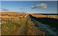
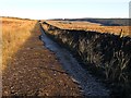
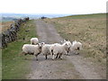
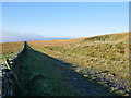
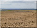
Nearby Images from Geograph Britain and Ireland:
©2012(licence)
©2016(licence)
©2010(licence)
©2021(licence)
©2010(licence)
The above images may not be of the site on this page, they are loaded from Geograph.
Please Submit an Image of this site or go out and take one for us!
Click here to see more info for this site
Nearby sites
Key: Red: member's photo, Blue: 3rd party photo, Yellow: other image, Green: no photo - please go there and take one, Grey: site destroyed
Download sites to:
KML (Google Earth)
GPX (GPS waypoints)
CSV (Garmin/Navman)
CSV (Excel)
To unlock full downloads you need to sign up as a Contributory Member. Otherwise downloads are limited to 50 sites.
Turn off the page maps and other distractions
Nearby sites listing. In the following links * = Image available
1.1km W 266° Hobbie Nobles Well (Bewcastle) Holy Well or Sacred Spring (NY5624076200)
1.9km SSW 202° Priest's Well (Bewcastle)* Holy Well or Sacred Spring (NY56607454)
1.9km SSW 204° Bewcastle Cross* Ancient Cross (NY5653574550)
2.5km SSE 152° Woodhead Round Cairn* Round Cairn (NY58507402)
3.5km S 187° Towerbrae Cairn* Cairn (NY56867282)
4.7km S 175° Robin Hood's Well (Askerton) Holy Well or Sacred Spring (NY57677161)
5.5km S 182° Gillalees Ring Cairn (NY571708)
6.0km SSW 196° Askerton Park* Ancient Village or Settlement (NY55567053)
8.2km SSE 164° Waterhead Holy Well (King Water)* Holy Well or Sacred Spring (NY5951068340)
8.4km ESE 120° Standingstone Rigg Standing Stone (Cumbria) Standing Stone (Menhir) (NY6458271969)
8.6km SW 233° Bride's Well (Stapleton)* Holy Well or Sacred Spring (NY50397119)
10.2km SE 142° Popping Stone* Natural Stone / Erratic / Other Natural Feature (NY63556815)
10.5km SE 143° Gilsland Spa Well* Holy Well or Sacred Spring (NY6354067815)
10.5km SE 144° Gilsland Spa Sulphur Spring Holy Well or Sacred Spring (NY63476776)
10.8km W 266° Holywell (Catlowdy)* Holy Well or Sacred Spring (NY4649175570)
10.9km W 265° Solport Holy Well (Catlowdy) Holy Well or Sacred Spring (NY4637075490)
11.5km NW 314° Carby Hill* Ancient Village or Settlement (NY4906084360)
11.6km S 179° Banks East Ancient Village or Settlement (NY574647)
11.6km W 273° Priest's Well (Catlowdy)* Holy Well or Sacred Spring (NY4573976887)
11.7km SSE 148° Hadrian's Wall (Poltross Burn)* Stone Fort or Dun (NY6340166198)
11.8km NW 304° Will O'Greena's Stane* Standing Stone (Menhir) (NY47578303)
12.8km SSW 203° St Mary's Church (Walton)* Ancient Cross (NY5220864492)
13.8km NW 315° Milnholm (Newcastleton)* Ancient Cross (NY4763986111)
14.4km SE 131° King Arthur's Well (Walltown Gap)* Holy Well or Sacred Spring (NY68066664)
14.4km SE 131° Hadrian's Wall (Turret 44b)* Misc. Earthwork (NY6813866704)
View more nearby sites and additional images


 We would like to know more about this location. Please feel free to add a brief description and any relevant information in your own language.
 Wir möchten mehr über diese Stätte erfahren. Bitte zögern Sie nicht, eine kurze Beschreibung und relevante Informationen in Deutsch hinzuzufügen.
 Nous aimerions en savoir encore un peu sur les lieux. S'il vous plaît n'hesitez pas à ajouter une courte description et tous les renseignements pertinents dans votre propre langue.
 Quisieramos informarnos un poco más de las lugares. No dude en añadir una breve descripción y otros datos relevantes en su propio idioma.