Featured: Friendly specialist tours to ancient, mystical and historical sites in the UK and beyond

Friendly specialist tours to ancient, mystical and historical sites in the UK and beyond

A Guide to Stone Circles (New Edition), Aubrey Burl

A Guide to Stone Circles (New Edition), Aubrey Burl

Who's Online

There are currently, 195 guests and 1 members online.

You are a guest. To join in, please register for free by clicking here

Sponsors

<< Our Photo Pages >> Clearwell Caves - Ancient Mine, Quarry or other Industry in England in Gloucestershire

Submitted by jakism on Tuesday, 03 July 2012  Page Views: 12396

Multi-periodSite Name: Clearwell Caves
Country: England
NOTE: This site is 0.719 km away from the location you searched for.

County: Gloucestershire Type: Ancient Mine, Quarry or other Industry
Nearest Town: Coleford  Nearest Village: Clearwell
Map Ref: SO57700822
Latitude: 51.771046N  Longitude: 2.614428W
Condition:
5Perfect
4Almost Perfect
3Reasonable but with some damage
2Ruined but still recognisable as an ancient site
1Pretty much destroyed, possibly visible as crop marks
0No data.
-1Completely destroyed
4 Ambience:
5Superb
4Good
3Ordinary
2Not Good
1Awful
0No data.
4 Access:
5Can be driven to, probably with disabled access
4Short walk on a footpath
3Requiring a bit more of a walk
2A long walk
1In the middle of nowhere, a nightmare to find
0No data.
5 Accuracy:
5co-ordinates taken by GPS or official recorded co-ordinates
4co-ordinates scaled from a detailed map
3co-ordinates scaled from a bad map
2co-ordinates of the nearest village
1co-ordinates of the nearest town
0no data
4

Internal Links:
External Links:

Clearwell Caves
Clearwell Caves submitted by Creative Commons : Lake within Clearwell Caves. Note the bright red colour of the roof, owing to the iron ochre pigment for which the caves are known. Creative Commons image by Andy Dingley (Vote or comment on this photo)
Ancient Mine or Quarry in Gloucestershire. Clearwell Caves are part of an ancient tradition of Free Mining that has operated in the Royal Forest of Dean since the dawn of the Bronze Age.

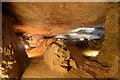
For over 4,000 years these natural caves have been tunnelled into by miners searching for iron ores to make iron and steel, as well as ochres to make paints.

Clearwell Caves is the only working ochre mine in Britain. It produces three to four tonnes of ochre a year, which is collected by scraping the ochre from the walls by hand. The ochre is then sold in the shop based on the premises.

Web site: Clearwell Caves - Ancient Iron Mines

Note: Wild boar roam free by the site of the prehistoric mine workings of Clearwell
You may be viewing yesterday's version of this page. To see the most up to date information please register for a free account.


Clearwell Caves
Clearwell Caves submitted by Flickr : Clearwell Caves just S of Coleford, Forest of Dean, Gloucestershire, England. - www.clearwellcaves.com/ The caves have been mined for iron ore and ochre pigment for artists, probably for over 4000 years, and mining here is amongst the earliest in the British Isles. This is a photo of one of the displays in the Clearwell Caves Museum, a black-and-white illustration showing prehis... (Vote or comment on this photo)

Do not use the above information on other web sites or publications without permission of the contributor.

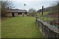
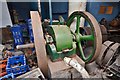
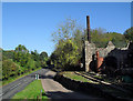
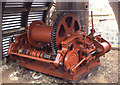
Nearby Images from Geograph Britain and Ireland:
SO5708 : Clearwell Caves by Ashley Dace
by Ashley Dace
©2013(licence)
SO5708 : Clearwell Caves - Oil Engine by Ashley Dace
by Ashley Dace
©2013(licence)
SO5708 : Clearwell Caves by Des Blenkinsopp
by Des Blenkinsopp
©2010(licence)
SO5708 : Clearwell Caverns - steam winch by Chris Allen
by Chris Allen
©2014(licence)
SO5708 : Clearwell Caves by Ashley Dace
by Ashley Dace
©2013(licence)

The above images may not be of the site on this page, they are loaded from Geograph.
Please Submit an Image of this site or go out and take one for us!


Click here to see more info for this site

Nearby sites

Click here to view sites on an interactive OS map

Key: Red: member's photo, Blue: 3rd party photo, Yellow: other image, Green: no photo - please go there and take one, Grey: site destroyed

Download sites to:
KML (Google Earth)
GPX (GPS waypoints)
CSV (Garmin/Navman)
CSV (Excel)

To unlock full downloads you need to sign up as a Contributory Member. Otherwise downloads are limited to 50 sites.


Turn off the page maps and other distractions

Nearby sites listing. In the following links * = Image available
 515m NE 55° Gattle's Cross* Marker Stone (SO5812608512)
 2.2km SW 215° Stowe Enclosure* Misc. Earthwork (SO56430643)
 2.7km WNW 298° Newland Crosses* Ancient Cross (SO5530809511)
 4.2km SSW 207° St Bride's Well* Holy Well or Sacred Spring (SO5574404515)
 4.2km NNW 335° Long Stone, Staunton* Standing Stone (Menhir) (SO55931206)
 4.3km SSW 204° The Ancient Barrow Well, St. Briavel's* Holy Well or Sacred Spring (SO5593004337)
 5.1km NNW 328° Staunton Cross* Ancient Cross (SO5506412571)
 5.3km NW 318° The Virgins Cup* Natural Stone / Erratic / Other Natural Feature (SO54191219)
 5.3km NW 324° Toads Mouth Stone* Natural Stone / Erratic / Other Natural Feature (SO54621260)
 5.4km NW 317° The Buck Stone (Gloucestershire)* Rock Outcrop (SO541122)
 5.8km NW 316° Staunton Broadstones* Natural Stone / Erratic / Other Natural Feature (SO53741242)
 5.8km NE 47° The Speech Stone* Marker Stone (SO62011212)
 6.4km NNW 337° Whipping Brook Cave Cave or Rock Shelter (SO55251410)
 6.7km NNW 329° Near Hearkening Rock* Natural Stone / Erratic / Other Natural Feature (SO54311401)
 6.7km NNW 337° The Biblins Cave Cave or Rock Shelter (SO55161446)
 6.8km SE 144° Lydney Hillfort* Hillfort (SO616027)
 6.8km NNW 329° Staunton Suck Stone (Gloucestershire)* Natural Stone / Erratic / Other Natural Feature (SO54211401)
 7.1km NNW 342° Lord's Wood Cave Cave or Rock Shelter (SO55551503)
 7.2km NNW 341° Biblins Cave or Rock Shelter (SO554150)
 7.2km NW 309° Kymin Hill Hillfort (SO521128)
 7.4km NNW 343° Merlin's Cave (Herefordshire) Cave or Rock Shelter (SO556153)
 7.4km NNW 347° Bowler's Hole Cave or Rock Shelter (SO56101545)
 7.4km N 354° Coldwell Rocks Cave or Rock Shelter (SO570156)
 7.5km NNW 347° Symonds Yat Cave 3 Cave or Rock Shelter (SO56101555)
 7.5km NNW 347° Symonds Yat Cave Cave or Rock Shelter (SO56101555)
View more nearby sites and additional images

<< Intipata

Babylon. >>

Please add your thoughts on this site

Long Barrows of the Cotswolds, Darvill

Long Barrows of the Cotswolds, Darvill

Sponsors

Auto-Translation (Google)

Translate from English into:

"Clearwell Caves" | Login/Create an Account | 6 News and Comments
  
Go back to top of page    Comments are owned by the poster. We aren't responsible for their content.
Evidence of Neolithic/BA mining at Clearwell Caves? And prehistoric use of Ochre by Andy B on Friday, 01 December 2017
(User Info | Send a Message)
I'm not sure if there is direct evidence but Clearwell Caves themselves have displays on it
https://www.flickr.com/photos/brize/36132970540

http://www.clearwellcaves.com/ochre.html
Clearwell Caves are amongst the earliest and one of the last producers of ochre (natural earth pigment) in the British Isles. Ochre is thought to have been mined here for more than 7000 years (since the Middle Stone Age) although we have stone tools dated to 4,500 years ago. Ochre pigment is found as a soft deposit intermingled with harder crystalline iron ore.

So evidence for Neolithic people in the caves, and ochre is known to have been used in the Neolithic.

This book references Ochre mining
and the related paper is here:
http://www.sciencedirect.com/science/article/pii/S1386142503003767

Ochre samples excavated from the neolithic site at Çatalhöyük, Turkey have been compared with “native” ochres from Clearwell Caves
The ochres from Çatalhöyük contain only about one-twentieth of the levels of iron found in the Clearwell Caves ochres.

So very strong colour pigment - must have been of interest?

This report The Archaeology of Mining and Quarrying in England: The Prehistoric and Roman Periods
https://www.namho.org/research/PREHISTORIC_Assessment_20130207.pdf

Says:
Forest of Dean
There may be early evidence for iron ochre pigment extraction in the Forest of Dean, Gloucestershire, in the form of rare small hand-held cobble stone implements used as crushing stones, presumably for hematite, some of which have been found within old ironstone mines with medieval (and probably pre-medieval origins) such as the Clearwell Caves (inf. Ian Standing). More recently, a small selection of hammerstones have been recovered from the surface of old scowles within a quarry at Drybrook on the east side of the Severn. Though fashioned from the same type of rock, at least one of these hammers shows distinct evidence of grooving for hafting, whilst another appears to be a small crushing stone. Small cup-marked hollows in bed rock near by (similar ones have been recorded from other sites in the Forest) have also been interpreted as anvils/mortars for crushing hematite (Strassburger 2000 unpub). No date has been ascribed to these workings, but it is has been suggested by Strassburger that they are Bronze Age - [Drybrook – Gloucester SMR 20829]

The SMR ref for this is
http://www.heritagegateway.org.uk/Gateway/Results_Single.aspx?uid=21483&resourceID=108
Which says:

Although the date and function of this arch is unknown, presumably it was associated with early iron ore mining in an area now destroyed by the quarry extension. {Pers. comm. J. Hoyle.} Possible ochre mining tools have been found here. Two probable stone hammers were found at the site, made from the same material as the bedrock.

This is about 12km from Clearwell Caves

So there is circumstantial evidence suggestive of mining - what else were they doing in a cave full of lovely deep coloured ochre?
[ Reply to This ]

WILD boar roam free by the site of the prehistoric mine workings of Clearwelll by bat400 on Tuesday, 03 July 2012
(User Info | Send a Message)
The Wild Boar Conservation Project is being organised by Clearwell Caves proprietor Ray Wright, who says a large field has been earmarked opposite the entrance to the caves and adjacent to the nearby scowles attraction which he also owns with his son Jonathan.

“Strong fencing is being put in place and the ground will be allowed to go back to nature. But there will also be a viewing platform from which the public will be able to look at the animals in safety and free of charge,” said Ray.

“It is not a part of our other attractions but will be run completely separately. We already have the offer of two animals but the idea is to hand-rear piglets that have been orphaned by road accidents or whose mothers have been shot by poachers. We will look after them until they are old enough to manage on their own.”

Thank to Coldrum for the link: Forest of Dean and Wye Valley Review.
[ Reply to This ]
    Re: WILD boar roam free by the site of the prehistoric mine workings of Clearwelll by Anonymous on Tuesday, 03 July 2012
    I find it slightly strange that there are poeple in the FoD who are actively trying to rear more boar. The population explosion of them in the last few years now has thousands of them spread across the forest, from just a few pairs released just a few years ago. The destruction they cause can be immense, and can now be seen almost everywhere in the forest. OK, a few make their way to the dinner table, but their numbers are still growing exponentially.
    [ Reply to This ]

Re: Clearwell Caves by Anonymous on Thursday, 13 November 2008
Ambience: Realistic
Condition: Atmospheric
Access: Easy for a mine
Accuracy: Spot on
[ Reply to This ]

Re: Free open day at Ffynnon Ter by Andy B on Wednesday, 12 July 2006
(User Info | Send a Message)
Sounds great jakism, please send us some photos
[ Reply to This ]

Free open day at Ffynnon Ter by Andy B on Wednesday, 12 July 2006
(User Info | Send a Message)
jakism writes: On July 23rd the Forest Living Archaeology Group are holding a free open day at their roundhouses, at Clearwell Caves, Forest of Dean, Gloucestershire.

Come & see iron age warriors, druids and lots more - bronze age cooking, iron smelting...

Come dressed for the occasion (if you dare)
Future events include copper casting, pit clamp firing.
Contact (01594) 840139 for details.
[ Reply to This ]

Your Name: Anonymous [ Register Now ]
Subject:


Add your comment or contribution to this page. Spam or offensive posts are deleted immediately, don't even bother

<<< What is five plus one as a number? (Please type the answer to this question in the little box on the left)
You can also embed videos and other things. For Youtube please copy and paste the 'embed code'.
For Google Street View please include Street View in the text.
Create a web link like this: <a href="https://www.megalithic.co.uk">This is a link</a>  

Allowed HTML is:
<p> <b> <i> <a> <img> <em> <br> <strong> <blockquote> <tt> <li> <ol> <ul> <object> <param> <embed> <iframe>

We would like to know more about this location. Please feel free to add a brief description and any relevant information in your own language.
Wir möchten mehr über diese Stätte erfahren. Bitte zögern Sie nicht, eine kurze Beschreibung und relevante Informationen in Deutsch hinzuzufügen.
Nous aimerions en savoir encore un peu sur les lieux. S'il vous plaît n'hesitez pas à ajouter une courte description et tous les renseignements pertinents dans votre propre langue.
Quisieramos informarnos un poco más de las lugares. No dude en añadir una breve descripción y otros datos relevantes en su propio idioma.