<< Text Pages >> Crapnell - Stone Circle in England in Somerset
Submitted by Tom_Bullock on Tuesday, 17 September 2002 Page Views: 8789
Neolithic and Bronze AgeSite Name: CrapnellCountry: England
NOTE: This site is 3.107 km away from the location you searched for.
County: Somerset Type: Stone Circle
Map Ref: ST596455 Landranger Map Number: 182
Latitude: 51.207270N Longitude: 2.579695W
Condition:
| 5 | Perfect |
| 4 | Almost Perfect |
| 3 | Reasonable but with some damage |
| 2 | Ruined but still recognisable as an ancient site |
| 1 | Pretty much destroyed, possibly visible as crop marks |
| 0 | No data. |
| -1 | Completely destroyed |
| 5 | Superb |
| 4 | Good |
| 3 | Ordinary |
| 2 | Not Good |
| 1 | Awful |
| 0 | No data. |
| 5 | Can be driven to, probably with disabled access |
| 4 | Short walk on a footpath |
| 3 | Requiring a bit more of a walk |
| 2 | A long walk |
| 1 | In the middle of nowhere, a nightmare to find |
| 0 | No data. |
| 5 | co-ordinates taken by GPS or official recorded co-ordinates |
| 4 | co-ordinates scaled from a detailed map |
| 3 | co-ordinates scaled from a bad map |
| 2 | co-ordinates of the nearest village |
| 1 | co-ordinates of the nearest town |
| 0 | no data |
Internal Links:
External Links:
Ancient site in Somerset
Have you visited this site? Please add a comment below.
You may be viewing yesterday's version of this page. To see the most up to date information please register for a free account.
Do not use the above information on other web sites or publications without permission of the contributor.
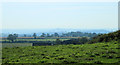
Nearby Images from Geograph Britain and Ireland:
©2011(licence)
©2011(licence)
©2011(licence)
©2006(licence)
©2011(licence)
The above images may not be of the site on this page, they are loaded from Geograph.
Please Submit an Image of this site or go out and take one for us!
Click here to see more info for this site
Nearby sites
Key: Red: member's photo, Blue: 3rd party photo, Yellow: other image, Green: no photo - please go there and take one, Grey: site destroyed
Download sites to:
KML (Google Earth)
GPX (GPS waypoints)
CSV (Garmin/Navman)
CSV (Excel)
To unlock full downloads you need to sign up as a Contributory Member. Otherwise downloads are limited to 50 sites.
Turn off the page maps and other distractions
Nearby sites listing. In the following links * = Image available
2.2km NE 39° Maesbury Castle* Hillfort (ST610472)
2.8km W 272° King's Castle (Wells) Ancient Village or Settlement (ST568456)
3.6km N 3° Whitnell Corner Barrows* Barrow Cemetery (ST5982849096)
3.9km E 80° Beacon Hill (Oakhill) Barrows* Barrow Cemetery (ST63484616)
4.4km W 274° St Andrew's Well (Wells)* Holy Well or Sacred Spring (ST5522745824)
4.4km W 271° Glastonbury Tor milestone at Wells* Modern Stone Circle etc (ST552456)
4.5km W 274° Wells Cathedral* Early Christian Sculptured Stone (ST5514645865)
4.5km W 275° Wells and Mendip Museum* Museum (ST551459)
4.6km NW 314° Pen Hill Longbarrow* Long Barrow (ST563487)
5.6km ESE 110° Doulting Quarries barrow* Modern Stone Circle etc (ST64824353)
5.6km ESE 114° St Aldhelm's Well* Holy Well or Sacred Spring (ST647432)
5.7km NW 319° Drove Cottage Henge* Henge (ST559498)
5.9km NW 321° Hunter's Lodge Inn Barrow* Round Barrow(s) (ST559501)
6.1km NE 41° Blackers Hill Promontory Fort* Hillfort (ST6364850045)
6.4km ENE 69° Fairy Cave Cave or Rock Shelter (ST65654775)
6.5km NNE 34° Three Tuns Tumuli* Barrow Cemetery (ST6324250870)
6.8km WNW 291° Badger Hole (Somerset) Cave or Rock Shelter (ST53244795)
6.8km ESE 113° West Cranmore Round Barrows* Barrow Cemetery (ST65844274)
6.8km WNW 288° Wookey Hole Caves Museum* Museum (ST531477)
6.9km WNW 291° Wookey Hole Caves* Cave or Rock Shelter (ST53194801)
6.9km S 183° Glastonbury Stone Circle* Modern Stone Circle etc (ST59143858)
7.1km WSW 249° Harters Hill* Ancient Trackway (ST529430)
7.3km NW 316° Fair Lady Well* Holy Well or Sacred Spring (ST54515079)
7.6km N 3° Lime House Long Barrow* Long Barrow (ST60095305)
7.6km N 360° Chewton Mendip Cross* Ancient Cross (ST5962353136)
View more nearby sites and additional images


 We would like to know more about this location. Please feel free to add a brief description and any relevant information in your own language.
 Wir möchten mehr über diese Stätte erfahren. Bitte zögern Sie nicht, eine kurze Beschreibung und relevante Informationen in Deutsch hinzuzufügen.
 Nous aimerions en savoir encore un peu sur les lieux. S'il vous plaît n'hesitez pas à ajouter une courte description et tous les renseignements pertinents dans votre propre langue.
 Quisieramos informarnos un poco más de las lugares. No dude en añadir una breve descripción y otros datos relevantes en su propio idioma.