<< Text Pages >> Oldbury Court Camp - Ancient Village or Settlement in England in Gloucestershire
Submitted by coldrum on Monday, 04 January 2010 Page Views: 5081
Multi-periodSite Name: Oldbury Court CampCountry: England County: Gloucestershire Type: Ancient Village or Settlement
Nearest Town: Bristol
Map Ref: ST633769
Latitude: 51.489848N Longitude: 2.529982W
Condition:
| 5 | Perfect |
| 4 | Almost Perfect |
| 3 | Reasonable but with some damage |
| 2 | Ruined but still recognisable as an ancient site |
| 1 | Pretty much destroyed, possibly visible as crop marks |
| 0 | No data. |
| -1 | Completely destroyed |
| 5 | Superb |
| 4 | Good |
| 3 | Ordinary |
| 2 | Not Good |
| 1 | Awful |
| 0 | No data. |
| 5 | Can be driven to, probably with disabled access |
| 4 | Short walk on a footpath |
| 3 | Requiring a bit more of a walk |
| 2 | A long walk |
| 1 | In the middle of nowhere, a nightmare to find |
| 0 | No data. |
| 5 | co-ordinates taken by GPS or official recorded co-ordinates |
| 4 | co-ordinates scaled from a detailed map |
| 3 | co-ordinates scaled from a bad map |
| 2 | co-ordinates of the nearest village |
| 1 | co-ordinates of the nearest town |
| 0 | no data |
Be the first person to rate this site - see the 'Contribute!' box in the right hand menu.
Internal Links:
External Links:
From Pastscape: "A possible prehistoric enclosure identified near Oldbury Court during the 18th century. In December 1928 earthworks including a mound about two feet high and 55 feet by 40 feet, surmounted by trees, were recorded east of the house. Other earthworks were identified in the fields across the road east of the Training College."
Near to Oldbury Court "... is a small camp, which gave name to the place". (1)
Oldbury Court Camp - "On the hill above Oldbury Court in the parish of Stapleton (now Bristol) .... there was a small camp which gave the name to the house (Witts quotes Rudder). I have not been able to visit this locality, but the owner of the property informs me that he is unable to now trace any defensive works."
In December 1928 Davies noticed a mound about two feet high and 55 feet by 40 feet, surmounted by trees, about 200 yards east of the house just in side Oldbury Park, and bumps in the fields across the road east of the Training College. (2)
You may be viewing yesterday's version of this page. To see the most up to date information please register for a free account.
Do not use the above information on other web sites or publications without permission of the contributor.
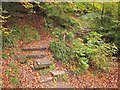
Nearby Images from Geograph Britain and Ireland:
©2013(licence)
©2018(licence)
©2018(licence)
©2014(licence)
©2014(licence)
The above images may not be of the site on this page, they are loaded from Geograph.
Please Submit an Image of this site or go out and take one for us!
Click here to see more info for this site
Nearby sites
Key: Red: member's photo, Blue: 3rd party photo, Yellow: other image, Green: no photo - please go there and take one, Grey: site destroyed
Download sites to:
KML (Google Earth)
GPX (GPS waypoints)
CSV (Garmin/Navman)
CSV (Excel)
To unlock full downloads you need to sign up as a Contributory Member. Otherwise downloads are limited to 50 sites.
Turn off the page maps and other distractions
Nearby sites listing. In the following links * = Image available
2.0km W 281° Stoke Park Long Barrow* Long Barrow (ST6132077294)
2.9km NE 40° Bury Hill Camp (Winterbourne)* Hillfort (ST652791)
4.0km E 96° Shortwood Circle* Modern Stone Circle etc (ST67277642)
4.2km ENE 60° The Beeracres Stone* Modern Stone Circle etc (ST6779)
4.3km SW 224° Armoury Square Standing Stone (Menhir) (ST60287386)
4.5km SSW 194° St Ann's Well (Brislington)* Holy Well or Sacred Spring (ST6217472515)
5.2km E 100° Shortwood Hill barrow* Round Barrow(s) (ST68457600)
5.4km W 280° Southmead Barrow* Round Barrow(s) (ST5794477902)
5.6km NW 314° Highwood Road Modern Menhir* Modern Stone Circle etc (ST5928080878)
5.7km WSW 249° Redland Park* Standing Stone (Menhir) (ST57947492)
5.7km ESE 110° St Anne’s well (Siston)* Holy Well or Sacred Spring (ST68697494)
6.4km SW 234° Bristol City Museum* Museum (ST58057321)
7.2km W 264° Druid Stoke* Chambered Tomb (ST56107620)
7.4km NNW 330° Knole Park Camp* Hillfort (ST59638334)
7.5km ESE 105° Abson Church* Sculptured Stone (ST70557485)
7.6km W 281° Blaise Castle* Hillfort (ST55857837)
7.6km WSW 241° Clifton Down Camp* Hillfort (ST56587329)
7.8km W 279° King's Weston Hillfort* Hillfort (ST55597813)
8.0km W 278° King's Weston Hill stockpound* Misc. Earthwork (ST55417807)
8.1km WSW 241° Burwalls Camp* Promontory Fort / Cliff Castle (ST562730)
8.1km NE 36° Iron Acton Churchyard Cross* Ancient Cross (ST6807583467)
8.1km WSW 243° Stokeleigh Camp* Promontory Fort / Cliff Castle (ST560733)
8.2km W 277° King's Weston Hill barrow cemetary* Barrow Cemetery (ST55127793)
8.7km SSE 149° Bitton Round Barrow* Round Barrow(s) (ST67806945)
8.8km SE 145° Bitton Camp* Misc. Earthwork (ST68276968)
View more nearby sites and additional images


 We would like to know more about this location. Please feel free to add a brief description and any relevant information in your own language.
 Wir möchten mehr über diese Stätte erfahren. Bitte zögern Sie nicht, eine kurze Beschreibung und relevante Informationen in Deutsch hinzuzufügen.
 Nous aimerions en savoir encore un peu sur les lieux. S'il vous plaît n'hesitez pas à ajouter une courte description et tous les renseignements pertinents dans votre propre langue.
 Quisieramos informarnos un poco más de las lugares. No dude en añadir una breve descripción y otros datos relevantes en su propio idioma.