<< Text Pages >> Alton Lane Field System - Misc. Earthwork in England in Dorset
Submitted by coldrum on Monday, 04 January 2010 Page Views: 3110
Multi-periodSite Name: Alton Lane Field SystemCountry: England
NOTE: This site is 2.592 km away from the location you searched for.
County: Dorset Type: Misc. Earthwork
Nearest Village: Cerne Abbas
Map Ref: ST677014
Latitude: 50.811243N Longitude: 2.459811W
Condition:
| 5 | Perfect |
| 4 | Almost Perfect |
| 3 | Reasonable but with some damage |
| 2 | Ruined but still recognisable as an ancient site |
| 1 | Pretty much destroyed, possibly visible as crop marks |
| 0 | No data. |
| -1 | Completely destroyed |
| 5 | Superb |
| 4 | Good |
| 3 | Ordinary |
| 2 | Not Good |
| 1 | Awful |
| 0 | No data. |
| 5 | Can be driven to, probably with disabled access |
| 4 | Short walk on a footpath |
| 3 | Requiring a bit more of a walk |
| 2 | A long walk |
| 1 | In the middle of nowhere, a nightmare to find |
| 0 | No data. |
| 5 | co-ordinates taken by GPS or official recorded co-ordinates |
| 4 | co-ordinates scaled from a detailed map |
| 3 | co-ordinates scaled from a bad map |
| 2 | co-ordinates of the nearest village |
| 1 | co-ordinates of the nearest town |
| 0 | no data |
Be the first person to rate this site - see the 'Contribute!' box in the right hand menu.
Internal Links:
External Links:
Misc. Earthwork in Dorset
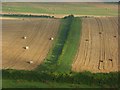
From Pastscape: "Remains of an Iron Age and Romano British field system."
You may be viewing yesterday's version of this page. To see the most up to date information please register for a free account.
Do not use the above information on other web sites or publications without permission of the contributor.
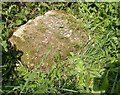
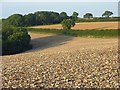
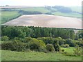
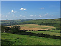
Nearby Images from Geograph Britain and Ireland:
©2017(licence)
©2007(licence)
©2008(licence)
©2007(licence)
©2007(licence)
The above images may not be of the site on this page, they are loaded from Geograph.
Please Submit an Image of this site or go out and take one for us!
Click here to see more info for this site
Nearby sites
Key: Red: member's photo, Blue: 3rd party photo, Yellow: other image, Green: no photo - please go there and take one, Grey: site destroyed
Download sites to:
KML (Google Earth)
GPX (GPS waypoints)
CSV (Garmin/Navman)
CSV (Excel)
To unlock full downloads you need to sign up as a Contributory Member. Otherwise downloads are limited to 50 sites.
Turn off the page maps and other distractions
Nearby sites listing. In the following links * = Image available
1.0km WNW 285° The Trendle* Misc. Earthwork (ST66730167)
1.0km SSW 209° Black Hill Farm Enclosure Ancient Village or Settlement (ST672005)
1.0km WNW 296° Giant Hill Bowl Barrow Round Barrow(s) (ST66760187)
1.1km W 268° St Augustine's Well (Cerne Abbas)* Holy Well or Sacred Spring (ST6664001369)
1.1km WNW 285° Cerne Abbas Giant* Hill Figure or Geoglyph (ST66660168)
1.1km WNW 291° Giant Hill Cross Ridge Dyke Misc. Earthwork (ST667018)
1.1km NW 323° Bowl Barrow (Dorset) Round Barrow(s) (ST67030229)
1.1km NW 318° Giant Hill Settlement Ancient Village or Settlement (ST66950225)
1.3km SSW 194° Oxencombe Bottom Bowl Barrow Round Barrow(s) (ST67380018)
2.1km SSW 198° Green Hill Barrows Barrow Cemetery (SY67069943)
2.2km SSW 193° Green Hill Field System Misc. Earthwork (SY672993)
2.3km W 275° Weam Commen Hill Field System Misc. Earthwork (ST654016)
2.3km WSW 241° Dickley Hill Settlement Ancient Village or Settlement (ST65650027)
2.4km WSW 241° Dickley Hill Bowl Barrows Round Barrow(s) (ST65600026)
2.7km NW 317° Farm Hill Bowl Barrow Round Barrow(s) (ST65880334)
2.7km NW 312° High Cank Henge Henge (ST65720319)
2.7km SW 223° Smacam Down Bowl Barrow Round Barrow(s) (SY65859946)
2.8km WNW 290° Seldon Hill Settlement Ancient Village or Settlement (ST65100235)
2.8km SW 224° Smacam Down Long Barrow Long Barrow (SY6572599389)
2.8km SW 225° Smacam Down Settlement Ancient Village or Settlement (SY657994)
3.0km WNW 281° Wancombe Hill Field System Misc. Earthwork (ST64790200)
3.1km WSW 258° Up Cerne/Sydling St Nicholas Boundary Stone Marker Stone (ST64610078)
3.6km NW 317° East Hill field System* Misc. Earthwork (ST65250405)
3.9km SSW 209° Nether Cerne Field System Misc. Earthwork (SY658980)
4.2km NW 321° St Mary's Well (Hermitage)* Holy Well or Sacred Spring (ST651047)
View more nearby sites and additional images


 We would like to know more about this location. Please feel free to add a brief description and any relevant information in your own language.
 Wir möchten mehr über diese Stätte erfahren. Bitte zögern Sie nicht, eine kurze Beschreibung und relevante Informationen in Deutsch hinzuzufügen.
 Nous aimerions en savoir encore un peu sur les lieux. S'il vous plaît n'hesitez pas à ajouter une courte description et tous les renseignements pertinents dans votre propre langue.
 Quisieramos informarnos un poco más de las lugares. No dude en añadir una breve descripción y otros datos relevantes en su propio idioma.