<< Text Pages >> Balaam's Grove burial mound - Round Barrow(s) in England in Lancashire
Submitted by AngieLake on Wednesday, 03 February 2016 Page Views: 2522
Neolithic and Bronze AgeSite Name: Balaam''s Grove burial moundCountry: England
NOTE: This site is 2.612 km away from the location you searched for.
County: Lancashire Type: Round Barrow(s)
Nearest Town: Clitheroe Nearest Village: Slaidburn
Map Ref: SD7112652069
Latitude: 53.963888N Longitude: 2.441587W
Condition:
| 5 | Perfect |
| 4 | Almost Perfect |
| 3 | Reasonable but with some damage |
| 2 | Ruined but still recognisable as an ancient site |
| 1 | Pretty much destroyed, possibly visible as crop marks |
| 0 | No data. |
| -1 | Completely destroyed |
| 5 | Superb |
| 4 | Good |
| 3 | Ordinary |
| 2 | Not Good |
| 1 | Awful |
| 0 | No data. |
| 5 | Can be driven to, probably with disabled access |
| 4 | Short walk on a footpath |
| 3 | Requiring a bit more of a walk |
| 2 | A long walk |
| 1 | In the middle of nowhere, a nightmare to find |
| 0 | No data. |
| 5 | co-ordinates taken by GPS or official recorded co-ordinates |
| 4 | co-ordinates scaled from a detailed map |
| 3 | co-ordinates scaled from a bad map |
| 2 | co-ordinates of the nearest village |
| 1 | co-ordinates of the nearest town |
| 0 | no data |
Internal Links:
External Links:
Round Barrow(s) in Lancashire
"Slaidburn Pipeline, Lancashire: Historical Research, Walkover Survey, Strip and Record Investigation and Topographic Survey
27
For the use of United Utilities Ltd © OA North: November 2010
Site number 09
NGR SD 71126 52069
HER number 33002
Period Bronze Age
Source LHER, current, and 1960s aerial photographs; Walkover survey
Description"
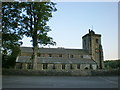
"An oval earthwork, measuring c 26m by 15m is located, to the rear of the church in an area known as Bawgreaves (tithe map) or Balaam’s Grove (OS First Edition). It is thought to have been a burial mound. There has been a local tradition of human bones and other artefacts being dug up over the years. A trial excavation with assistance from BJN Edwards was undertaken on the site in 1984. It revealed a very large burial cairn constructed of rounded river cobbles. Cremated bones, flint implements and both Neolithic pottery and Bronze Age collarded urn fragments were retrieved. The finds, and an abbreviated summary of the excavation, are held in Slaidburn Archive. The cairn can be seen as three long a sub-oval depression measuring approximately 27m long by 22m wide and up to 0.5-0.6m high."
[From pdf:
https://library.thehumanjourney.net/2363//L10221_complete_report_smaller2.pdf]
Also in the pdf:
"There is clear evidence of human activity at Slaidburn from the prehistoric period, with a Bronze Age burial cairn (Site 9) being sited just to the south of the parish church. Slaidburn appeared in the Domesday Survey, and it has been suggested that the raised land in the vicinity of St Andrew’s Church (Site01), which dates to at least as early as the first half of the twelfth century, would represent the most likely location for any pre-Conquest settlement associated with the village. The church foundation occurred prior to 1090 AD, and two pieces of stone sculpture of apparent early-medieval date have been found in the vicinity of Slaidburn, one of which was discovered in the area close to the church."
and
"3.1.4
There is clear evidence of human activity during the prehistoric period
within the study area, with a putative Bronze Age burial cairn (LHER
33002) having been subject to trial excavation to the rear of St Andrew’s
Church, in the area known as Balaam’s Grove (Site 9; Plate 1). This oval-
shaped earthwork has been described as measuring 26m by 15m and human
bones and artefacts have been found within this area over a protracted period. The excavation was undertaken in 1984 by the Pendle Archaeology
Group, under the supervision of BJN Edwards (Slaidburn Archive Notes).
The excavations revealed a large burial cairn constructed of rounded river
cobbles. Trenches cut through to the relict ground surface recovered fragments of both putative Neolithic pottery and more numerous fragments of Bronze Age collared funerary urn found in associated with cremated teeth and bones (Plate 2). Approximately 10km to the south of the study area, near Chipping, the site of Bleasdale stone circle dating to c2200 BC also indicates prehistoric activity in the surrounding area (Middleton 1996, 53)"
(NB: Access rating guessed from description.)
You may be viewing yesterday's version of this page. To see the most up to date information please register for a free account.
Do not use the above information on other web sites or publications without permission of the contributor.
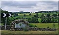
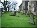
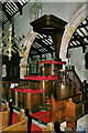
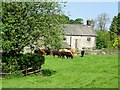
Nearby Images from Geograph Britain and Ireland:
©2022(licence)
©2007(licence)
©2008(licence)
©2017(licence)
©2009(licence)
The above images may not be of the site on this page, they are loaded from Geograph.
Please Submit an Image of this site or go out and take one for us!
Click here to see more info for this site
Nearby sites
Key: Red: member's photo, Blue: 3rd party photo, Yellow: other image, Green: no photo - please go there and take one, Grey: site destroyed
Download sites to:
KML (Google Earth)
GPX (GPS waypoints)
CSV (Garmin/Navman)
CSV (Excel)
To unlock full downloads you need to sign up as a Contributory Member. Otherwise downloads are limited to 50 sites.
Turn off the page maps and other distractions
Nearby sites listing. In the following links * = Image available
150m NW 322° Slaidburn Angel Stone* Sculptured Stone (SD7103552188)
1.9km SSE 155° Skelshaw Ring (Easington) Ancient Village or Settlement (SD71915036)
3.0km S 169° Easington Fell Ring (Newton) Ancient Village or Settlement (SD71674911)
3.4km SSW 212° The Foulscales Stone (Newton)* Early Christian Sculptured Stone (SD693492)
3.9km S 169° Walloper Well (Newton) Holy Well or Sacred Spring (SD7182348265)
3.9km SW 234° The Knowlmere Cross* Ancient Cross (SD679498)
7.7km SW 226° Fairy Holes* Cave or Rock Shelter (SD65534678)
7.9km ESE 110° St Peter and St Paul's Church, Bolton-by-Bowland* Sculptured Stone (SD786493)
8.5km S 169° Pinder Hill (Waddington) Cairn (SD72724370)
9.3km NNE 29° Brown Hills Beck East* Round Barrow(s) (SD75656025)
9.3km ESE 110° Fooden Spring Holy Well or Sacred Spring (SD7993548892)
9.4km NNE 28° Brown Hills Beck* Round Barrow(s) (SD75616035)
9.7km SSE 164° Peg o'Nell's Well* Holy Well or Sacred Spring (SD73684266)
10.5km SE 137° Great Stone (Downham)* Standing Stone (Menhir) (SD782443)
11.1km SE 142° Worsaw Hill Burial Mound* Round Barrow(s) (SD77934323)
11.5km S 182° Withgill Cross (Great Mitton) Ancient Cross (SD70604062)
11.8km E 99° Little Painley* Round Barrow(s) (SD8284350125)
11.9km SSW 192° Kemple End Cross* Ancient Cross (SD6864240438)
11.9km E 96° Castle Haugh Ringwork (Paythorne Bridge) Misc. Earthwork (SD8299650776)
12.4km S 179° Mitton Green Cross (Great Mitton) Ancient Cross (SD7121739613)
13.1km S 178° The Great Mitton Cross* Ancient Cross (SD7156438954)
13.2km SE 144° Pendle Hill* Round Barrow(s) (SD789414)
13.2km SE 134° Pendle Hill Ringwork and Barrow Hillfort (SD806428)
13.3km SSW 209° Thornley Hall Fell Cairn* Round Barrow(s) (SD64524047)
13.5km SSW 210° Jeffrey Hill Cairn Circle* Cairn (SD644404)
View more nearby sites and additional images


 We would like to know more about this location. Please feel free to add a brief description and any relevant information in your own language.
 Wir möchten mehr über diese Stätte erfahren. Bitte zögern Sie nicht, eine kurze Beschreibung und relevante Informationen in Deutsch hinzuzufügen.
 Nous aimerions en savoir encore un peu sur les lieux. S'il vous plaît n'hesitez pas à ajouter une courte description et tous les renseignements pertinents dans votre propre langue.
 Quisieramos informarnos un poco más de las lugares. No dude en añadir una breve descripción y otros datos relevantes en su propio idioma.