<< Our Photo Pages >> Cocker Cobb - Stone Circle in England in Lancashire
Submitted by DavidHoyle on Wednesday, 15 January 2020 Page Views: 1428
Neolithic and Bronze AgeSite Name: Cocker CobbCountry: England
NOTE: This site is 2.259 km away from the location you searched for.
County: Lancashire Type: Stone Circle
Nearest Town: Blackburn Nearest Village: Oswaldtwistle
Map Ref: SD7385225360
Latitude: 53.723982N Longitude: 2.397755W
Condition:
| 5 | Perfect |
| 4 | Almost Perfect |
| 3 | Reasonable but with some damage |
| 2 | Ruined but still recognisable as an ancient site |
| 1 | Pretty much destroyed, possibly visible as crop marks |
| 0 | No data. |
| -1 | Completely destroyed |
| 5 | Superb |
| 4 | Good |
| 3 | Ordinary |
| 2 | Not Good |
| 1 | Awful |
| 0 | No data. |
| 5 | Can be driven to, probably with disabled access |
| 4 | Short walk on a footpath |
| 3 | Requiring a bit more of a walk |
| 2 | A long walk |
| 1 | In the middle of nowhere, a nightmare to find |
| 0 | No data. |
| 5 | co-ordinates taken by GPS or official recorded co-ordinates |
| 4 | co-ordinates scaled from a detailed map |
| 3 | co-ordinates scaled from a bad map |
| 2 | co-ordinates of the nearest village |
| 1 | co-ordinates of the nearest town |
| 0 | no data |
Internal Links:
External Links:
")
You may be viewing yesterday's version of this page. To see the most up to date information please register for a free account.
")
")
Do not use the above information on other web sites or publications without permission of the contributor.
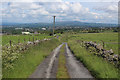
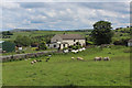
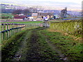
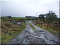
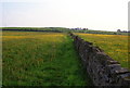
Nearby Images from Geograph Britain and Ireland:
©2019(licence)
©2019(licence)
©2009(licence)
©2008(licence)
©2010(licence)
The above images may not be of the site on this page, they are loaded from Geograph.
Please Submit an Image of this site or go out and take one for us!
Click here to see more info for this site
Nearby sites
Key: Red: member's photo, Blue: 3rd party photo, Yellow: other image, Green: no photo - please go there and take one, Grey: site destroyed
Download sites to:
KML (Google Earth)
GPX (GPS waypoints)
CSV (Garmin/Navman)
CSV (Excel)
To unlock full downloads you need to sign up as a Contributory Member. Otherwise downloads are limited to 50 sites.
Turn off the page maps and other distractions
Nearby sites listing. In the following links * = Image available
3.0km ESE 111° Thirteen Stone Hill* Stone Circle (SD7665324273)
6.2km ENE 60° May Hole Well (Hyndburn Moor)* Holy Well or Sacred Spring (SD7923528430)
6.2km SW 223° White Hall* Round Barrow(s) (SD696208)
7.1km SE 145° Robin Hood's Well, Haslingden* Holy Well or Sacred Spring (SD77861954)
7.5km WNW 301° Revidge Moor Barrow* Round Barrow(s) (SD674293)
8.0km WSW 255° Norman Arch over Well Holy Well or Sacred Spring (SD6606023393)
8.3km WNW 302° Beardwood Holed Stone* Holed Stone (SD6684829793)
8.3km WSW 253° Tocca's Stone* Ancient Cross (SD65842302)
9.1km WNW 281° Pleasington Cemetery (Blackburn) Cairn (SD649272)
9.2km SW 234° Hollinshead Holy Well* Holy Well or Sacred Spring (SD66361994)
9.6km S 170° Carve Hill Low* Barrow Cemetery (SD755159)
9.7km SSW 193° Cheetham Close* Stone Circle (SD71631586)
10.2km N 4° Portfield* Hillfort (SD7458135499)
10.4km WNW 303° Mellor Brow Mound* Misc. Earthwork (SD6517231081)
10.7km ESE 122° Waugh's Well (Edenfield) Holy Well or Sacred Spring (SD82871957)
10.7km N 357° St Mary and All Saints Church (Whalley)* Sculptured Stone (SD733361)
10.8km N 357° Whalley Crosses* Ancient Cross (SD73263616)
10.8km SSE 168° Dodd Lee* Barrow Cemetery (SD76121476)
11.0km SSE 164° Whippalow Hill* Barrow Cemetery (SD76921477)
11.3km SE 144° Whitelow* Cairn (SD80501626)
11.4km NNE 19° Simon's Cross (Padiham)* Ancient Cross (SD77603609)
11.7km N 359° High Wall Well (Bramley Meade)* Holy Well or Sacred Spring (SD73663702)
11.8km S 172° Affetside Cross (Lancashire) Ancient Cross (SD7546613689)
11.8km S 172° Affetside Cross (Bury)* Ancient Cross (SD7546613686)
12.0km N 3° Wisa's Well (Wiswell)* Holy Well or Sacred Spring (SD746373)
View more nearby sites and additional images


 We would like to know more about this location. Please feel free to add a brief description and any relevant information in your own language.
 Wir möchten mehr über diese Stätte erfahren. Bitte zögern Sie nicht, eine kurze Beschreibung und relevante Informationen in Deutsch hinzuzufügen.
 Nous aimerions en savoir encore un peu sur les lieux. S'il vous plaît n'hesitez pas à ajouter une courte description et tous les renseignements pertinents dans votre propre langue.
 Quisieramos informarnos un poco más de las lugares. No dude en añadir una breve descripción y otros datos relevantes en su propio idioma.