


<< Our Photo Pages >> The Common (Herm) - Burial Chamber or Dolmen in Channel Islands and Isle of Man in Guernsey
Submitted by Andy B on Wednesday, 13 October 2010 Page Views: 10600
Neolithic and Bronze AgeSite Name: The Common (Herm)Country: Channel Islands and Isle of Man Island: Guernsey Type: Burial Chamber or Dolmen
Nearest Town: St Peter Port Nearest Village: Herm Island
Latitude: 49.479400N Longitude: 2.4521W
Condition:
| 5 | Perfect |
| 4 | Almost Perfect |
| 3 | Reasonable but with some damage |
| 2 | Ruined but still recognisable as an ancient site |
| 1 | Pretty much destroyed, possibly visible as crop marks |
| 0 | No data. |
| -1 | Completely destroyed |
| 5 | Superb |
| 4 | Good |
| 3 | Ordinary |
| 2 | Not Good |
| 1 | Awful |
| 0 | No data. |
| 5 | Can be driven to, probably with disabled access |
| 4 | Short walk on a footpath |
| 3 | Requiring a bit more of a walk |
| 2 | A long walk |
| 1 | In the middle of nowhere, a nightmare to find |
| 0 | No data. |
| 5 | co-ordinates taken by GPS or official recorded co-ordinates |
| 4 | co-ordinates scaled from a detailed map |
| 3 | co-ordinates scaled from a bad map |
| 2 | co-ordinates of the nearest village |
| 1 | co-ordinates of the nearest town |
| 0 | no data |
Internal Links:
External Links:
 (PID:104885)")
They are focusing on the known tomb sites on Grand Monceau, Petit Monceau, Robert’s Cross and the Common.
Chris has worked mostly in north-west France for the past 20 years and this led to his interest in Herm.
‘Although the Channel Islands are insular and have their own character, they are archaeologically part of Normandy,’ he explained.
The team are looking to find the prehistoric ground surface beneath the Common. Sand has blown in over the past 2,000 years to cover this area, but beneath it is yellow clay which helps preserve evidence.
‘There are 19 tombs on the island, most of them on Grand Monceau leading down to Robert’s Cross and on the east side of Petit Monceau,’ said Chris. ‘There are three known on the Common and one reported under what is now the Obelisk. There was also one at Oyster Point, which is now covered in dunes.’
The team were excited to work on Herm, as many sites in Britain and France have been ‘ploughed to pieces’, whereas Herm is relatively untouched.
There were two preliminary visits this year to prepare for the dig. In June, they used geophysics to show up anomalies that could be granite blocks beneath the sand.
In July, boreholes were made in various parts of the Common. They have also used ground penetrating radar.
The team is also using the work done by Frederick Lukis in 1840 as a reference to help them decide where to explore further.
Stones and tombs unearthed by the Lukis group are still visible on the Common.
It is near one of these that Chris and his team have made an interesting discovery.
The site contains a long wall, in the middle of which is a one metre-wide stone circular structure filled with small white pebbles. Further along are more white pebbles and evidence of what may have been a container holding them which has since perished.
‘To be honest, we don’t as yet have any idea what this was,’ said Chris. ‘It is possibly the foundation of some kind of wooden building. But the circular structure with no entrances is very enigmatic.’
Samples need to be analysed but this is probably a Neolithic finding, dated from 4000 to 1000BC. A little further along the common, towards Shell Beach, is the next interesting site. The team discovered an outcrop which was buried long ago. Surrounding it was almost 100 pieces of flint and pottery.
Many of the findings were the outer layer of pieces of flint, which would have been chipped off in order to use the inner flint to make tools.
Chris believes the original coastline was much further in than it is today. Boreholes beyond this area went down to around 3m and found sand beneath. The team believes what is under this area is the original prehistoric beach.
The team hopes to return next year to see what other historical treasures are lying just beneath the island’s surface.
With many thanks to Cheryl Lee Latter from the Guernsey Press for the article.
The Durham University excavation website.
Read more, with photos on Herm's web site
IMPORTANT NOTE: The only information we have is that this site is on the island of Herm. Please help us pinpoint it with a GPS reference.
Note: Excavations on Herm find prehistoric house, see comment
You may be viewing yesterday's version of this page. To see the most up to date information please register for a free account.
 (PID:104886)")
Do not use the above information on other web sites or publications without permission of the contributor.
Nearby Images from Flickr
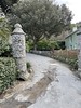

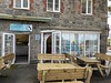
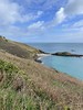
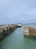

The above images may not be of the site on this page, but were taken nearby. They are loaded from Flickr so please click on them for image credits.
Click here to see more info for this site
Nearby sites
Click here to view sites on an interactive map of the areaKey: Red: member's photo, Blue: 3rd party photo, Yellow: other image, Green: no photo - please go there and take one, Grey: site destroyed
Download sites to:
KML (Google Earth)
GPX (GPS waypoints)
CSV (Garmin/Navman)
CSV (Excel)
To unlock full downloads you need to sign up as a Contributory Member. Otherwise downloads are limited to 50 sites.
Turn off the page maps and other distractions
Nearby sites listing. In the following links * = Image available
241m SSE 151° Grand Monceau* Burial Chamber or Dolmen
259m S 190° Robert's Cross* Burial Chamber or Dolmen
298m SW 225° Petit Monceau* Burial Chamber or Dolmen
2.3km SSW 198° Jethou Stone Standing Stone (Menhir)
4.4km WNW 297° Le Dehus* Burial Chamber or Dolmen
5.0km WNW 285° La Roque qui Sonne* Passage Grave
5.2km W 269° Delancey* Burial Chamber or Dolmen (WV346810)
5.5km W 269° La Pointue Rocque* Standing Stone (Menhir)
5.9km W 271° Route St Clair* Standing Stone (Menhir) (WV339812)
6.1km WSW 242° Guernsey Maritime Museum Museum
6.2km WNW 294° Martello 7* Stone Circle
6.3km WNW 293° La Mare es Mauves* Burial Chamber or Dolmen
6.3km W 262° Le Chateau Du Marais* Artificial Mound
6.5km WNW 289° La Platte Mare* Burial Chamber or Dolmen
6.5km WNW 288° Les Fouaillages* Burial Chamber or Dolmen
6.5km WNW 283° St Michel Du Valle* Not Known (by us)
6.6km WNW 293° La Varde* Passage Grave (WV337836)
6.8km W 279° L'Islet* Burial Chamber or Dolmen
6.9km WSW 252° La Petite L'Hyvreuse Passage Grave
6.9km W 279° Sandy Lane* Burial Chamber or Dolmen
7.0km WSW 250° La Pierre de L'Hyvreuse Standing Stone (Menhir)
7.1km ESE 119° L'Eperquerie Cist* Cist
7.5km WSW 252° Courtil D'Ydol de St Jacques Standing Stone (Menhir)
7.6km WSW 250° La Petite Longue Rocque des Granges* Standing Stone (Menhir) (WV326785)
7.7km WNW 286° Rousse Cists* Cist
View more nearby sites and additional images


 We would like to know more about this location. Please feel free to add a brief description and any relevant information in your own language.
 Wir möchten mehr über diese Stätte erfahren. Bitte zögern Sie nicht, eine kurze Beschreibung und relevante Informationen in Deutsch hinzuzufügen.
 Nous aimerions en savoir encore un peu sur les lieux. S'il vous plaît n'hesitez pas à ajouter une courte description et tous les renseignements pertinents dans votre propre langue.
 Quisieramos informarnos un poco más de las lugares. No dude en añadir una breve descripción y otros datos relevantes en su propio idioma.