
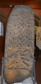

<< Our Photo Pages >> Upper Arley stone - Standing Stone (Menhir) in England in Worcestershire
Submitted by PhilKidderminster on Monday, 28 February 2011 Page Views: 8234
Neolithic and Bronze AgeSite Name: Upper Arley stoneCountry: England
NOTE: This site is 2.003 km away from the location you searched for.
County: Worcestershire Type: Standing Stone (Menhir)
Nearest Village: Upper Arley
Map Ref: SO773809
Latitude: 52.425609N Longitude: 2.335253W
Condition:
| 5 | Perfect |
| 4 | Almost Perfect |
| 3 | Reasonable but with some damage |
| 2 | Ruined but still recognisable as an ancient site |
| 1 | Pretty much destroyed, possibly visible as crop marks |
| 0 | No data. |
| -1 | Completely destroyed |
| 5 | Superb |
| 4 | Good |
| 3 | Ordinary |
| 2 | Not Good |
| 1 | Awful |
| 0 | No data. |
| 5 | Can be driven to, probably with disabled access |
| 4 | Short walk on a footpath |
| 3 | Requiring a bit more of a walk |
| 2 | A long walk |
| 1 | In the middle of nowhere, a nightmare to find |
| 0 | No data. |
| 5 | co-ordinates taken by GPS or official recorded co-ordinates |
| 4 | co-ordinates scaled from a detailed map |
| 3 | co-ordinates scaled from a bad map |
| 2 | co-ordinates of the nearest village |
| 1 | co-ordinates of the nearest town |
| 0 | no data |
Internal Links:
External Links:
")
Small standing stone approx 1.2 metres tall.
You may be viewing yesterday's version of this page. To see the most up to date information please register for a free account.
Do not use the above information on other web sites or publications without permission of the contributor.
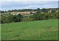
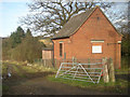
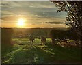
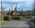
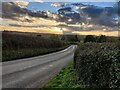
Nearby Images from Geograph Britain and Ireland:
©2010(licence)
©2008(licence)
©2022(licence)
©2017(licence)
©2022(licence)
The above images may not be of the site on this page, they are loaded from Geograph.
Please Submit an Image of this site or go out and take one for us!
Click here to see more info for this site
Nearby sites
Key: Red: member's photo, Blue: 3rd party photo, Yellow: other image, Green: no photo - please go there and take one, Grey: site destroyed
Download sites to:
KML (Google Earth)
GPX (GPS waypoints)
CSV (Garmin/Navman)
CSV (Excel)
To unlock full downloads you need to sign up as a Contributory Member. Otherwise downloads are limited to 50 sites.
Turn off the page maps and other distractions
Nearby sites listing. In the following links * = Image available
3.9km NNW 339° Alveley Cross* Ancient Cross (SO7595584525)
3.9km SSE 146° Wassell Wood earthwork* Misc. Earthwork (SO7944277665)
4.9km E 90° Drakelow Hillfort Hillfort (SO8219780879)
5.3km NNW 337° Hampton Loade Cross* Ancient Cross (SO75258574)
6.0km ENE 60° Boltstone* Standing Stone (Menhir) (SO825839)
6.6km ENE 69° Kinver* Promontory Fort / Cliff Castle (SO835832)
7.0km SE 124° Kidderminster Cross* Ancient Cross (SO8303476939)
7.1km SSE 151° Devil's Spittleful* Natural Stone / Erratic / Other Natural Feature (SO80727468)
7.1km ENE 67° The Giant's Well (Kinver)* Holy Well or Sacred Spring (SO839836)
7.5km NNW 347° Quatt Cross* Ancient Cross (SO7562988192)
7.6km SSE 166° Blackstone Iron Age Settlement Ancient Village or Settlement (SO791735)
10.0km N 354° Burf Castle Hillfort (SO76279085)
12.2km E 97° Stakenbridge Lane* Round Barrow(s) (SO894794)
14.7km E 86° Wychbury Camp* Hillfort (SO920818)
14.7km ESE 113° Barrow Hill (Worcestershire)* Barrow Cemetery (SO9088475138)
15.0km N 354° St Peter's Well (Worfield)* Holy Well or Sacred Spring (SO758958)
15.8km N 5° Chesterton Walls* Hillfort (SO78679668)
16.0km E 92° The Four Stones* Modern Stone Circle etc (SO9337180328)
16.6km S 188° Woodbury Hill (Worcestershire)* Hillfort (SO749645)
16.6km NW 321° Morville Cross* Ancient Cross (SO6695893875)
17.1km E 90° St Kenelm's Well* Holy Well or Sacred Spring (SO9444280755)
18.2km W 281° Clee Burf* Hillfort (SO59338433)
18.3km W 260° Titterstone Clee Camp* Hillfort (SO592779)
18.6km WNW 288° Giant's Shaft Standing Stone (Menhir) (SO595866)
18.6km WNW 288° Abdon Burf* Hillfort (SO59508660)
View more nearby sites and additional images


 We would like to know more about this location. Please feel free to add a brief description and any relevant information in your own language.
 Wir möchten mehr über diese Stätte erfahren. Bitte zögern Sie nicht, eine kurze Beschreibung und relevante Informationen in Deutsch hinzuzufügen.
 Nous aimerions en savoir encore un peu sur les lieux. S'il vous plaît n'hesitez pas à ajouter une courte description et tous les renseignements pertinents dans votre propre langue.
 Quisieramos informarnos un poco más de las lugares. No dude en añadir una breve descripción y otros datos relevantes en su propio idioma.