<< Text Pages >> Bul Barrow - Round Barrow(s) in England in Dorset
Submitted by JimChampion on Sunday, 02 October 2005 Page Views: 9315
Neolithic and Bronze AgeSite Name: Bul Barrow Alternative Name: BulbarrowCountry: England
NOTE: This site is 1.316 km away from the location you searched for.
County: Dorset Type: Round Barrow(s)
Nearest Town: Blandford Forum Nearest Village: Woollard
Map Ref: ST774057
Latitude: 50.850372N Longitude: 2.322405W
Condition:
| 5 | Perfect |
| 4 | Almost Perfect |
| 3 | Reasonable but with some damage |
| 2 | Ruined but still recognisable as an ancient site |
| 1 | Pretty much destroyed, possibly visible as crop marks |
| 0 | No data. |
| -1 | Completely destroyed |
| 5 | Superb |
| 4 | Good |
| 3 | Ordinary |
| 2 | Not Good |
| 1 | Awful |
| 0 | No data. |
| 5 | Can be driven to, probably with disabled access |
| 4 | Short walk on a footpath |
| 3 | Requiring a bit more of a walk |
| 2 | A long walk |
| 1 | In the middle of nowhere, a nightmare to find |
| 0 | No data. |
| 5 | co-ordinates taken by GPS or official recorded co-ordinates |
| 4 | co-ordinates scaled from a detailed map |
| 3 | co-ordinates scaled from a bad map |
| 2 | co-ordinates of the nearest village |
| 1 | co-ordinates of the nearest town |
| 0 | no data |
Internal Links:
External Links:
Round Barrow(s) in Dorset
The Bul Barrow, appropriately enough, is a bowl barrow on top of the chalk escarpment known as Bulbarrow Hill. The barrow has a mound which is 16m in diameter and a maximum of 1.5m high, with a hollow at its centre. The mound is surrounded by a ditch 3m wide and 0.3m deep which has been truncated by the road on the south west
side. [source]
Access Bulbarrow Hill is signposted on the minor roads west of Blandford Forum. The barrow itself is not an impressive sight, but you can park right next to it on the verge and its only a short walk down the lane to Rawlsbury hillfort. Impressive views on a clear day, presumably the reason why the barrow has been used as the site of a beacon in the past. Its now overshadowed by the MOD "wireless telegraphy" masts.
You may be viewing yesterday's version of this page. To see the most up to date information please register for a free account.
Do not use the above information on other web sites or publications without permission of the contributor.
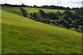
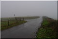
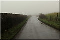
Nearby Images from Geograph Britain and Ireland:

©2019(licence)

©2005(licence)
©2019(licence)
©2019(licence)
©2019(licence)
The above images may not be of the site on this page, they are loaded from Geograph.
Please Submit an Image of this site or go out and take one for us!
Click here to see more info for this site
Nearby sites
Key: Red: member's photo, Blue: 3rd party photo, Yellow: other image, Green: no photo - please go there and take one, Grey: site destroyed
Download sites to:
KML (Google Earth)
GPX (GPS waypoints)
CSV (Garmin/Navman)
CSV (Excel)
To unlock full downloads you need to sign up as a Contributory Member. Otherwise downloads are limited to 50 sites.
Turn off the page maps and other distractions
Nearby sites listing. In the following links * = Image available
656m W 279° Rawlsbury Camp* Hillfort (ST76750580)
3.7km SW 228° Nordon Hill Tumulus* Round Barrow(s) (ST746032)
4.3km SSW 203° Giant's Grave Sarsen Stone* Standing Stone (Menhir) (ST757017)
4.5km SW 236° Nettlecombe Tout* Promontory Fort / Cliff Castle (ST737032)
4.5km NE 50° Ringmoor Settlement* Ancient Village or Settlement (ST809086)
5.6km W 275° Brockhampton Green Standing Stone (Menhir) (ST718062)
6.3km WSW 250° Church Hill Enclosure (Alton Pancras)* Artificial Mound (ST7145403608)
6.4km NNE 14° Banbury Hill Hillfort (ST790119)
7.1km SSW 209° Cheselbourne Round Barrow(s) (SY739995)
8.1km SE 145° Deverel Barrow* Round Barrow(s) (SY820990)
8.5km ESE 115° Combs Ditch Ancient Village or Settlement (ST851021)
8.5km W 281° Dungeon Hill* Hillfort (ST690074)
9.5km ENE 59° Hod Hill* Hillfort (ST856106)
9.7km NE 49° Southern cross-dyke* Misc. Earthwork (ST84791202)
9.8km NE 49° Hambledon Hill long barrow* Long Barrow (ST84891205)
9.8km NE 48° Hambledon Hill enclosure* Causewayed Enclosure (ST848122)
9.8km NW 310° Holy Well (Holwell)* Holy Well or Sacred Spring (ST699121)
9.9km NE 54° Stepleton Enclosure Causewayed Enclosure (ST8540311526)
9.9km NE 45° Hambledon Hill long barrow Long Barrow (ST84511265)
10.0km NE 45° Hambledon Hill hillfort* Hillfort (ST84511270)
10.0km NE 44° Hambledon Hillfort Spur Enclosure Misc. Earthwork (ST84351290)
10.1km SSE 161° Weatherby Castle* Hillfort (SY807962)
10.1km SE 146° Milborne St Andrew 2 Round Barrow(s) (SY830973)
10.2km NE 48° Eastern Cross Dyke Misc. Earthwork (ST85051242)
10.3km NE 41° Hambledon Farm Stone Circle* Modern Stone Circle etc (ST8420413467)
View more nearby sites and additional images


 We would like to know more about this location. Please feel free to add a brief description and any relevant information in your own language.
 Wir möchten mehr über diese Stätte erfahren. Bitte zögern Sie nicht, eine kurze Beschreibung und relevante Informationen in Deutsch hinzuzufügen.
 Nous aimerions en savoir encore un peu sur les lieux. S'il vous plaît n'hesitez pas à ajouter une courte description et tous les renseignements pertinents dans votre propre langue.
 Quisieramos informarnos un poco más de las lugares. No dude en añadir una breve descripción y otros datos relevantes en su propio idioma.