

<< Text Pages >> Badger Wells Cairn - Cairn in England in Lancashire
Submitted by Anne T on Thursday, 20 April 2017 Page Views: 1185
Neolithic and Bronze AgeSite Name: Badger Wells CairnCountry: England County: Lancashire Type: Cairn
Nearest Town: Clitheroe Nearest Village: Sabden
Map Ref: SD783396
Latitude: 53.852174N Longitude: 2.331354W
Condition:
| 5 | Perfect |
| 4 | Almost Perfect |
| 3 | Reasonable but with some damage |
| 2 | Ruined but still recognisable as an ancient site |
| 1 | Pretty much destroyed, possibly visible as crop marks |
| 0 | No data. |
| -1 | Completely destroyed |
| 5 | Superb |
| 4 | Good |
| 3 | Ordinary |
| 2 | Not Good |
| 1 | Awful |
| 0 | No data. |
| 5 | Can be driven to, probably with disabled access |
| 4 | Short walk on a footpath |
| 3 | Requiring a bit more of a walk |
| 2 | A long walk |
| 1 | In the middle of nowhere, a nightmare to find |
| 0 | No data. |
| 5 | co-ordinates taken by GPS or official recorded co-ordinates |
| 4 | co-ordinates scaled from a detailed map |
| 3 | co-ordinates scaled from a bad map |
| 2 | co-ordinates of the nearest village |
| 1 | co-ordinates of the nearest town |
| 0 | no data |
Be the first person to rate this site - see the 'Contribute!' box in the right hand menu.
Internal Links:
External Links:
Cairn in Lancashire
Situated on Pendle Hill, not far from the Devil's Apronful and Apronful of Stones cairns, just south of Howcroft Brook, this site is described on The Northern Antiquarian (TNA) page for Badger Wells Cairn, Pendle Hill, Lancashire.
This web page gives directions for finding this cairn, together with the archaeology and history of the immediate area. TNA discovered this huge cairn in 2006, and have found it is not mentioned in any archaeological texts. There is no entry on Pastscape for it.
Note: Have you visited this site? Do you have any photographs or further information you can add?
You may be viewing yesterday's version of this page. To see the most up to date information please register for a free account.
Do not use the above information on other web sites or publications without permission of the contributor.
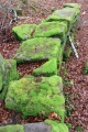
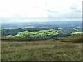
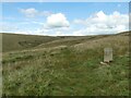
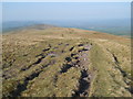
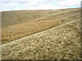
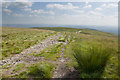
Nearby Images from Geograph Britain and Ireland:
©2022(licence)
©2022(licence)
©2011(licence)
©2006(licence)
©2014(licence)
The above images may not be of the site on this page, they are loaded from Geograph.
Please Submit an Image of this site or go out and take one for us!
Click here to see more info for this site
Nearby sites
Key: Red: member's photo, Blue: 3rd party photo, Yellow: other image, Green: no photo - please go there and take one, Grey: site destroyed
Download sites to:
KML (Google Earth)
GPX (GPS waypoints)
CSV (Garmin/Navman)
CSV (Excel)
To unlock full downloads you need to sign up as a Contributory Member. Otherwise downloads are limited to 50 sites.
Turn off the page maps and other distractions
Nearby sites listing. In the following links * = Image available
499m SW 233° Devil's Apronful (Pendle Hill) Cairn (SD779393)
780m SW 219° Lower Apronful of Stones (Pendle Hill) Cairn (SD778390)
1.5km SW 220° Solar Wheel Year Stone (Sabden) Rock Art (SD77323846)
1.7km SW 221° Coffin Stone (Sabden) Standing Stone (Menhir) (SD77173830)
1.9km NNE 18° Pendle Hill* Round Barrow(s) (SD789414)
2.9km SW 232° Jeppe Knave's Grave* Cairn (SD75993782)
3.6km S 191° Simon's Cross (Padiham)* Ancient Cross (SD77603609)
3.6km N 354° Worsaw Hill Burial Mound* Round Barrow(s) (SD77934323)
3.9km NE 35° Pendle Hill Ringwork and Barrow Hillfort (SD806428)
4.0km ESE 103° Newchurch-in-Pendle* Stone Circle (SD822387)
4.1km E 92° Jinny Well* Holy Well or Sacred Spring (SD8238039461)
4.1km ESE 106° St Chad's Well, Tinedale Farm, Spen Brook.* Holy Well or Sacred Spring (SD82253845)
4.3km WSW 238° Wisa's Well (Wiswell)* Holy Well or Sacred Spring (SD746373)
4.7km N 359° Great Stone (Downham)* Standing Stone (Menhir) (SD782443)
5.3km WSW 241° High Wall Well (Bramley Meade)* Holy Well or Sacred Spring (SD73663702)
5.5km SW 222° Portfield* Hillfort (SD7458135499)
5.5km WNW 303° Peg o'Nell's Well* Holy Well or Sacred Spring (SD73684266)
6.1km SW 235° Whalley Crosses* Ancient Cross (SD73263616)
6.1km SW 235° St Mary and All Saints Church (Whalley)* Sculptured Stone (SD733361)
6.7km W 264° The Great Mitton Cross* Ancient Cross (SD7156438954)
6.8km ENE 72° Aedmer's Mound (Admergill)* Artificial Mound (SD8482941718)
6.9km NW 306° Pinder Hill (Waddington) Cairn (SD72724370)
7.1km W 270° Mitton Green Cross (Great Mitton) Ancient Cross (SD7121739613)
7.4km ENE 72° Blacko Cross (Blacko Hill) Ancient Cross (SD85414187)
7.5km ENE 78° Cock Hill Standing Stone* Standing Stone (Menhir) (SD85624110)
View more nearby sites and additional images


 We would like to know more about this location. Please feel free to add a brief description and any relevant information in your own language.
 Wir möchten mehr über diese Stätte erfahren. Bitte zögern Sie nicht, eine kurze Beschreibung und relevante Informationen in Deutsch hinzuzufügen.
 Nous aimerions en savoir encore un peu sur les lieux. S'il vous plaît n'hesitez pas à ajouter une courte description et tous les renseignements pertinents dans votre propre langue.
 Quisieramos informarnos un poco más de las lugares. No dude en añadir una breve descripción y otros datos relevantes en su propio idioma.