<< Text Pages >> High Shaw Farm (Staward) - Rock Art in England in Northumberland
Submitted by Anne T on Saturday, 31 March 2018 Page Views: 926
Rock ArtSite Name: High Shaw Farm (Staward) Alternative Name: ERA-751; Beckensall 796; SMR/HER N7314Country: England
NOTE: This site is 0.982 km away from the location you searched for.
County: Northumberland Type: Rock Art
Nearest Town: Haydon Bridge Nearest Village: Langley
Map Ref: NY8098959165
Latitude: 54.926804N Longitude: 2.298175W
Condition:
| 5 | Perfect |
| 4 | Almost Perfect |
| 3 | Reasonable but with some damage |
| 2 | Ruined but still recognisable as an ancient site |
| 1 | Pretty much destroyed, possibly visible as crop marks |
| 0 | No data. |
| -1 | Completely destroyed |
| 5 | Superb |
| 4 | Good |
| 3 | Ordinary |
| 2 | Not Good |
| 1 | Awful |
| 0 | No data. |
| 5 | Can be driven to, probably with disabled access |
| 4 | Short walk on a footpath |
| 3 | Requiring a bit more of a walk |
| 2 | A long walk |
| 1 | In the middle of nowhere, a nightmare to find |
| 0 | No data. |
| 5 | co-ordinates taken by GPS or official recorded co-ordinates |
| 4 | co-ordinates scaled from a detailed map |
| 3 | co-ordinates scaled from a bad map |
| 2 | co-ordinates of the nearest village |
| 1 | co-ordinates of the nearest town |
| 0 | no data |
Be the first person to rate this site - see the 'Contribute!' box in the right hand menu.
Internal Links:
External Links:
Rock Art in Northumberland
This rock art panel is located on a vertical gatepost, on its western side. NADRAP records it as having 15 cups, one of which is a large oval and two of which have been truncated by quarrying/dressing. Two short grooves can also be seen. Beckensall adds that this is a rare example in this part of the Shire; the source may be the quarry 200m to the south.
For more information see England's Rock Art entry for ERA-751 High Shaw Farm, which includes both NADRAP's and Beckensall's Archive notes, photographs, a sketch of the rock and its motifs, plus photogrammetry, a VRML model and media from the Beckensall Archive.
The original Beckensall record can be found at Internet Archive: Beckensall 796 High Shaw Farm, Staward.
Please note this rock art panel is located on private land.
Note: Have you seen this rock art panel? Do you have any photographs or information to add?
You may be viewing yesterday's version of this page. To see the most up to date information please register for a free account.
Do not use the above information on other web sites or publications without permission of the contributor.
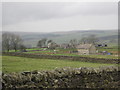
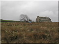
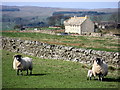
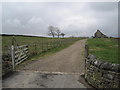
Nearby Images from Geograph Britain and Ireland:
©2011(licence)
©2011(licence)
©2007(licence)

©2007(licence)
©2011(licence)
The above images may not be of the site on this page, they are loaded from Geograph.
Please Submit an Image of this site or go out and take one for us!
Click here to see more info for this site
Nearby sites
Key: Red: member's photo, Blue: 3rd party photo, Yellow: other image, Green: no photo - please go there and take one, Grey: site destroyed
Download sites to:
KML (Google Earth)
GPX (GPS waypoints)
CSV (Garmin/Navman)
CSV (Excel)
To unlock full downloads you need to sign up as a Contributory Member. Otherwise downloads are limited to 50 sites.
Turn off the page maps and other distractions
Nearby sites listing. In the following links * = Image available
3.3km SE 141° Tommy Stout's Well (Thornley Gate)* Holy Well or Sacred Spring (NY83065661)
3.8km WNW 298° East Steel Farm* Modern Stone Circle etc (NY776610)
4.7km E 95° Bulman's Rigg (Allendale) Rock Art (NY8569958770)
5.0km NNW 346° Allen Banks Rock Art (NY7980064010)
5.2km NNW 336° St Cuthbert's Church, Beltingham* Early Christian Sculptured Stone (NY789639)
6.0km E 93° Stobs Cross (Tynedale) Rock Art (NY8697458832)
6.5km N 11° Tony's Patch 1* Rock Art (NY8228165572)
7.5km NNE 14° Joicey Shaft Cairn* Round Barrow(s) (NY8286966437)
7.5km NNE 14° Joicey Shaft b* Rock Art (NY8287266469)
7.6km ESE 112° Crawberry Hill* Stone Circle (NY880563)
7.6km ENE 70° The Hanging Stone (Haydon)* Standing Stone (Menhir) (NY8810161779)
7.6km NNE 14° Joicey Shaft a* Rock Art (NY8291066485)
7.8km ESE 115° Burntridge Moor Rock Art (NY8811155864)
7.9km NNW 337° Long Stone (Barcombe Hill)* Ancient Cross (NY77896646)
8.1km NNW 340° Barcombe Hill Settlement* Ancient Village or Settlement (NY78306682)
8.2km E 85° Jingling Gate* Ancient Village or Settlement (NY89145984)
8.2km NNW 331° Vindolanda Roman Fort* Stone Fort or Dun (NY7705266352)
8.8km SSW 203° Park House (West Allen)* Marker Stone (NY7749151027)
8.9km NW 323° Smith's Shield Milestone* Marker Stone (NY7561766242)
9.1km N 350° Housesteads Mound* Misc. Earthwork (NY79386815)
9.3km N 350° Housesteads Tumulus* Artificial Mound (NY7938268330)
9.5km S 189° Limestone Brae (West Allen)* Ancient Cross (NY79534973)
9.6km NNW 335° Hadrian's Wall* Misc. Earthwork (NY770679)
9.6km NW 323° The Sill* Museum (NY7527566896)
9.8km NNW 348° Housesteads Roman Fort* Stone Fort or Dun (NY78986880)
View more nearby sites and additional images


 We would like to know more about this location. Please feel free to add a brief description and any relevant information in your own language.
 Wir möchten mehr über diese Stätte erfahren. Bitte zögern Sie nicht, eine kurze Beschreibung und relevante Informationen in Deutsch hinzuzufügen.
 Nous aimerions en savoir encore un peu sur les lieux. S'il vous plaît n'hesitez pas à ajouter une courte description et tous les renseignements pertinents dans votre propre langue.
 Quisieramos informarnos un poco más de las lugares. No dude en añadir una breve descripción y otros datos relevantes en su propio idioma.