


<< Our Photo Pages >> Swynnerton bowl barrow - Barrow Cemetery in England in Staffordshire
Submitted by Andrewnturner on Tuesday, 20 December 2022 Page Views: 662
Neolithic and Bronze AgeSite Name: Swynnerton bowl barrowCountry: England
NOTE: This site is 3.335 km away from the location you searched for.
County: Staffordshire Type: Barrow Cemetery
Nearest Town: Stone Nearest Village: Swynnerton
Map Ref: SJ8474635109
Latitude: 52.913186N Longitude: 2.228281W
Condition:
| 5 | Perfect |
| 4 | Almost Perfect |
| 3 | Reasonable but with some damage |
| 2 | Ruined but still recognisable as an ancient site |
| 1 | Pretty much destroyed, possibly visible as crop marks |
| 0 | No data. |
| -1 | Completely destroyed |
| 5 | Superb |
| 4 | Good |
| 3 | Ordinary |
| 2 | Not Good |
| 1 | Awful |
| 0 | No data. |
| 5 | Can be driven to, probably with disabled access |
| 4 | Short walk on a footpath |
| 3 | Requiring a bit more of a walk |
| 2 | A long walk |
| 1 | In the middle of nowhere, a nightmare to find |
| 0 | No data. |
| 5 | co-ordinates taken by GPS or official recorded co-ordinates |
| 4 | co-ordinates scaled from a detailed map |
| 3 | co-ordinates scaled from a bad map |
| 2 | co-ordinates of the nearest village |
| 1 | co-ordinates of the nearest town |
| 0 | no data |
Internal Links:
External Links:
I have visited· I would like to visit
Andrewnturner has visited here
")
Listed by Historic England entry 1009314 with the following description-
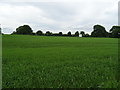
The monument includes a bowl barrow located on a plateau 50m south of Swynnerton cricket ground. It survives as a slightly oval earth and stone mound up to 2.5m high with maximum dimensions of 33m by 32m. The barrow's centre has been partly mutilated by the digging of two small pits up to 0.4m deep. This limited investigation was not recorded. In 1990 an Anglo-Saxon pendant and a copper alloy disc were found on the site.
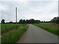
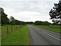
Site is visible from the road, no access to field. It is on the edge of the village, a short walk from the village pub.
https://historicengland.org.uk/listing/the-list/list-entry/1009314?section=official-list-entry
You may be viewing yesterday's version of this page. To see the most up to date information please register for a free account.
Do not use the above information on other web sites or publications without permission of the contributor.
Nearby Images from Geograph Britain and Ireland:
©2019(licence)
©2019(licence)
©2019(licence)
©2019(licence)
©2019(licence)
The above images may not be of the site on this page, they are loaded from Geograph.
Please Submit an Image of this site or go out and take one for us!
Click here to see more info for this site
Nearby sites
Key: Red: member's photo, Blue: 3rd party photo, Yellow: other image, Green: no photo - please go there and take one, Grey: site destroyed
Download sites to:
KML (Google Earth)
GPX (GPS waypoints)
CSV (Garmin/Navman)
CSV (Excel)
To unlock full downloads you need to sign up as a Contributory Member. Otherwise downloads are limited to 50 sites.
Turn off the page maps and other distractions
Nearby sites listing. In the following links * = Image available
3.2km ENE 60° Saxon's Lowe* Round Barrow(s) (SJ8750136662)
3.6km ENE 77° Bury Bank (Staffordshire)* Hillfort (SJ883359)
6.1km NNE 17° St Mary and All Saints (Trentham)* Ancient Cross (SJ8654640940)
6.3km SSW 198° Holy Trinity Church, Eccleshall* Ancient Cross (SJ82752917)
6.7km S 169° All Saints (Chebsey)* Ancient Cross (SJ85982856)
6.7km SW 227° St. Catherine's Well (Sugnall)* Holy Well or Sacred Spring (SJ798306)
7.1km NW 304° Berth Hill* Hillfort (SJ788391)
8.8km E 100° Hollywood enclosure* Misc. Earthwork (SJ9338033501)
10.0km ESE 121° St Rufin's Well Holy Well or Sacred Spring (SJ93372995)
10.1km S 183° St Anne's Well (nr Lawnhead) Holy Well or Sacred Spring (SJ84262498)
10.3km W 261° Bishop's Wood Hillfort (SJ745336)
10.5km NNE 17° Stoke Minster* Ancient Cross (SJ8788745169)
10.9km N 0° Market Cross (Newcastle-under-Lyme) Ancient Cross (SJ8485745979)
12.0km NNE 29° Berryhill Fields* Modern Stone Circle etc (SJ905456)
12.7km NNE 15° Potteries Museum & Art Gallery* Museum (SJ8815147308)
13.4km NNE 16° Hanley Stone Circle* Modern Stone Circle etc (SJ884480)
14.2km W 281° Devil's Ring and Finger* Holed Stone (SJ7072737783)
14.3km W 277° The Blew Stone Standing Stone (Menhir) (SJ705370)
14.5km SSE 164° Berry Ring* Hillfort (SJ887212)
14.6km W 277° The Ineaz Stone Standing Stone (Menhir) (SJ70223706)
14.8km WNW 284° Bradling Stone* Standing Stone (Menhir) (SJ70333864)
14.9km ENE 57° Cat Low* Round Barrow(s) (SJ97344320)
15.6km SE 135° Kings Low Long Barrow (SJ9567023990)
15.6km W 276° Betton Standing Stone (Menhir) (SJ69193691)
16.1km SE 134° Queens Low Long Barrow (SJ9634323909)
View more nearby sites and additional images


 We would like to know more about this location. Please feel free to add a brief description and any relevant information in your own language.
 Wir möchten mehr über diese Stätte erfahren. Bitte zögern Sie nicht, eine kurze Beschreibung und relevante Informationen in Deutsch hinzuzufügen.
 Nous aimerions en savoir encore un peu sur les lieux. S'il vous plaît n'hesitez pas à ajouter une courte description et tous les renseignements pertinents dans votre propre langue.
 Quisieramos informarnos un poco más de las lugares. No dude en añadir una breve descripción y otros datos relevantes en su propio idioma.