<< Text Pages >> Branxton Hill Settlement - Hillfort in England in Northumberland
Submitted by Modern-Neolithic on Sunday, 23 June 2013 Page Views: 2565
Iron Age and Later PrehistorySite Name: Branxton Hill SettlementCountry: England County: Northumberland Type: Hillfort
Nearest Town: Coldstream Nearest Village: Branxton
Map Ref: NT896366
Latitude: 55.622868N Longitude: 2.166705W
Condition:
| 5 | Perfect |
| 4 | Almost Perfect |
| 3 | Reasonable but with some damage |
| 2 | Ruined but still recognisable as an ancient site |
| 1 | Pretty much destroyed, possibly visible as crop marks |
| 0 | No data. |
| -1 | Completely destroyed |
| 5 | Superb |
| 4 | Good |
| 3 | Ordinary |
| 2 | Not Good |
| 1 | Awful |
| 0 | No data. |
| 5 | Can be driven to, probably with disabled access |
| 4 | Short walk on a footpath |
| 3 | Requiring a bit more of a walk |
| 2 | A long walk |
| 1 | In the middle of nowhere, a nightmare to find |
| 0 | No data. |
| 5 | co-ordinates taken by GPS or official recorded co-ordinates |
| 4 | co-ordinates scaled from a detailed map |
| 3 | co-ordinates scaled from a bad map |
| 2 | co-ordinates of the nearest village |
| 1 | co-ordinates of the nearest town |
| 0 | no data |
Internal Links:
External Links:
I have visited· I would like to visit
Modern-Neolithic visited - their rating: Cond: 1 Amb: 4 Access: 4
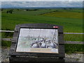
An Iron aged settlement sits close to the modern farm on Branxton Hill. The fort survives as archaeology under the ground and shows up as a crop mark.
Canmore ID: 59421
You may be viewing yesterday's version of this page. To see the most up to date information please register for a free account.
Do not use the above information on other web sites or publications without permission of the contributor.
Nearby Images from Geograph Britain and Ireland:
©2016(licence)
©2013(licence)
©2011(licence)
©2007(licence)
©2012(licence)
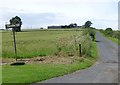
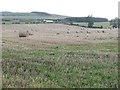
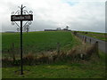
The above images may not be of the site on this page, they are loaded from Geograph.
Please Submit an Image of this site or go out and take one for us!
Click here to see more info for this site
Nearby sites
Key: Red: member's photo, Blue: 3rd party photo, Yellow: other image, Green: no photo - please go there and take one, Grey: site destroyed
Download sites to:
KML (Google Earth)
GPX (GPS waypoints)
CSV (Garmin/Navman)
CSV (Excel)
To unlock full downloads you need to sign up as a Contributory Member. Otherwise downloads are limited to 50 sites.
Turn off the page maps and other distractions
Nearby sites listing. In the following links * = Image available
2.2km NNW 327° The King's Stone* Standing Stone (Menhir) (NT88423845)
3.0km SW 232° Moneylaws Castle Hill Ancient Village or Settlement (NT87213474)
3.1km ESE 118° Flodden Camp Hillfort (NT92373510)
3.6km ESE 108° Milfield North* Henge (NT930355)
4.0km NE 47° Broom Ridge Round Barrow(s) (NT925393)
4.1km ESE 117° Whitton Hill Timber Circle (NT933347)
4.2km NE 44° Etal Fort Hillfort (NT925396)
4.2km ESE 115° Milfield North Timber Circle (NT934348)
4.3km ESE 118° Milfield South Henge (NT934346)
4.3km E 81° Ford Westfield a & b Rock Art (NT9390037300)
4.5km NE 45° St Mary's Well (New Etal)* Holy Well or Sacred Spring (NT92763976)
5.2km ESE 121° Maelmin Anglo-Saxon Royal Settlement. Ancient Village or Settlement (NT941339)
5.3km SE 124° Milfield Reconstructed Henge at Maelmin Heritage Centre* Henge (NT9400033631)
5.7km SE 129° Coupland Henge Henge (NT940330)
6.1km SSW 203° Longknowe (Kilham)* Ancient Village or Settlement (NT8716831040)
6.3km SE 133° East Marleyknowe Henge Henge (NT94233226)
6.4km SE 132° Milfield Cursus Cursus (NT943323)
6.6km SW 224° Pawston Hill Camp Hillfort (NT8505031847)
6.6km SSE 165° St. Gregory's The Great (Kirknewton)* Sculptured Stone (NT9134630251)
6.6km S 190° Staw Hill Hillfort (NT884301)
6.9km SSE 153° Ad Gefrin* Ancient Palace (NT9270630484)
6.9km ENE 79° Blackchesters* Hillfort (NT96383793)
6.9km N 353° Twizel Standing Stone* Standing Stone (Menhir) (NT88804349)
7.0km SSE 152° Old Yeavering Henge* Henge (NT92853043)
7.1km SSE 151° Battle Stone (Kirknewton)* Standing Stone (Menhir) (NT92993038)
View more nearby sites and additional images


 We would like to know more about this location. Please feel free to add a brief description and any relevant information in your own language.
 Wir möchten mehr über diese Stätte erfahren. Bitte zögern Sie nicht, eine kurze Beschreibung und relevante Informationen in Deutsch hinzuzufügen.
 Nous aimerions en savoir encore un peu sur les lieux. S'il vous plaît n'hesitez pas à ajouter une courte description et tous les renseignements pertinents dans votre propre langue.
 Quisieramos informarnos un poco más de las lugares. No dude en añadir una breve descripción y otros datos relevantes en su propio idioma.