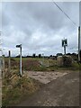
<< Our Photo Pages >> Avenis Barrow - Long Barrow in England in Gloucestershire
Submitted by vicky on Wednesday, 24 November 2004 Page Views: 8186
Neolithic and Bronze AgeSite Name: Avenis Barrow Alternative Name: Bisley-with-Lypiatt ICountry: England
NOTE: This site is 1.271 km away from the location you searched for.
County: Gloucestershire Type: Long Barrow
Map Ref: SO907037 Landranger Map Number: 163
Latitude: 51.731934N Longitude: 2.136062W
Condition:
| 5 | Perfect |
| 4 | Almost Perfect |
| 3 | Reasonable but with some damage |
| 2 | Ruined but still recognisable as an ancient site |
| 1 | Pretty much destroyed, possibly visible as crop marks |
| 0 | No data. |
| -1 | Completely destroyed |
| 5 | Superb |
| 4 | Good |
| 3 | Ordinary |
| 2 | Not Good |
| 1 | Awful |
| 0 | No data. |
| 5 | Can be driven to, probably with disabled access |
| 4 | Short walk on a footpath |
| 3 | Requiring a bit more of a walk |
| 2 | A long walk |
| 1 | In the middle of nowhere, a nightmare to find |
| 0 | No data. |
| 5 | co-ordinates taken by GPS or official recorded co-ordinates |
| 4 | co-ordinates scaled from a detailed map |
| 3 | co-ordinates scaled from a bad map |
| 2 | co-ordinates of the nearest village |
| 1 | co-ordinates of the nearest town |
| 0 | no data |
Internal Links:
External Links:
I have visited· I would like to visit
4clydesdale7 visited on 2nd Oct 2011 - their rating: Cond: 2 Amb: 3 Access: 4 Found it at last - tucked in the NW corner and against the hedge/wall on S side of sunken road W-E
hamish have visited here
")
Human remains were found here during the 19th Century.
Have you visited this site? Please add a comment below.
You may be viewing yesterday's version of this page. To see the most up to date information please register for a free account.
")
")
")
Do not use the above information on other web sites or publications without permission of the contributor.
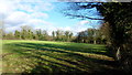
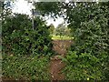
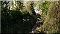
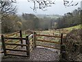
Nearby Images from Geograph Britain and Ireland:
©2016(licence)
©2021(licence)
©2016(licence)
©2024(licence)
©2024(licence)
The above images may not be of the site on this page, they are loaded from Geograph.
Please Submit an Image of this site or go out and take one for us!
Click here to see more info for this site
Nearby sites
Key: Red: member's photo, Blue: 3rd party photo, Yellow: other image, Green: no photo - please go there and take one, Grey: site destroyed
Download sites to:
KML (Google Earth)
GPX (GPS waypoints)
CSV (Garmin/Navman)
CSV (Excel)
To unlock full downloads you need to sign up as a Contributory Member. Otherwise downloads are limited to 50 sites.
Turn off the page maps and other distractions
Nearby sites listing. In the following links * = Image available
894m SE 140° Ashmead Well* Holy Well or Sacred Spring (SO91270301)
1.2km NNW 340° Money Tump* Round Barrow(s) (SO90300479)
1.6km NNE 26° Bisley Barrow* Chambered Tomb (SO914051)
1.6km E 89° Litteridge Cross* Ancient Cross (SO92350373)
1.9km E 85° The Golden Coffin (Far Oakridge)* Round Barrow(s) (SO92620388)
2.1km N 352° Seven Wells* Holy Well or Sacred Spring (SO9039005827)
2.5km ENE 63° The Trench* Misc. Earthwork (SO92900482)
2.6km NNE 24° The Giant's Stone (Gloucestershire)* Chambered Cairn (SO918061)
2.7km SW 216° Hyde Tumulus 1* Round Barrow(s) (SO89060149)
2.9km SW 214° Hyde Tumulus 2* Round Barrow(s) (SO89070130)
3.3km NNW 332° Lypiatt Cross* Ancient Cross (SO89150662)
3.3km ENE 61° Westwood (Gloucestershire)* Chambered Tomb (SO936053)
3.6km NE 42° Juniper Hill* Misc. Earthwork (SO93130638)
3.7km N 6° Througham* Chambered Tomb (SO911074)
4.0km SSW 211° Crackstone Long Barrow* Long Barrow (SO88650030)
4.3km SW 226° The Bulwarks - East 1 and 2 - Minchinhampton* Misc. Earthwork (SO87620072)
4.4km SSW 212° Long Stone (Minchinhampton)* Standing Stones (ST88359992)
4.6km SSW 210° Gatcombe Lodge* Long Barrow (ST88399972)
4.7km SW 230° The Cobstone* Holed Stone (SO87050070)
4.7km ESE 108° Cassey Well* Holy Well or Sacred Spring (SO952022)
4.8km SW 221° Bubblewell* Standing Stone (Menhir) (SO875001)
5.1km SW 224° The Lang Stone* Standing Stone (Menhir) (SO87170004)
5.1km WSW 255° The Horestone (Rodborough)* Standing Stone (Menhir) (SO85770241)
5.3km SSW 208° The Tingle Stone* Long Barrow (ST88239899)
5.3km ENE 72° Pinbury Hillfort Hillfort (SO958053)
View more nearby sites and additional images


 We would like to know more about this location. Please feel free to add a brief description and any relevant information in your own language.
 Wir möchten mehr über diese Stätte erfahren. Bitte zögern Sie nicht, eine kurze Beschreibung und relevante Informationen in Deutsch hinzuzufügen.
 Nous aimerions en savoir encore un peu sur les lieux. S'il vous plaît n'hesitez pas à ajouter une courte description et tous les renseignements pertinents dans votre propre langue.
 Quisieramos informarnos un poco más de las lugares. No dude en añadir una breve descripción y otros datos relevantes en su propio idioma.