<< Text Pages >> St Rufin's Well - Holy Well or Sacred Spring in England in Staffordshire
Submitted by TimPrevett on Friday, 13 July 2007 Page Views: 6506
Springs and Holy WellsSite Name: St Rufin's Well Alternative Name: The Druid's Well, Druid WellCountry: England
NOTE: This site is 2.476 km away from the location you searched for.
County: Staffordshire Type: Holy Well or Sacred Spring
Nearest Town: Stone
Map Ref: SJ93372995
Latitude: 52.866988N Longitude: 2.099931W
Condition:
| 5 | Perfect |
| 4 | Almost Perfect |
| 3 | Reasonable but with some damage |
| 2 | Ruined but still recognisable as an ancient site |
| 1 | Pretty much destroyed, possibly visible as crop marks |
| 0 | No data. |
| -1 | Completely destroyed |
| 5 | Superb |
| 4 | Good |
| 3 | Ordinary |
| 2 | Not Good |
| 1 | Awful |
| 0 | No data. |
| 5 | Can be driven to, probably with disabled access |
| 4 | Short walk on a footpath |
| 3 | Requiring a bit more of a walk |
| 2 | A long walk |
| 1 | In the middle of nowhere, a nightmare to find |
| 0 | No data. |
| 5 | co-ordinates taken by GPS or official recorded co-ordinates |
| 4 | co-ordinates scaled from a detailed map |
| 3 | co-ordinates scaled from a bad map |
| 2 | co-ordinates of the nearest village |
| 1 | co-ordinates of the nearest town |
| 0 | no data |
Be the first person to rate this site - see the 'Contribute!' box in the right hand menu.
Internal Links:
External Links:
I have visited· I would like to visit
BrownEdger would like to visit
LordLard visited on 26th Jun 2021 - their rating: Cond: 2 Amb: 4 Access: 3 A lovely place under a tree by a canal, but very overgrown as seen in the photo my neice who went 'Well Hunting' with me.
A short walk down the path from the pretty hamlet and pool of Burston, then over a cowfield
St Rufin's Well, AKA the Druid's Well, SE from Stone.
You may be viewing yesterday's version of this page. To see the most up to date information please register for a free account.
")
Do not use the above information on other web sites or publications without permission of the contributor.
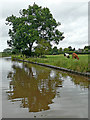
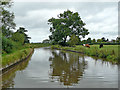
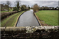
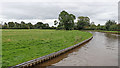
Nearby Images from Geograph Britain and Ireland:
©2020(licence)
©2020(licence)

©2021(licence)
©2021(licence)
©2020(licence)
The above images may not be of the site on this page, they are loaded from Geograph.
Please Submit an Image of this site or go out and take one for us!
Click here to see more info for this site
Nearby sites
Key: Red: member's photo, Blue: 3rd party photo, Yellow: other image, Green: no photo - please go there and take one, Grey: site destroyed
Download sites to:
KML (Google Earth)
GPX (GPS waypoints)
CSV (Garmin/Navman)
CSV (Excel)
To unlock full downloads you need to sign up as a Contributory Member. Otherwise downloads are limited to 50 sites.
Turn off the page maps and other distractions
Nearby sites listing. In the following links * = Image available
3.5km N 0° Hollywood enclosure* Misc. Earthwork (SJ9338033501)
6.4km SSE 159° Kings Low Long Barrow (SJ9567023990)
6.7km SSE 154° Queens Low Long Barrow (SJ9634323909)
7.5km W 259° All Saints (Chebsey)* Ancient Cross (SJ85982856)
7.8km NW 320° Bury Bank (Staffordshire)* Hillfort (SJ883359)
8.9km NW 319° Saxon's Lowe* Round Barrow(s) (SJ8750136662)
9.9km SSW 208° Berry Ring* Hillfort (SJ887212)
10.0km WNW 301° Swynnerton bowl barrow* Barrow Cemetery (SJ8474635109)
10.4km WSW 241° St Anne's Well (nr Lawnhead) Holy Well or Sacred Spring (SJ84262498)
10.6km W 266° Holy Trinity Church, Eccleshall* Ancient Cross (SJ82752917)
12.2km SE 141° Oakedge Stone* Marker Stone (SK0106220493)
12.3km NE 50° St Mary and All Saints (Checkley)* Ancient Cross (SK02783787)
12.9km NNW 328° St Mary and All Saints (Trentham)* Ancient Cross (SJ8654640940)
13.3km SSW 203° Webb Stone* Standing Stone (Menhir) (SJ881177)
13.5km W 273° St. Catherine's Well (Sugnall)* Holy Well or Sacred Spring (SJ798306)
13.8km NNE 17° Cat Low* Round Barrow(s) (SJ97344320)
14.2km SE 137° Bower Farm* Cave or Rock Shelter (SK030195)
14.7km ENE 57° Toot Hill Barrow (1) Round Barrow(s) (SK05773797)
15.9km N 350° Berryhill Fields* Modern Stone Circle etc (SJ905456)
16.2km NNW 340° Stoke Minster* Ancient Cross (SJ8788745169)
16.3km E 80° Maiden's Well* Holy Well or Sacred Spring (SK09493264)
16.4km ENE 75° Pennycroft Well Holy Well or Sacred Spring (SK09293422)
16.6km SW 216° St Edith's Well (Church Eaton)* Holy Well or Sacred Spring (SJ83521653)
16.8km E 83° Toot Hill Barrow (2)* Round Barrow(s) (SK10143184)
17.2km WNW 302° Berth Hill* Hillfort (SJ788391)
View more nearby sites and additional images


 We would like to know more about this location. Please feel free to add a brief description and any relevant information in your own language.
 Wir möchten mehr über diese Stätte erfahren. Bitte zögern Sie nicht, eine kurze Beschreibung und relevante Informationen in Deutsch hinzuzufügen.
 Nous aimerions en savoir encore un peu sur les lieux. S'il vous plaît n'hesitez pas à ajouter une courte description et tous les renseignements pertinents dans votre propre langue.
 Quisieramos informarnos un poco más de las lugares. No dude en añadir una breve descripción y otros datos relevantes en su propio idioma.