<< Our Photo Pages >> Barrow Hill (Worcestershire) - Barrow Cemetery in England in Worcestershire
Submitted by PhilKidderminster on Thursday, 01 March 2012 Page Views: 10301
Neolithic and Bronze AgeSite Name: Barrow Hill (Worcestershire)Country: England County: Worcestershire Type: Barrow Cemetery
Nearest Village: Drayton
Map Ref: SO9088475138
Latitude: 52.374207N Longitude: 2.135329W
Condition:
| 5 | Perfect |
| 4 | Almost Perfect |
| 3 | Reasonable but with some damage |
| 2 | Ruined but still recognisable as an ancient site |
| 1 | Pretty much destroyed, possibly visible as crop marks |
| 0 | No data. |
| -1 | Completely destroyed |
| 5 | Superb |
| 4 | Good |
| 3 | Ordinary |
| 2 | Not Good |
| 1 | Awful |
| 0 | No data. |
| 5 | Can be driven to, probably with disabled access |
| 4 | Short walk on a footpath |
| 3 | Requiring a bit more of a walk |
| 2 | A long walk |
| 1 | In the middle of nowhere, a nightmare to find |
| 0 | No data. |
| 5 | co-ordinates taken by GPS or official recorded co-ordinates |
| 4 | co-ordinates scaled from a detailed map |
| 3 | co-ordinates scaled from a bad map |
| 2 | co-ordinates of the nearest village |
| 1 | co-ordinates of the nearest town |
| 0 | no data |
Internal Links:
External Links:
I have visited· I would like to visit
Warren-ap-EuddavAD322 would like to visit
 (PID:87236)")
This is described as an "ancient Celtic Burial site" in a local walking book. Close to road but on private ground.
It is described in detail in "On Ancient British Roman and Saxon Antquities and Folklore of Worcestershire" by Jabez Allies, published in 1852 (available to download from Google books - well worth a look as it includes lots of other finds from Worcestershire). Allies visited the site in 1840s and the book includes a plan of the hill.
You may be viewing yesterday's version of this page. To see the most up to date information please register for a free account.
Do not use the above information on other web sites or publications without permission of the contributor.
Nearby Images from Geograph Britain and Ireland:
©2019(licence)
©2020(licence)

©2007(licence)

©2019(licence)

©2023(licence)
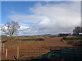
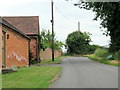
The above images may not be of the site on this page, they are loaded from Geograph.
Please Submit an Image of this site or go out and take one for us!
Click here to see more info for this site
Nearby sites
Key: Red: member's photo, Blue: 3rd party photo, Yellow: other image, Green: no photo - please go there and take one, Grey: site destroyed
Download sites to:
KML (Google Earth)
GPX (GPS waypoints)
CSV (Garmin/Navman)
CSV (Excel)
To unlock full downloads you need to sign up as a Contributory Member. Otherwise downloads are limited to 50 sites.
Turn off the page maps and other distractions
Nearby sites listing. In the following links * = Image available
4.5km NNW 341° Stakenbridge Lane* Round Barrow(s) (SO894794)
5.8km NNE 25° The Four Stones* Modern Stone Circle etc (SO9337180328)
6.6km NNE 32° St Kenelm's Well* Holy Well or Sacred Spring (SO9444280755)
6.8km N 9° Wychbury Camp* Hillfort (SO920818)
8.0km WNW 283° Kidderminster Cross* Ancient Cross (SO8303476939)
10.1km W 267° Devil's Spittleful* Natural Stone / Erratic / Other Natural Feature (SO80727468)
10.4km WNW 303° Drakelow Hillfort Hillfort (SO8219780879)
10.9km NW 317° Kinver* Promontory Fort / Cliff Castle (SO835832)
11.0km NW 320° The Giant's Well (Kinver)* Holy Well or Sacred Spring (SO839836)
11.7km WNW 282° Wassell Wood earthwork* Misc. Earthwork (SO7944277665)
11.9km W 262° Blackstone Iron Age Settlement Ancient Village or Settlement (SO791735)
12.1km NW 316° Boltstone* Standing Stone (Menhir) (SO825839)
14.7km WNW 293° Upper Arley stone* Standing Stone (Menhir) (SO773809)
16.1km ENE 59° Lapworth Museum Museum (SP047834)
16.8km S 182° Tibberton Cursus Cursus (SO90335831)
17.6km WNW 302° Alveley Cross* Ancient Cross (SO7595584525)
17.7km ESE 108° Beoley Hill Fort Hillfort (SP077695)
18.4km S 186° Warndon Cross* Ancient Cross (SO8878256887)
18.8km E 82° Berry Mound* Hillfort (SP095778)
18.9km NW 304° Hampton Loade Cross* Ancient Cross (SO75258574)
19.2km SW 236° Woodbury Hill (Worcestershire)* Hillfort (SO749645)
19.5km NE 50° War Stone* Natural Stone / Erratic / Other Natural Feature (SP058877)
19.6km NE 53° Birmingham Museum & Art Gallery Museum (SP066869)
19.7km ENE 69° Moseley Bog Burnt Mound* Artificial Mound (SP0934382043)
19.9km NE 35° St Augustine's Well (Sandwell)* Holy Well or Sacred Spring (SP0248391296)
View more nearby sites and additional images


 We would like to know more about this location. Please feel free to add a brief description and any relevant information in your own language.
 Wir möchten mehr über diese Stätte erfahren. Bitte zögern Sie nicht, eine kurze Beschreibung und relevante Informationen in Deutsch hinzuzufügen.
 Nous aimerions en savoir encore un peu sur les lieux. S'il vous plaît n'hesitez pas à ajouter une courte description et tous les renseignements pertinents dans votre propre langue.
 Quisieramos informarnos un poco más de las lugares. No dude en añadir una breve descripción y otros datos relevantes en su propio idioma.