 with our Megalithic Portal iPhone app")


<< Our Photo Pages >> St Farmin's Well - Holy Well or Sacred Spring in England in County Durham
Submitted by TimPrevett on Saturday, 07 July 2007 Page Views: 7105
Springs and Holy WellsSite Name: St Farmin's Well Alternative Name: St Fermin's Well, St Firminus' Well (possibly)Country: England County: County Durham Type: Holy Well or Sacred Spring
Nearest Town: Bowes
Map Ref: NY99491325
Latitude: 54.514552N Longitude: 2.009389W
Condition:
| 5 | Perfect |
| 4 | Almost Perfect |
| 3 | Reasonable but with some damage |
| 2 | Ruined but still recognisable as an ancient site |
| 1 | Pretty much destroyed, possibly visible as crop marks |
| 0 | No data. |
| -1 | Completely destroyed |
| 5 | Superb |
| 4 | Good |
| 3 | Ordinary |
| 2 | Not Good |
| 1 | Awful |
| 0 | No data. |
| 5 | Can be driven to, probably with disabled access |
| 4 | Short walk on a footpath |
| 3 | Requiring a bit more of a walk |
| 2 | A long walk |
| 1 | In the middle of nowhere, a nightmare to find |
| 0 | No data. |
| 5 | co-ordinates taken by GPS or official recorded co-ordinates |
| 4 | co-ordinates scaled from a detailed map |
| 3 | co-ordinates scaled from a bad map |
| 2 | co-ordinates of the nearest village |
| 1 | co-ordinates of the nearest town |
| 0 | no data |
Internal Links:
External Links:
")
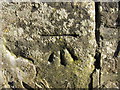
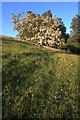
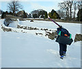
"The old Ordnance Survey maps of Bowes show St. Farmin's Well on the path from Gilmonby Bridge to the old mill, about 20 yards before the gate on the north side of the path. "Nothing much was evident from the few pieces of stonework among the vegetation, but the spring which fed it could be seen running into the river further down the bank side" from www.bowes.org.uk.
See more here
You may be viewing yesterday's version of this page. To see the most up to date information please register for a free account.
")
")
Do not use the above information on other web sites or publications without permission of the contributor.
Nearby Images from Geograph Britain and Ireland:
©2012(licence)
©2009(licence)
©2010(licence)
©2010(licence)
©2010(licence)
The above images may not be of the site on this page, they are loaded from Geograph.
Please Submit an Image of this site or go out and take one for us!
Click here to see more info for this site
Nearby sites
Key: Red: member's photo, Blue: 3rd party photo, Yellow: other image, Green: no photo - please go there and take one, Grey: site destroyed
Download sites to:
KML (Google Earth)
GPX (GPS waypoints)
CSV (Garmin/Navman)
CSV (Excel)
To unlock full downloads you need to sign up as a Contributory Member. Otherwise downloads are limited to 50 sites.
Turn off the page maps and other distractions
Nearby sites listing. In the following links * = Image available
850m W 274° Bowes Barrows* Barrow Cemetery (NY98641331)
2.4km S 172° Scargill Low Moor 1* Rock Art (NY9983610843)
2.4km S 172° Scargill Low Moor 2* Rock Art (NY9984510839)
2.4km SSE 154° Scargill Low Moor 4* Rock Art (NZ0056711054)
2.4km SSE 156° Scargill Low Moor 5* Rock Art (NZ0049011016)
2.5km S 171° Scargill Low Moor 3* Rock Art (NY9988510766)
2.5km N 11° High Crag 2 Rock Art (NY9996715733)
2.5km N 11° High Crag 1 Rock Art (NY9996315736)
2.5km SSE 162° Scargill Low Moor 6* Rock Art (NZ0027310836)
2.9km N 2° Crag Hill (Lartington) Rock Art (NY9957016163)
3.0km NNE 13° Low Crag Farm 1, 2, 3, 4, 5 & 6 Rock Art (NZ0016616146)
3.3km NNE 12° Lartington, The Rigg 15 Rock Art (NZ0016716488)
3.4km NNE 18° Lartington, The Rigg 1.* Rock Art (NZ00511645)
3.4km NNE 22° Lartington, The Rigg 13* Rock Art (NZ0076016376)
3.4km NNE 18° Lartington, The Rigg 4* Rock Art (NZ0055116469)
3.4km NNE 18° Lartington, The Rigg 2* Rock Art (NZ0054916470)
3.4km NNE 18° Lartington, The Rigg 3* Rock Art (NZ0055616471)
3.4km NNE 21° Lartington, The Rigg 6* Rock Art (NZ0070716481)
3.5km NNE 21° Lartington, The Rigg 14* Rock Art (NZ0070716482)
3.5km NNE 21° Lartington, The Rigg 7* Rock Art (NZ0071816482)
3.5km NNE 20° Lartington, The Rigg 5* Rock Art (NZ0070116489)
3.5km NNE 21° Lartington, The Rigg 8* Rock Art (NZ0073016479)
3.5km NNE 22° Lartington, The Rigg 9 Rock Art (NZ0082216495)
3.5km NNE 23° Lartington, The Rigg 16, 17 & 18 Rock Art (NZ0086016500)
3.6km NNE 24° Lartington, The Rigg 12 Rock Art (NZ0092416510)
View more nearby sites and additional images


 We would like to know more about this location. Please feel free to add a brief description and any relevant information in your own language.
 Wir möchten mehr über diese Stätte erfahren. Bitte zögern Sie nicht, eine kurze Beschreibung und relevante Informationen in Deutsch hinzuzufügen.
 Nous aimerions en savoir encore un peu sur les lieux. S'il vous plaît n'hesitez pas à ajouter une courte description et tous les renseignements pertinents dans votre propre langue.
 Quisieramos informarnos un poco más de las lugares. No dude en añadir una breve descripción y otros datos relevantes en su propio idioma.