<< Text Pages >> South Dowdeswell - Hillfort in England in Gloucestershire
Submitted by h_fenton on Thursday, 12 April 2012 Page Views: 3055
Iron Age and Later PrehistorySite Name: South DowdeswellCountry: England County: Gloucestershire Type: Hillfort
Nearest Village: Upper Dowdeswell
Map Ref: SP0040018600
Latitude: 51.865979N Longitude: 1.995596W
Condition:
| 5 | Perfect |
| 4 | Almost Perfect |
| 3 | Reasonable but with some damage |
| 2 | Ruined but still recognisable as an ancient site |
| 1 | Pretty much destroyed, possibly visible as crop marks |
| 0 | No data. |
| -1 | Completely destroyed |
| 5 | Superb |
| 4 | Good |
| 3 | Ordinary |
| 2 | Not Good |
| 1 | Awful |
| 0 | No data. |
| 5 | Can be driven to, probably with disabled access |
| 4 | Short walk on a footpath |
| 3 | Requiring a bit more of a walk |
| 2 | A long walk |
| 1 | In the middle of nowhere, a nightmare to find |
| 0 | No data. |
| 5 | co-ordinates taken by GPS or official recorded co-ordinates |
| 4 | co-ordinates scaled from a detailed map |
| 3 | co-ordinates scaled from a bad map |
| 2 | co-ordinates of the nearest village |
| 1 | co-ordinates of the nearest town |
| 0 | no data |
Internal Links:
External Links:
South Dowdeswell hillfort was visible as an earthwork on aerial photographs taken in the 1940-1950's. From the late 1950's the area began to be quarried for stone, aerial photographs taken in 1970 showed that the hillfort had been almost completely destroyed.
Two slight banks with ditches remain in the plantation at the east of the site between around Grid References SP 00596 18579 and SP 00530 18518.
There is no public access to the plantation and the trees/undergrowth are quite thick in places. Kilkenny Viewpoint and Picnic Area covers most of the former quarries and where the hillfort used to be. The quarries have been recolonised by a herb rich grassland and supports many rare plants, butterflies and other insects.
The lower part of the quarry is sometimes used by off road motorcycles, not sure whether this is done legally but probably best not to venture into the area of the motorcycle tracks if there are any motorcycles around.
further information can be found on Pastscape: www.pastscape.org.uk/hob.aspx?hob_id=327538
English Heritage's Cotswold Hills National Mapping Programme Report contains a map on Page 41 (page 51 of the PDF document) showing where the earthworks were: An Archaeological Aerial Survey in the Cotswold Hills - A Report for the National Mapping Programme ( 6MB PDF document )
You may be viewing yesterday's version of this page. To see the most up to date information please register for a free account.
Do not use the above information on other web sites or publications without permission of the contributor.
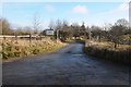
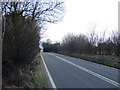
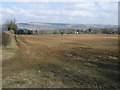
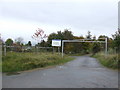
Nearby Images from Geograph Britain and Ireland:
©2013(licence)
©2013(licence)
©2013(licence)
©2009(licence)
©2005(licence)
The above images may not be of the site on this page, they are loaded from Geograph.
Please Submit an Image of this site or go out and take one for us!
Click here to see more info for this site
Nearby sites
Key: Red: member's photo, Blue: 3rd party photo, Yellow: other image, Green: no photo - please go there and take one, Grey: site destroyed
Download sites to:
KML (Google Earth)
GPX (GPS waypoints)
CSV (Garmin/Navman)
CSV (Excel)
To unlock full downloads you need to sign up as a Contributory Member. Otherwise downloads are limited to 50 sites.
Turn off the page maps and other distractions
Nearby sites listing. In the following links * = Image available
742m NW 312° North Dowdeswell* Hillfort (SO99851910)
1.2km W 268° Lineover* Chambered Tomb (SO99231856)
4.0km SSW 202° Norbury Hillfort (Colesbourne)* Hillfort (SO989149)
4.1km WSW 246° Seven Springs (Gloucestershire)* Holy Well or Sacred Spring (SO96631694)
4.7km SSE 153° Withington Woods Cross Dyke* Misc. Earthwork (SP025144)
5.1km NNW 337° Prestbury (Glos) Chambered Tomb (SO984233)
5.2km SSE 149° Withington Woods Chambered Tomb (SP031142)
5.3km ESE 122° Sales Lot Chambered Cairn (SP04871578)
5.5km W 268° Leckhampton Hill Barrow* Round Barrow(s) (SO94911838)
5.6km W 268° Leckhampton Hill* Hillfort (SO948184)
5.7km WSW 239° Coberley* Chambered Tomb (SO95521564)
6.0km SSE 165° Monument Number 327710* Artificial Mound (SP0193712749)
6.4km E 82° Penhill Farm Bowl Barrow* Round Barrow(s) (SP06761954)
6.6km SW 216° High Cross Stone (Elkstone)* Standing Stone (Menhir) (SO9653213246)
6.6km SE 135° Round barrow N of Chedworth Roman villa* Round Barrow(s) (SP0511013931)
6.8km E 88° Hazleton South* Chambered Tomb (SP072188)
6.8km NW 306° Cheltenham Centre Stone* Marker Stone (SO9488422583)
6.9km E 88° Hazleton North* Chambered Tomb (SP073189)
6.9km NW 304° Cheltenham Museum* Museum (SO947225)
7.0km NW 310° The Wish Stone* Marker Stone (SO950231)
7.0km WSW 258° Dry Heathfield Barrow Round Barrow(s) (SO93521711)
7.0km SE 137° Chedworth Villa Nymphaeum* Holy Well or Sacred Spring (SP05241350)
7.1km NNE 14° Belas Knap* Long Barrow (SP02092545)
7.1km W 260° Crippet's Barrow* Chambered Tomb (SO93421739)
7.1km NNW 344° Cleeve Hill (Gloucestershire)* Hillfort (SO98492546)
View more nearby sites and additional images


 We would like to know more about this location. Please feel free to add a brief description and any relevant information in your own language.
 Wir möchten mehr über diese Stätte erfahren. Bitte zögern Sie nicht, eine kurze Beschreibung und relevante Informationen in Deutsch hinzuzufügen.
 Nous aimerions en savoir encore un peu sur les lieux. S'il vous plaît n'hesitez pas à ajouter une courte description et tous les renseignements pertinents dans votre propre langue.
 Quisieramos informarnos un poco más de las lugares. No dude en añadir una breve descripción y otros datos relevantes en su propio idioma.