<< Other Photo Pages >> Obsidian Cliff - Ancient Mine, Quarry or other Industry in United States in The Northwest Mountains
Submitted by bat400 on Thursday, 08 April 2010 Page Views: 12737
Multi-periodSite Name: Obsidian CliffCountry: United States
NOTE: This site is 28.272 km away from the location you searched for.
Region: The Northwest Mountains Type: Ancient Mine, Quarry or other Industry
Nearest Town: Bozeman, MT Nearest Village: Mamoth Hot Springs
Latitude: 44.822200N Longitude: 110.7279W
Condition:
| 5 | Perfect |
| 4 | Almost Perfect |
| 3 | Reasonable but with some damage |
| 2 | Ruined but still recognisable as an ancient site |
| 1 | Pretty much destroyed, possibly visible as crop marks |
| 0 | No data. |
| -1 | Completely destroyed |
| 5 | Superb |
| 4 | Good |
| 3 | Ordinary |
| 2 | Not Good |
| 1 | Awful |
| 0 | No data. |
| 5 | Can be driven to, probably with disabled access |
| 4 | Short walk on a footpath |
| 3 | Requiring a bit more of a walk |
| 2 | A long walk |
| 1 | In the middle of nowhere, a nightmare to find |
| 0 | No data. |
| 5 | co-ordinates taken by GPS or official recorded co-ordinates |
| 4 | co-ordinates scaled from a detailed map |
| 3 | co-ordinates scaled from a bad map |
| 2 | co-ordinates of the nearest village |
| 1 | co-ordinates of the nearest town |
| 0 | no data |
Internal Links:
External Links:
")
Yellowstone obsidian appears to have been traded along numerous routes to what is now the United States Pacific Northwest, throughout the northern Rocky Mountains, and most far flung - along the Missouri watershed in the Great Plains and into the Great Lakes area. Most spectacularly, Yellowstone obsidian was used to make unique Hopewell culture spear points found in Ohio.
Obsidian Cliff may be viewed easily from a nearby road (open in summer months). But remember, like all mineral finds within the National Park, collecting is now allowed only as part of permit approved research, and rangers are well aware of the allure of this ancient resource.
Note: For over 10,000 year visitors to Yellowstone have been impressed.
You may be viewing yesterday's version of this page. To see the most up to date information please register for a free account.
")
")
")
")
Do not use the above information on other web sites or publications without permission of the contributor.
Nearby Images from Flickr
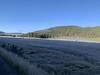
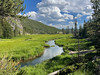
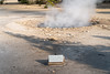


The above images may not be of the site on this page, but were taken nearby. They are loaded from Flickr so please click on them for image credits.
Click here to see more info for this site
Nearby sites
Click here to view sites on an interactive map of the areaKey: Red: member's photo, Blue: 3rd party photo, Yellow: other image, Green: no photo - please go there and take one, Grey: site destroyed
Download sites to:
KML (Google Earth)
GPX (GPS waypoints)
CSV (Garmin/Navman)
CSV (Excel)
To unlock full downloads you need to sign up as a Contributory Member. Otherwise downloads are limited to 50 sites.
Turn off the page maps and other distractions
Nearby sites listing. In the following links * = Image available
50.7km SE 145° Yellowstone Lake* Ancient Village or Settlement
88.2km ESE 117° Mummy Cave* Cave or Rock Shelter
153.7km ENE 67° Valley of the Shields* Rock Art
176.2km E 83° Petroglyph Canyon (Cowley)* Rock Art
178.0km SSE 150° High Rise Village Ancient Village or Settlement
204.1km ESE 123° Legend Rock* Rock Art
206.5km ENE 60° Pictograph Caves* Rock Art
213.3km NNW 334° Megaliths Of Helena* Natural Stone / Erratic / Other Natural Feature
221.3km E 89° Bighorn Medicine Wheel* Stone Circle
251.1km E 91° Falling Block* Natural Stone / Erratic / Other Natural Feature
259.1km ESE 102° Medicine Lodge State Archeological Site* Rock Art
301.7km NNW 349° First Peoples Buffalo Jump* Natural Stone / Erratic / Other Natural Feature
326.5km SE 129° Castle Gardens* Rock Art
342.6km WSW 239° Shoshone Ice Caves* Cave or Rock Shelter
347.0km SSE 159° White Mountain Wyoming* Rock Art
353.5km WSW 238° Idaho's Mammoth Cave* Cave or Rock Shelter
359.9km SW 232° Wilson Butte Cave Cave or Rock Shelter
413.4km SSW 201° Great Salt Lake Cave* Cave or Rock Shelter
443.0km ESE 118° Glenrock Buffalo Jump* Natural Stone / Erratic / Other Natural Feature
458.9km WNW 287° Cooper's Ferry Archaeological Site* Ancient Village or Settlement
468.4km W 279° Snake River Archaeological Site* Rock Art
477.0km E 91° Devil's Tower National Monument* Natural Stone / Erratic / Other Natural Feature
478.4km N 352° Writing-on-Stone Provincial Park* Rock Art
481.3km E 94° Arch Creek Petroglyphs* Rock Art
482.9km W 274° Hells Canyon Archeological District* Rock Art
View more nearby sites and additional images


 We would like to know more about this location. Please feel free to add a brief description and any relevant information in your own language.
 Wir möchten mehr über diese Stätte erfahren. Bitte zögern Sie nicht, eine kurze Beschreibung und relevante Informationen in Deutsch hinzuzufügen.
 Nous aimerions en savoir encore un peu sur les lieux. S'il vous plaît n'hesitez pas à ajouter une courte description et tous les renseignements pertinents dans votre propre langue.
 Quisieramos informarnos un poco más de las lugares. No dude en añadir una breve descripción y otros datos relevantes en su propio idioma.