<< Text Pages >> Cueva del Maguey - Ancient Village or Settlement in Mexico in Mexico Other
Submitted by davidmorgan on Wednesday, 05 October 2011 Page Views: 3915
Multi-periodSite Name: Cueva del MagueyCountry: Mexico
NOTE: This site is 248.588 km away from the location you searched for.
Region: Mexico Other Type: Ancient Village or Settlement
Nearest Town: El Salto
Latitude: 23.786601N Longitude: 105.370102W
Condition:
| 5 | Perfect |
| 4 | Almost Perfect |
| 3 | Reasonable but with some damage |
| 2 | Ruined but still recognisable as an ancient site |
| 1 | Pretty much destroyed, possibly visible as crop marks |
| 0 | No data. |
| -1 | Completely destroyed |
| 5 | Superb |
| 4 | Good |
| 3 | Ordinary |
| 2 | Not Good |
| 1 | Awful |
| 0 | No data. |
| 5 | Can be driven to, probably with disabled access |
| 4 | Short walk on a footpath |
| 3 | Requiring a bit more of a walk |
| 2 | A long walk |
| 1 | In the middle of nowhere, a nightmare to find |
| 0 | No data. |
| 5 | co-ordinates taken by GPS or official recorded co-ordinates |
| 4 | co-ordinates scaled from a detailed map |
| 3 | co-ordinates scaled from a bad map |
| 2 | co-ordinates of the nearest village |
| 1 | co-ordinates of the nearest town |
| 0 | no data |
Be the first person to rate this site - see the 'Contribute!' box in the right hand menu.
Internal Links:
External Links:
Ancient Village or Settlement in Durango, Mexico.
A cave hamlet built into a cliff dating back to around 1425 CE which was formerly home tο the Xiximes tribe.
You may be viewing yesterday's version of this page. To see the most up to date information please register for a free account.
Do not use the above information on other web sites or publications without permission of the contributor.
Nearby Images from Flickr
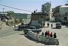
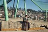
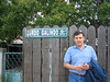
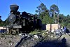
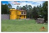
The above images may not be of the site on this page, but were taken nearby. They are loaded from Flickr so please click on them for image credits.
Click here to see more info for this site
Nearby sites
Click here to view sites on an interactive map of the areaKey: Red: member's photo, Blue: 3rd party photo, Yellow: other image, Green: no photo - please go there and take one, Grey: site destroyed
Download sites to:
KML (Google Earth)
GPX (GPS waypoints)
CSV (Garmin/Navman)
CSV (Excel)
To unlock full downloads you need to sign up as a Contributory Member. Otherwise downloads are limited to 50 sites.
Turn off the page maps and other distractions
Nearby sites listing. In the following links * = Image available
143.5km W 263° Las Labradas* Rock Art
234.8km SSE 168° Cantil de las animas Rock Art
299.7km ESE 119° La Quemada* Ancient Village or Settlement
308.7km E 100° La Florida (Zacatecas) Shaft Tomb* Chambered Tomb
325.1km SE 143° El Teul Archaeological Zone Ancient Village or Settlement
334.3km S 183° Careyeros Hill Ancient Village or Settlement
378.2km SSE 155° Los Guachimontones* Ancient Temple
486.4km NE 42° Cuatro Cienegas Footprints Ancient Trackway
506.8km W 276° Conchalito* Ancient Village or Settlement
533.5km SSE 161° Colima - Eastern Shaft Tomb* Barrow Cemetery
538.8km ENE 61° Boca de Potrerillos Rock Art
561.0km SE 125° Cañada de la Virgen Ancient Village or Settlement
578.6km SE 146° Purepecha Digs Ancient Village or Settlement
595.8km SE 134° Huandacareo Ancient Village or Settlement
599.5km SE 142° Tingambato* Ancient Village or Settlement
606.6km SE 138° Purépecha Proto Urban Site Ancient Village or Settlement
606.6km SE 139° Tzintzuntzan* Ancient Village or Settlement
607.4km SE 140° Ihuatzio* Ancient Village or Settlement
615.2km SE 139° Sacapu Angamuco Ancient Village or Settlement
619.9km SE 143° Tipitarillo Yacata Pyramid / Mastaba
621.8km SE 124° El Cerrito Pyramid / Mastaba
630.9km E 91° Balcon de Montezuma Ancient Village or Settlement
689.3km NNE 16° Bee Cave Canyon* Cave or Rock Shelter
698.4km NNW 337° Madera Caves Cave or Rock Shelter
698.4km NNW 337° Valley of the Caves, Chihuahua* Cave or Rock Shelter
View more nearby sites and additional images


 We would like to know more about this location. Please feel free to add a brief description and any relevant information in your own language.
 Wir möchten mehr über diese Stätte erfahren. Bitte zögern Sie nicht, eine kurze Beschreibung und relevante Informationen in Deutsch hinzuzufügen.
 Nous aimerions en savoir encore un peu sur les lieux. S'il vous plaît n'hesitez pas à ajouter une courte description et tous les renseignements pertinents dans votre propre langue.
 Quisieramos informarnos un poco más de las lugares. No dude en añadir una breve descripción y otros datos relevantes en su propio idioma.