<< Text Pages >> Macclesfield Forest - Ancient Cross in England in Cheshire
Submitted by TimPrevett on Saturday, 26 May 2007 Page Views: 8924
Early Medieval (Dark Age)Site Name: Macclesfield ForestCountry: England
NOTE: This site is 2.475 km away from the location you searched for.
County: Cheshire Type: Ancient Cross
Nearest Town: Macclesfield
Map Ref: SJ97767136
Latitude: 53.239263N Longitude: 2.035021W
Condition:
| 5 | Perfect |
| 4 | Almost Perfect |
| 3 | Reasonable but with some damage |
| 2 | Ruined but still recognisable as an ancient site |
| 1 | Pretty much destroyed, possibly visible as crop marks |
| 0 | No data. |
| -1 | Completely destroyed |
| 5 | Superb |
| 4 | Good |
| 3 | Ordinary |
| 2 | Not Good |
| 1 | Awful |
| 0 | No data. |
| 5 | Can be driven to, probably with disabled access |
| 4 | Short walk on a footpath |
| 3 | Requiring a bit more of a walk |
| 2 | A long walk |
| 1 | In the middle of nowhere, a nightmare to find |
| 0 | No data. |
| 5 | co-ordinates taken by GPS or official recorded co-ordinates |
| 4 | co-ordinates scaled from a detailed map |
| 3 | co-ordinates scaled from a bad map |
| 2 | co-ordinates of the nearest village |
| 1 | co-ordinates of the nearest town |
| 0 | no data |
Be the first person to rate this site - see the 'Contribute!' box in the right hand menu.
Internal Links:
External Links:
I have visited· I would like to visit
Couplands would like to visit
gritstone visited on 1st Jun 2020 To my knowledge this listing does not exist.
There are a lot of dry stone walls in the area, but the info in this listing gives no clue as to where to look.
You may be viewing yesterday's version of this page. To see the most up to date information please register for a free account.
Do not use the above information on other web sites or publications without permission of the contributor.
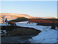
Nearby Images from Geograph Britain and Ireland:
©2012(licence)
©2021(licence)
©2010(licence)
©2016(licence)
©2011(licence)
The above images may not be of the site on this page, they are loaded from Geograph.
Please Submit an Image of this site or go out and take one for us!
Click here to see more info for this site
Nearby sites
Key: Red: member's photo, Blue: 3rd party photo, Yellow: other image, Green: no photo - please go there and take one, Grey: site destroyed
Download sites to:
KML (Google Earth)
GPX (GPS waypoints)
CSV (Garmin/Navman)
CSV (Excel)
To unlock full downloads you need to sign up as a Contributory Member. Otherwise downloads are limited to 50 sites.
Turn off the page maps and other distractions
Nearby sites listing. In the following links * = Image available
690m NNW 338° Rains Low* Round Barrow(s) (SJ975720)
851m NW 309° Toot Hill Warilow* Round Barrow(s) (SJ971719)
918m NW 314° Toot Hill* Ancient Village or Settlement (SJ971720)
1.3km NW 324° Charity Lane I* Round Barrow(s) (SJ970724)
1.6km NW 320° Charity Lane III* Round Barrow(s) (SJ967726)
1.6km NW 320° Charity Lane II Round Barrow(s) (SJ967726)
2.3km W 277° Higher Ridgegate* Standing Stone (Menhir) (SJ9550671636)
2.5km WNW 282° Teggs Nose reservoir* Round Barrow(s) (SJ953719)
2.7km W 273° High Low* Round Barrow(s) (SJ951715)
3.0km W 277° Langley Conical mound* Round Barrow(s) (SJ948717)
3.0km SW 225° The Plague Stone* Ancient Cross (SJ9561269221)
3.6km N 349° Brock Low* Round Barrow(s) (SJ971749)
3.6km WNW 292° Teggs Nose Farm Round Barrow(s) (SJ944727)
3.8km SSW 211° Cessbank Common* Round Barrow(s) (SJ958681)
4.3km WNW 297° Macclesfield Common II Round Barrow(s) (SJ939733)
4.3km SSW 210° Bullstones* Stone Circle (SJ9556867627)
4.4km WNW 295° Macclesfield Common I Round Barrow(s) (SJ938732)
4.6km SSW 210° Longgutter* Round Barrow(s) (SJ955674)
4.7km SSW 213° Clulow Cross* Round Barrow(s) (SJ952674)
4.8km NNW 344° Yearnslow* Round Barrow(s) (SJ96447597)
4.9km S 190° Allgreave* Standing Stone (Menhir) (SJ969665)
5.0km ESE 102° Dane Head* Marker Stone (SK02657036)
5.2km N 353° Blue Boar Farm* Round Barrow(s) (SJ971765)
5.2km NNE 30° Foxlowe Edge* Standing Stone (Menhir) (SK0038675907)
5.2km W 269° Sutton Hall* Round Barrow(s) (SJ925713)
View more nearby sites and additional images


 We would like to know more about this location. Please feel free to add a brief description and any relevant information in your own language.
 Wir möchten mehr über diese Stätte erfahren. Bitte zögern Sie nicht, eine kurze Beschreibung und relevante Informationen in Deutsch hinzuzufügen.
 Nous aimerions en savoir encore un peu sur les lieux. S'il vous plaît n'hesitez pas à ajouter une courte description et tous les renseignements pertinents dans votre propre langue.
 Quisieramos informarnos un poco más de las lugares. No dude en añadir una breve descripción y otros datos relevantes en su propio idioma.