<< Our Photo Pages >> Colebarrow - Hillfort in England in Dorset
Submitted by Gedv1 on Sunday, 20 March 2011 Page Views: 5007
Iron Age and Later PrehistorySite Name: ColebarrowCountry: England
NOTE: This site is 1.733 km away from the location you searched for.
County: Dorset Type: Hillfort
Nearest Town: Wimborne Minster Nearest Village: Holt
Map Ref: SU033057
Latitude: 50.850809N Longitude: 1.954492W
Condition:
| 5 | Perfect |
| 4 | Almost Perfect |
| 3 | Reasonable but with some damage |
| 2 | Ruined but still recognisable as an ancient site |
| 1 | Pretty much destroyed, possibly visible as crop marks |
| 0 | No data. |
| -1 | Completely destroyed |
| 5 | Superb |
| 4 | Good |
| 3 | Ordinary |
| 2 | Not Good |
| 1 | Awful |
| 0 | No data. |
| 5 | Can be driven to, probably with disabled access |
| 4 | Short walk on a footpath |
| 3 | Requiring a bit more of a walk |
| 2 | A long walk |
| 1 | In the middle of nowhere, a nightmare to find |
| 0 | No data. |
| 5 | co-ordinates taken by GPS or official recorded co-ordinates |
| 4 | co-ordinates scaled from a detailed map |
| 3 | co-ordinates scaled from a bad map |
| 2 | co-ordinates of the nearest village |
| 1 | co-ordinates of the nearest town |
| 0 | no data |
Internal Links:
External Links:
")
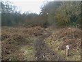
Colebarrow has little to see on the ground to merit its interest or even a visit. Indeed, an ariel view from Google Earth combined with investigation of the ground-plan with OS 1:25,000 Explorer can be just as rewarding. However, combining the two plus the help of PastScape's description and Old-Maps 1888 1:25,000 Dorset, it is possible to piece it all together to discover the site for what it is, which is easily over-looked on location.
SU034057 is centred on the middle of the track bisecting the site. It is also clear to see on OS 1:25,000 map that the site is very much hexagonal radiating from this centre.
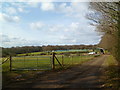
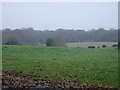
Between Holt Wood and Holt Forest lies a wishbone ( on its side ) shaped sytem of two tracks branching from the main. The continuation of the northern branch of this fork is, for a short way (75m?), the northern bank/wall and limit of the 'fort'. There is nothing to see immediately here on this right-hand side high hedge line, but a short distance down and to the right, the 'fort' turns direction south-south west, where the ditch and bank can be clearly seen well fenced off to the right in a field. After another short distance of maybe 75m the bank turns again to the south but then peters out. This can later be seen from across a field fence from the opposite track of the fork.
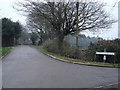
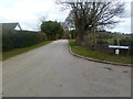
Returning to the southerly branch of the fork, the bank wall would be where the track now cuts through; from the corner of the high hedge on the left across the track and into the garden on the right. From the field gate here on the right, the fort bank can be seen as the external garden embankment of the house, Twin Oaks. A short walk down the track gives a view back up through the garden to the low inner wall. It is clear that the interior of the fort is greatly raised as the inner height of the bank is very much less than the exterior. Continuing down the track the fort wall would have cut across and into the field on the left, where although ploughed out, it would have joined the ditch and bank where it petered out and as seen from the northern branch of the track system.
On Google Earth, the southern part of the fort is more discernable as a traceable ring from the field east, across the track into the garden west, but in truth, the north east and north west are more easily seen on location. The forelock/kiss curl shaped low scarp as seen beside the garden to the west of the fort, is no more than the back inside workings of a historic sand pit as seen on the 1888 OS Old -Map supplied by PastScape. This map is interesting as it details the whole hexagonal fort site as furze and scrub prior to the present buildings, with the sand pit no doubt being essential to the local brick industry opposite to the site on the main road.
There is mention of field field systems locally on PastScape. These may well be in the field to the north of the site, as there is evidence of some low, degraded terracing with 90 degree returns.
You may be viewing yesterday's version of this page. To see the most up to date information please register for a free account.
")
")
Do not use the above information on other web sites or publications without permission of the contributor.
Nearby Images from Geograph Britain and Ireland:
©2012(licence)
©2006(licence)
©2006(licence)
©2012(licence)
©2012(licence)
The above images may not be of the site on this page, they are loaded from Geograph.
Please Submit an Image of this site or go out and take one for us!
Click here to see more info for this site
Nearby sites
Key: Red: member's photo, Blue: 3rd party photo, Yellow: other image, Green: no photo - please go there and take one, Grey: site destroyed
Download sites to:
KML (Google Earth)
GPX (GPS waypoints)
CSV (Garmin/Navman)
CSV (Excel)
To unlock full downloads you need to sign up as a Contributory Member. Otherwise downloads are limited to 50 sites.
Turn off the page maps and other distractions
Nearby sites listing. In the following links * = Image available
2.3km ESE 110° Holt Heath* Round Barrow(s) (SU055049)
2.4km NE 48° Roman Barrow, Knob's Crook* Round Barrow(s) (SU051073)
3.4km W 277° High Lea Farm* Barrow Cemetery (ST999061)
3.4km ENE 60° David's Cross* Round Barrow(s) (SU063074)
4.1km SW 217° Bakers Dozen* Modern Stone Circle etc (SU008024)
4.3km NNW 348° Knowlton Great Circle* Henge (SU024099)
4.4km ENE 66° Redman's Hill Barrow* Round Barrow(s) (SU073075)
4.4km ENE 70° Horton Common Earthworks* Misc. Earthwork (SU075072)
4.5km NE 45° Woodlands Common Barrow* Round Barrow(s) (SU065089)
4.6km N 351° Knowlton Great Barrow* Round Barrow(s) (SU02541027)
4.7km NNW 349° Knowlton Rings* Henge (SU02381028)
4.7km N 357° Knowle Hill Farm long barrow* Long Barrow (SU0306210415)
5.5km SSE 164° Bowl round barrow just outside Stapehill community centre Dorset Barrow Cemetery (SU0482700373)
6.5km N 7° Wimborne St Giles* Round Barrow(s) (SU041122)
6.6km SW 215° Pamphill* Natural Stone / Erratic / Other Natural Feature (ST995003)
7.0km NE 55° Stephen's Castle Tumulus* Round Barrow(s) (SU091097)
7.2km ESE 104° Lions Hill Enclosure* Misc. Earthwork (SU103039)
7.2km SSE 152° Ferndown Town Common* Round Barrow(s) (SZ067993)
7.4km WSW 249° Badbury Rings* Hillfort (ST96400299)
7.5km NE 54° Verwood Stone* Standing Stone (Menhir) (SU09371005)
7.5km NE 52° Boveridge Heath* Round Barrow(s) (SU093103)
7.7km NW 318° Parsonage Hill* Long Barrow (ST98131137)
7.8km E 83° Ashley Heath North* Round Barrow(s) (SU111067)
7.9km ENE 74° Ebblake Barrow* Round Barrow(s) (SU109079)
7.9km SW 216° The Bearstone* Standing Stone (Menhir) (SY986993)
View more nearby sites and additional images


 We would like to know more about this location. Please feel free to add a brief description and any relevant information in your own language.
 Wir möchten mehr über diese Stätte erfahren. Bitte zögern Sie nicht, eine kurze Beschreibung und relevante Informationen in Deutsch hinzuzufügen.
 Nous aimerions en savoir encore un peu sur les lieux. S'il vous plaît n'hesitez pas à ajouter une courte description et tous les renseignements pertinents dans votre propre langue.
 Quisieramos informarnos un poco más de las lugares. No dude en añadir una breve descripción y otros datos relevantes en su propio idioma.