<< Text Pages >> St Modwen's Well (Canwell) - Holy Well or Sacred Spring in England in Staffordshire
Submitted by TimPrevett on Friday, 13 July 2007 Page Views: 7113
Springs and Holy WellsSite Name: St Modwen's Well (Canwell)Country: England
NOTE: This site is 4.944 km away from the location you searched for.
County: Staffordshire Type: Holy Well or Sacred Spring
Nearest Town: Sutton Coldfield Nearest Village: Canwell
Map Ref: SK14890058
Latitude: 52.602806N Longitude: 1.781579W
Condition:
| 5 | Perfect |
| 4 | Almost Perfect |
| 3 | Reasonable but with some damage |
| 2 | Ruined but still recognisable as an ancient site |
| 1 | Pretty much destroyed, possibly visible as crop marks |
| 0 | No data. |
| -1 | Completely destroyed |
| 5 | Superb |
| 4 | Good |
| 3 | Ordinary |
| 2 | Not Good |
| 1 | Awful |
| 0 | No data. |
| 5 | Can be driven to, probably with disabled access |
| 4 | Short walk on a footpath |
| 3 | Requiring a bit more of a walk |
| 2 | A long walk |
| 1 | In the middle of nowhere, a nightmare to find |
| 0 | No data. |
| 5 | co-ordinates taken by GPS or official recorded co-ordinates |
| 4 | co-ordinates scaled from a detailed map |
| 3 | co-ordinates scaled from a bad map |
| 2 | co-ordinates of the nearest village |
| 1 | co-ordinates of the nearest town |
| 0 | no data |
Be the first person to rate this site - see the 'Contribute!' box in the right hand menu.
Internal Links:
External Links:
I have visited· I would like to visit
BrownEdger would like to visit
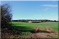
The site of St Modwen's Well, south west from Tamworth, east from Sutton Coldfield.
You may be viewing yesterday's version of this page. To see the most up to date information please register for a free account.
Do not use the above information on other web sites or publications without permission of the contributor.
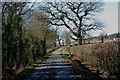
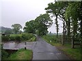
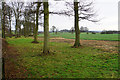
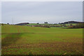
Nearby Images from Geograph Britain and Ireland:
©2012(licence)
©2007(licence)
©2018(licence)
©2018(licence)
©2012(licence)
The above images may not be of the site on this page, they are loaded from Geograph.
Please Submit an Image of this site or go out and take one for us!
Click here to see more info for this site
Nearby sites
Key: Red: member's photo, Blue: 3rd party photo, Yellow: other image, Green: no photo - please go there and take one, Grey: site destroyed
Download sites to:
KML (Google Earth)
GPX (GPS waypoints)
CSV (Garmin/Navman)
CSV (Excel)
To unlock full downloads you need to sign up as a Contributory Member. Otherwise downloads are limited to 50 sites.
Turn off the page maps and other distractions
Nearby sites listing. In the following links * = Image available
5.4km WSW 241° Druid's Well (Sutton Park) Holy Well or Sacred Spring (SP1016297991)
5.9km SW 228° Keeper's Well* Holy Well or Sacred Spring (SP1049296613)
6.6km ENE 61° St Ruffin's Well (Tamworth)* Holy Well or Sacred Spring (SK207038)
6.9km SW 234° Rowton Well* Holy Well or Sacred Spring (SP0927496487)
7.9km NW 320° Wall Roman sites (Letocetum)* Ancient Village or Settlement (SK0977506660)
8.5km SW 234° The King's Standing* Round Barrow(s) (SP080956)
10.1km NNW 345° St Chad's Well (Lichfield)* Holy Well or Sacred Spring (SK122103)
11.7km SSE 156° Beggars Well* Holy Well or Sacred Spring (SP1962989822)
13.2km NNE 30° Stone in Croxall Churchyard* Marker Stone (SK2140512127)
13.8km N 2° Alrewas Causewayed Enclosure* Causewayed Enclosure (SK15351436)
14.5km NNE 15° National Memorial Arboretum* Henge (SK18531459)
14.6km N 11° Alrewas Cursus* Cursus (SK177149)
14.6km N 11° Alrewas and Fradley Cursus Cursus (SK177149)
15.5km SW 233° St Augustine's Well (Sandwell)* Holy Well or Sacred Spring (SP0248391296)
15.5km NNW 348° King's Bromley Cursus Cursus (SK116157)
15.5km NW 316° Nun's Well (Cannock Wood)* Holy Well or Sacred Spring (SK04151180)
15.7km SW 215° War Stone* Natural Stone / Erratic / Other Natural Feature (SP058877)
16.0km SSW 211° Birmingham Museum & Art Gallery Museum (SP066869)
16.0km NW 320° Castle Ring (Staffordshire)* Hillfort (SK045128)
16.7km NNE 16° Catholme 02 Henge (SK19431670)
16.8km NNE 17° Catholme 01* Timber Circle (SK19621666)
16.9km WNW 288° The Great Stones of Landywood* Stone Circle (SJ9872805826)
17.0km NNE 15° Barton Under Needwood Cursus Cursus (SK19301697)
17.3km ESE 114° Ansley Common Round Barrow(s) (SP307935)
17.3km NNE 16° Efflinch Cursus (SK19521724)
View more nearby sites and additional images


 We would like to know more about this location. Please feel free to add a brief description and any relevant information in your own language.
 Wir möchten mehr über diese Stätte erfahren. Bitte zögern Sie nicht, eine kurze Beschreibung und relevante Informationen in Deutsch hinzuzufügen.
 Nous aimerions en savoir encore un peu sur les lieux. S'il vous plaît n'hesitez pas à ajouter une courte description et tous les renseignements pertinents dans votre propre langue.
 Quisieramos informarnos un poco más de las lugares. No dude en añadir una breve descripción y otros datos relevantes en su propio idioma.