Featured: How and why the ancients enchanted Great Britain and Brittany

How and why the ancients enchanted Great Britain and Brittany

Megaliths, Stones of Memory

Megaliths, Stones of Memory

Who's Online

There are currently, 352 guests and 3 members online.

You are a guest. To join in, please register for free by clicking here

Sponsors

<< Our Photo Pages >> Liddington Castle - Hillfort in England in Wiltshire

Submitted by Andy B on Wednesday, 20 February 2008  Page Views: 25123

Iron Age and Later PrehistorySite Name: Liddington Castle
Country: England County: Wiltshire Type: Hillfort
Nearest Town: Swindon  Nearest Village: Chiseldon
Map Ref: SU209797  Landranger Map Number: 174
Latitude: 51.515840N  Longitude: 1.700199W
Condition:
5Perfect
4Almost Perfect
3Reasonable but with some damage
2Ruined but still recognisable as an ancient site
1Pretty much destroyed, possibly visible as crop marks
0No data.
-1Completely destroyed
3 Ambience:
5Superb
4Good
3Ordinary
2Not Good
1Awful
0No data.
4 Access:
5Can be driven to, probably with disabled access
4Short walk on a footpath
3Requiring a bit more of a walk
2A long walk
1In the middle of nowhere, a nightmare to find
0No data.
3 Accuracy:
5co-ordinates taken by GPS or official recorded co-ordinates
4co-ordinates scaled from a detailed map
3co-ordinates scaled from a bad map
2co-ordinates of the nearest village
1co-ordinates of the nearest town
0no data
4

Internal Links:
External Links:

I have visited· I would like to visit

Couplands saw from a distance on 12th Sep 2023 - their rating: Cond: 2 Amb: 3 Access: 3

GemmaJ visited on 24th May 2020 - their rating: Cond: 3 Amb: 5 Access: 3

fran1944 visited on 9th Oct 2012 - their rating: Cond: 2 Amb: 4 Access: 3

SolarMegalith visited on 20th Apr 2012 - their rating: Cond: 4 Amb: 4 Access: 3

graemefield visited on 4th Jun 2009 - their rating: Cond: 3 Amb: 4 Access: 3

Tiamthe visited - their rating: Cond: 4 Amb: 5 Access: 3

hevveh have visited here

Average ratings for this site from all visit loggers: Condition: 3 Ambience: 4.17 Access: 3

Liddington Castle
Liddington Castle submitted by croppy : Liddington Castle (Vote or comment on this photo)
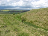
Hillfort in Wiltshire. Said to be the site of Arthur's victory over the Saxons at Mount Badon, but without any evidence whatsoever. Reached by a steep climb from the Ridgeway and giving superb views.


Note: Iron Age to the 21st Century Walk, 8th March 2008, Liddington, Wiltshire, see latest comment
You may be viewing yesterday's version of this page. To see the most up to date information please register for a free account.


Liddington Castle
Liddington Castle submitted by mobaypop : Appoaching Liddington Hillfort On August Bank Holiday 2008 (Vote or comment on this photo)

Liddington Castle
Liddington Castle submitted by diggers92 : Liddington from the Ridgeway. A view of Liddington castle facing North along the Ridgeway, not too far from Snap the lost village. (1 comment - Vote or comment on this photo)

Liddington Castle
Liddington Castle submitted by GemmaJ : Atop Liddington Castle 24/05/20 (Vote or comment on this photo)

Liddington Castle
Liddington Castle submitted by diggers92 : The causeway entrance. Swindon is in the background and the trig point can be seen on the bank. Next to it is a memorial stone dedicated to local writers Richard Jefferies and Alfred Williams. (2 comments - Vote or comment on this photo)

Liddington Castle
Liddington Castle submitted by diggers92 : A view of the ramparts, facing west. Barbury Castle is just over the horizon.

Liddington Castle
Liddington Castle submitted by diggers92 : Liddington Castle just after a downpour.

Liddington Castle
Liddington Castle submitted by southdownsancientsites : Liddington Hill fort, Wilts.. Liddington Hill fort in Wiltshire is one of the oldest in England dating back to ca. 7thC BC. Image copyright: Graeme Hutson (Graeme Hutson), hosted on Flickr and displayed under the terms of their API.

Liddington Castle
Liddington Castle submitted by SolarMegalith : View alongside the earthworks in western part of Liddington Castle - view from the south (photo taken on April 2012).

Liddington Castle
Liddington Castle submitted by SolarMegalith : Rampart and ditch in eastern part of the Iron Age univallate hillfort - view from the SE (photo taken on April 2012).

Liddington Castle
Liddington Castle submitted by SolarMegalith : SW corner of the earthworks - view from the SE (photo taken on April 2012).

Liddington Castle
Liddington Castle submitted by SolarMegalith : Earthworks in northern part of Liddington Castle. This Iron Age univallate hillfort encloses 3 ha (photo taken on April 2012).

Liddington Castle
Liddington Castle submitted by SolarMegalith : Causewayed entrance at the SE (photo taken on April 2012).

Liddington Castle
Liddington Castle submitted by SolarMegalith : Counter-scarp bank in the foreground and the rampart in the background (photo taken on April 2012).

Liddington Castle
Liddington Castle submitted by Thorgrim : Liddington Castle is one of the earliest forts in Wiltshire. Its association with Arthur's victory at Mount Badon probably stems from the fact that the village of Baydon is overlooked by the fort.

Do not use the above information on other web sites or publications without permission of the contributor.
Click here to see more info for this site

Nearby sites

Click here to view sites on an interactive OS map

Key: Red: member's photo, Blue: 3rd party photo, Yellow: other image, Green: no photo - please go there and take one, Grey: site destroyed

Download sites to:
KML (Google Earth)
GPX (GPS waypoints)
CSV (Garmin/Navman)
CSV (Excel)

To unlock full downloads you need to sign up as a Contributory Member. Otherwise downloads are limited to 50 sites.


Turn off the page maps and other distractions

Nearby sites listing. In the following links * = Image available
 1.6km E 89° Liddington Wanborough* Long Barrow (SU2248679737)
 2.3km ESE 121° Liddington Shipley Bottom* Round Barrow(s) (SU22897854)
 3.1km E 101° Wanborough 2 Bowl Barrow* Round Barrow(s) (SU23927914)
 3.5km ESE 112° Sugar Hill Bowl Barrow 1* Round Barrow(s) (SU24167842)
 3.8km NW 315° Coate circle* Stone Circle (SU18168239)
 3.8km ESE 113° Sugar Hill Bowl Barrow 2* Round Barrow(s) (SU24457820)
 3.9km NE 54° Strip Lynchets, Bishopstone* Misc. Earthwork (SU2482)
 3.9km SW 217° Ogbourne St. George* Round Barrow(s) (SU18557653)
 4.6km SE 125° Whitecomb Plantation Bowl Barrows* Round Barrow(s) (SU24727707)
 4.6km S 185° Ogbourne Downs Round Barrow(s) (SU20497507)
 4.7km ESE 121° Aldbourne Four Barrows* Barrow Cemetery (SU249773)
 4.8km SW 226° Draycot Foliat Bowl Barrow* Round Barrow(s) (SU17487634)
 4.9km SE 132° Giant's Grave Barrow Cemetery* Barrow Cemetery (SU24557641)
 5.0km WNW 293° Fir Clump, Burderop Wood Stone Circle (SU16298164)
 5.0km NW 304° Broome Circle Stone Circle (SU16748251)
 5.3km SW 232° Burderop Down Disc Barrow* Round Barrow(s) (SU16737642)
 5.4km NE 44° William's Well Holy Well or Sacred Spring (SU246836)
 5.8km SW 236° Burderop Down* Ancient Village or Settlement (SU16077645)
 6.0km WSW 239° Burderop Barrows Round Barrow(s) (SU15777665)
 6.1km SW 236° Memorial stone to Richard Jefferies and Alfred Williams* Modern Stone Circle etc (SU15847626)
 6.5km ENE 57° Idstone Hill Barrow Round Barrow(s) (SU26348327)
 6.5km ENE 78° Bishopstone Barrow Round Barrow(s) (SU27268111)
 6.7km ENE 74° Swinley Copse Barrows Round Barrow(s) (SU27318159)
 6.7km E 79° Three Barrows (Oxfordshire) Round Barrow(s) (SU27508102)
 6.9km WSW 240° Barbury Castle* Hillfort (SU14927628)
View more nearby sites and additional images

<< Weasenham Plantation

Camp Farm >>

Please add your thoughts on this site

Children Of The Stones DVD

Children Of The Stones DVD

Sponsors

Auto-Translation (Google)

Translate from English into:

"Liddington Castle" | Login/Create an Account | 9 News and Comments
  
Go back to top of page    Comments are owned by the poster. We aren't responsible for their content.
Re: Liddington and Richard Jefferies by AngieLake on Friday, 22 October 2021
(User Info | Send a Message)
A long while ago I bought a very old copy of Richard Jefferies' book 'The Story of my Heart', and finally got around to reading it. I was prompted to find out more about this 19th century author having seen his name come up frequently while reading other countryside/nature/walkers' books. I'm over halfway through it now, and finding it a bit repetitive, but am determined to finish. He writes about a hillfort and burial mound that he enjoys sitting on and beside, while absorbing the special feelings his surroundings give him. The sun always seems to be shining. Maybe those years were a bit more settled.
So, I looked for more info on Google and found that the hillfort was Liddington, and as no-one has so far posted any link to Richard Jefferies, this is where I read about him: http://www.richardjefferiessociety.org/p/the-life-of-richard-jefferies-with.html.
Here is an excerpt from the section on his life.

" A self-absorbed and independent youth, Jefferies spent much of his time walking through the countryside around Coate and along the wide chalk expanses of the Marlborough Downs. He regularly visited Burderop woods and Liddington Hill near his home and on longer trips explored Savernake Forest and the stretch of the downs to the east, where the famous white horse is engraved in the hillside above Uffington. His favourite haunt was Liddington Hill, a height crowned with an ancient fort commanding superb views of the north Wiltshire plain and the downs. It was on the summit of Liddington at the age of about eighteen, as he relates in The Story of My Heart, that his unusual sensitivity to nature began to induce in him a powerful inner awakening - a desire for a larger existence or reality which he termed 'soul life'. Wherever he went in the countryside he found himself in awe of the beauty and tranquillity of the natural world; not only the trees, flowers and animals, but also the sun, the stars and the entire cosmos seemed to him to be filled with an inexpressible sense of magic and meaning."
............
and ........

"In the 1880s, the last decade of his life, Jefferies often departed radically from the style of writing and the material that had brought him his success. A return to fiction produced some novels of striking imaginative power and, in a highly individual way, he found expression for the esoteric feelings and aspirations which had been with him from his teenage years. However, in late 1881 he" ... (became ill) .... "necessitated four operations in a year, during which time he could do no work at all. After an apparent recovery which lasted only a few months his health declined again, and during the remaining years of his life he was afflicted with a chain of illnesses which became increasingly serious. In these years, however, Jefferies wrote some of his best and most original work, including his extraordinary autobiography, The Story of My Heart (1883). He had been planning this work for seventeen years and, in his words, it was 'absolutely and unflinchingly true'. It was not an autobiography of the events of his life, but an outpouring of his deepest thoughts and feelings, beginning with his first 'soul experiences' on Liddington Hill, expressed in prose poetry that is often impassioned, sensuous and evocative. He describes his mystical communion with nature and his yearning for the fullest 'soul life'. Within him burned a desire to grasp the great truths which he felt were all around him - 'to have from all green things and from the sunlight the inner meaning which was not known to them, that I might be full of light as the woods of the sun's rays'."
[ Reply to This ]

A Celtic Feast: The Iron Age Cauldrons from Chiseldon, Wiltshire by Andy B on Thursday, 12 September 2019
(User Info | Send a Message)
A Celtic Feast: The Iron Age Cauldrons from Chiseldon, Wiltshire - Jody Joy et al

This volume presents the results from the excavation and scientific analysis between 2005 and 2014 of seventeen Iron Age cauldrons discovered in a large pit on farmland in the parish of Chiseldon, Wiltshire, and consequently acquired by the British Museum.

https://www.academia.edu/32160654/A_Celtic_Feast_The_Iron_Age_Cauldrons_from_Chiseldon_Wiltshire
[ Reply to This ]

Liddington Castle - is this 'Mons Badonicus', site of Arthur's last stand? by Andy B on Wednesday, 07 May 2014
(User Info | Send a Message)
Kate Prendergast writes: Liddington Castle is a prehistoric hill-fort perched on some of the highest ground on the Ridgeway - the path that runs like a backbone along the ridge of the Berkshire Downs. The Ridgeway is an ancient trackway and it is dotted with hill-forts and other archaeological sites as it runs from Avebury in Wiltshire to the Goring gap by the Thames in Oxfordshire.

Liddington Castle probably dates from the late Bronze Age. Little known and inaccessible, it has far fewer visitors than more popular sites along the Ridgeway like the White Horse of Uffington. However, the climb to visit it is worth it. Once on top, the views in all directions are spectacular - a truly panoramic vision.Liddington 106

Mons Badonicus - or the hill of Badon - is a legendary location, cited by Gildas, the sixth century historian of the collapse of Roman rule in Britain, as the place where Aurelius Ambrosius won his decisive battle against the Saxons. In later texts, notably in Geoffrey of Monmouth's History of the Kings of Britain written in the twelfth century, Aurelius Ambrosius has become King Arthur, and Mons Badonicus the site of Arthur's heroic last stand.

What evidence is there to suggest Liddington Castle may be Mount Badon?

More at
http://kateprendergast.typepad.com/my_web/2013/08/liddington-castle-is-this-mons-badonicus-site-of-arthurs-last-stand.html
[ Reply to This ]

Re: Liddington by coldrum on Wednesday, 07 April 2010
(User Info | Send a Message)
Street View


View Larger Map
[ Reply to This ]

Liddington hill iron age hillfort on youtube by graemefield on Monday, 13 April 2009
(User Info | Send a Message)
You may not agree with my King Arthur theory, but its a nice video all the same, please let me know what you think!

[ Reply to This ]

Iron Age to the 21st Century Walk, 8th March 2008, Liddington, Wiltshire by Andy B on Wednesday, 20 February 2008
(User Info | Send a Message)
Iron Age to the 21st Century

Description:
This walk, led by National Trail Volunteers and experienced walkers Colin Minto and George Darmody, encompasses two starkly contrasting features - an Iron Age fort and a piece of modern communications infrastructure. The circular walk will follow some lovely downland walking along The Ridgeway from Liddington to Aldbourne. Meet at the lay-by on B4192 (formerly A419), 3 miles north west of Aldbourne.

Distance and time - 10 miles / 5 ½ hours

Meeting point grid reference - SU 230786 (Landranger 174)
Date(s): 8 March 2008

Time(s): Start 10:30am

Location: Liddington, Wilts , SN4 0HB

For further information: Tel: 01865 810224

http://www.aylesburyvaledc.gov.uk/avdc/events/detail.jsp?contentid=-1561190903
[ Reply to This ]

Re: Liddington by Anonymous on Monday, 10 September 2007
just got back from a strange little festival at sugar hill near liddington witha WICKED crop circle in the field next door...........
what a sacred space.
this land is our land

Jess
[ Reply to This ]
    Re: Liddington by Anonymous on Sunday, 24 February 2008
    and the festival is happenning again this year........ http://www.offworld.org.uk/ can any body point me in the direction of a photo of the crop circle please...........as it was so wet whilst we were there we could not gain adequate height on the ridgeway to capture a usuable image.
    regards The Pixies
    [ Reply to This ]

Re: Liddington by mishkin on Monday, 29 May 2006
(User Info | Send a Message)
There was a small excavation at Liddington hillfort in 1976, and it was found that the ramparts were constructed in four different phases, the last being Saxon, probably why it has been associated with the site of Arthur's battle. Its scheduled as "slight univallate" which probably gives it an age range from late Bronze to early iron age, also it is close to the Ridgeway.
[ Reply to This ]

Your Name: Anonymous [ Register Now ]
Subject:


Add your comment or contribution to this page. Spam or offensive posts are deleted immediately, don't even bother

<<< What is five plus one as a number? (Please type the answer to this question in the little box on the left)
You can also embed videos and other things. For Youtube please copy and paste the 'embed code'.
For Google Street View please include Street View in the text.
Create a web link like this: <a href="https://www.megalithic.co.uk">This is a link</a>  

Allowed HTML is:
<p> <b> <i> <a> <img> <em> <br> <strong> <blockquote> <tt> <li> <ol> <ul> <object> <param> <embed> <iframe>

We would like to know more about this location. Please feel free to add a brief description and any relevant information in your own language.
Wir möchten mehr über diese Stätte erfahren. Bitte zögern Sie nicht, eine kurze Beschreibung und relevante Informationen in Deutsch hinzuzufügen.
Nous aimerions en savoir encore un peu sur les lieux. S'il vous plaît n'hesitez pas à ajouter une courte description et tous les renseignements pertinents dans votre propre langue.
Quisieramos informarnos un poco más de las lugares. No dude en añadir una breve descripción y otros datos relevantes en su propio idioma.