<< Our Photo Pages >> Dacre Top - Ancient Village or Settlement in England in Yorkshire (North)
Submitted by GillianHovell on Sunday, 14 August 2011 Page Views: 9380
Multi-periodSite Name: Dacre TopCountry: England
NOTE: This site is 2.987 km away from the location you searched for.
County: Yorkshire (North) Type: Ancient Village or Settlement
Nearest Town: Pateley Bridge Nearest Village: Dacre
Map Ref: SE179599
Latitude: 54.034777N Longitude: 1.728195W
Condition:
| 5 | Perfect |
| 4 | Almost Perfect |
| 3 | Reasonable but with some damage |
| 2 | Ruined but still recognisable as an ancient site |
| 1 | Pretty much destroyed, possibly visible as crop marks |
| 0 | No data. |
| -1 | Completely destroyed |
| 5 | Superb |
| 4 | Good |
| 3 | Ordinary |
| 2 | Not Good |
| 1 | Awful |
| 0 | No data. |
| 5 | Can be driven to, probably with disabled access |
| 4 | Short walk on a footpath |
| 3 | Requiring a bit more of a walk |
| 2 | A long walk |
| 1 | In the middle of nowhere, a nightmare to find |
| 0 | No data. |
| 5 | co-ordinates taken by GPS or official recorded co-ordinates |
| 4 | co-ordinates scaled from a detailed map |
| 3 | co-ordinates scaled from a bad map |
| 2 | co-ordinates of the nearest village |
| 1 | co-ordinates of the nearest town |
| 0 | no data |
Internal Links:
External Links:
")
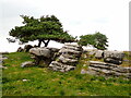
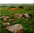
The exposed nature of the site means that any soil cover will have been lost and it is likely that stone has been removed for other purposes by a succession of settlements and industrial activity. No detailed investigation of the cairn has yet taken place.
The most complete prehistoric feature is less ancient, being a Bronze Age barrow. Its characteristic shape is not apparent from some viewpoints, especially from public roads and until recently it was generally considered to be a natural feature. We now know that this is not the case although a natural rock outcrop has been incorporated and the strength of that rock is one of the reasons why it remains in place today. The rock has been shaped by splitting off layers of stone on the north side, giving the impression of a series of shallow steps that were then covered with soil to produce the distinctive profile of the barrow. The outcrop was too small to provide the complete barrow mound so the profile of the south side has been created by soil covered by a layer of carefully placed stones that have protected the barrow against erosion by wind and rain. There are no other similar features nearby today but there are prominent hilltops nearby that may have been similarly used only to have their structures destroyed by weather or human hand.
Read more in Prehistoric Dacre (link to PDF on that page) by J Brophy, Gillian Hovell and the Iron Age Nidderdale team.
IMPORTANT NOTE: The location given is approximate, at present the sites are 'off limits' on private farmland, and can only be visited by invitation on accompanied visits, see below for details of the next one.
Note: Gillian Hovell presents a weekly video blog on the Iron Age and Prehistoric Nidderdale project
You may be viewing yesterday's version of this page. To see the most up to date information please register for a free account.
")
")
Do not use the above information on other web sites or publications without permission of the contributor.
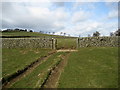
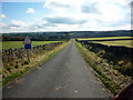
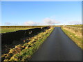
Nearby Images from Geograph Britain and Ireland:
©2008(licence)
©2021(licence)
©2010(licence)
©2021(licence)
©2019(licence)
The above images may not be of the site on this page, they are loaded from Geograph.
Please Submit an Image of this site or go out and take one for us!
Click here to see more info for this site
Nearby sites
Key: Red: member's photo, Blue: 3rd party photo, Yellow: other image, Green: no photo - please go there and take one, Grey: site destroyed
Download sites to:
KML (Google Earth)
GPX (GPS waypoints)
CSV (Garmin/Navman)
CSV (Excel)
To unlock full downloads you need to sign up as a Contributory Member. Otherwise downloads are limited to 50 sites.
Turn off the page maps and other distractions
Nearby sites listing. In the following links * = Image available
1.9km NNE 22° Tadpole Stone (Eastwoods Rough)* Rock Art (SE1860161644)
2.0km NNE 18° Eastwoods Rough 3 (Dacre) Rock Art (SE18506177)
2.0km NNE 19° Morphing Stone (Dacre)* Rock Art (SE1855961795)
2.2km NNE 16° Eastwoods Cross Base (Summerbridge) Rock Art (SE1850662013)
2.2km NNE 17° Eastwoods Farm Cup (Heyshaw)* Rock Art (SE1852062010)
2.4km NNE 17° Eastwoods Farm 02 (Heyshaw) Rock Art (SE1857262168)
2.4km NNE 16° Fertility Stone (CR-638)* Rock Art (SE1855262228)
2.4km NNE 16° Eastwoods Farm 01 (Heyshaw) Rock Art (SE1855662240)
2.5km NNE 18° Bryan's Wood 01 Rock Art (SE1866362280)
3.7km NNW 334° Hayshaw Moor North (Dacre) Cairn (SE1621863253)
4.0km NNW 338° Guisecliff Wood (629)* Rock Art (SE1641563565)
4.2km NNW 334° Guisecliff Wood (626)* Rock Art (SE1607863641)
4.4km WNW 290° Abbot's Hand* Marker Stone (SE138614)
4.4km NE 50° Hartwith Moor* Standing Stone (Menhir) (SE2123362737)
5.4km NE 37° Graffa Plain (Hartwith) Cairn (SE211642)
5.5km S 172° Busky Dike (Fewston) Natural Stone / Erratic / Other Natural Feature (SE187545)
5.5km NNE 27° Brimham Rocks Rock Art Rock Art (SE2039764782)
5.6km SSE 148° Long Stoop* Standing Stones (SE209552)
5.8km NNE 27° Brimham Rocks Circle Stone Circle (SE20566507)
5.8km SSW 208° James Stone* Standing Stone (Menhir) (SE1519654722)
5.9km NNE 32° Brimham Rocks* Rock Outcrop (SE210649)
6.1km SW 222° The Dovestones* Stone Circle (SE138554)
6.2km WSW 253° Rocking Moor Rock Art (SE1193458081)
6.3km WSW 253° Raven Stones (559) Rock Art (SE1183558006)
6.5km SSE 147° Bank Slack* Misc. Earthwork (SE215545)
View more nearby sites and additional images


 We would like to know more about this location. Please feel free to add a brief description and any relevant information in your own language.
 Wir möchten mehr über diese Stätte erfahren. Bitte zögern Sie nicht, eine kurze Beschreibung und relevante Informationen in Deutsch hinzuzufügen.
 Nous aimerions en savoir encore un peu sur les lieux. S'il vous plaît n'hesitez pas à ajouter une courte description et tous les renseignements pertinents dans votre propre langue.
 Quisieramos informarnos un poco más de las lugares. No dude en añadir una breve descripción y otros datos relevantes en su propio idioma.